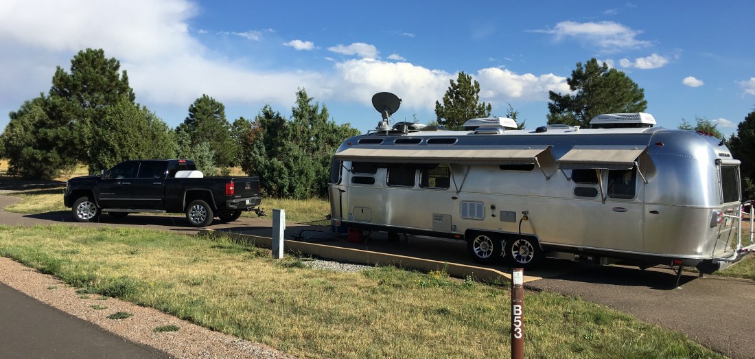
In our continuing series on places we’ve stayed in the Airstream, I am proud to introduce Chatfield State Park Colorado.
*At the time of this blog Chatfield State Park is undergoing extensive renovation to fill the reservoir an additional 12 ft (3.7 m). It is said the park will remain open during these renovations but perform your due diligence before booking.
This is another mega-post, primarily amount mountain biking the Denver area. Enjoy the photos and take your time!
Booking
Reservations for Chatfield can be made on the Reserve America portal. When I was a kid Chatfield was considered to be way out in the sticks. I only have one distinct memory of actually going there and at that age I felt like we’d driven to Utah. Now days though, Chatfield is in the middle of the massive urban sprawl that has become Denver. RV sites bloom over three massive loops, but owing to the park’s immediate proximity to the city it is still extremely busy and it pays to make reservations way in advance.
We were able to get reservationos, albeit over Memorial Day, but only at a site with power and water but no sewer. As a result we towed to the dump station once a week. The dump station, by the way, is the best we’ve ever used owing to small concrete bumps that tilt the trailer gently towards the driver side making it drain faster.
Amenities
Chatfield State Park is located south of Denver and has two major entrances, one off of Roxborough Park Rd to the south and another off of South Wadsworth Blvd to the west, though it appears that entrance may experience interference during renovation. The entrances are guarded during the day and unmanned at night. One sour patch for us is we found it cheaper to buy an annual pass rather than pay a daily vehicle fee and the park rangers threatened us with a ticket if we didn’t affix it to the passenger-side windshield!
Camping is split among three enormous loops, Loop A, Loop B (our loop) and Loop C, as well as some group camping options. Each loop contains a combination of bath houses, laundry and bathrooms. We were somewhat put off by having to pay for showers – a curiosity that never took place before or again on our entire trip.
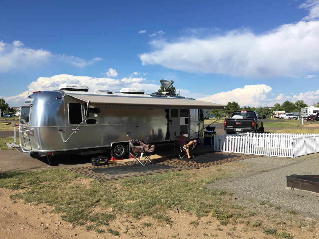
Pads were a mixture of asphalt and concrete backing up to extremely well groomed and open play areas with a fire pit surrounded by gravel. There was also a publicly available WiFi network that was fast and reliable, even during Memorial Day weekend. Even without the WiFi, cell signal here was strong and catching a satellite signal was a snap.
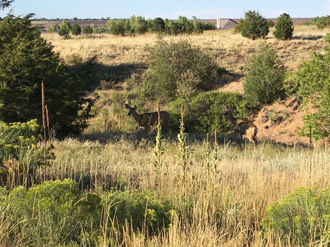
We found noise at the campground to be highly variable, depending on where you were located. Our site experienced intermittent music but the park patrol was omnipresent and we enjoyed our stay, which the deer did too.
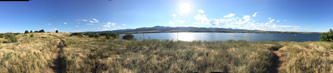
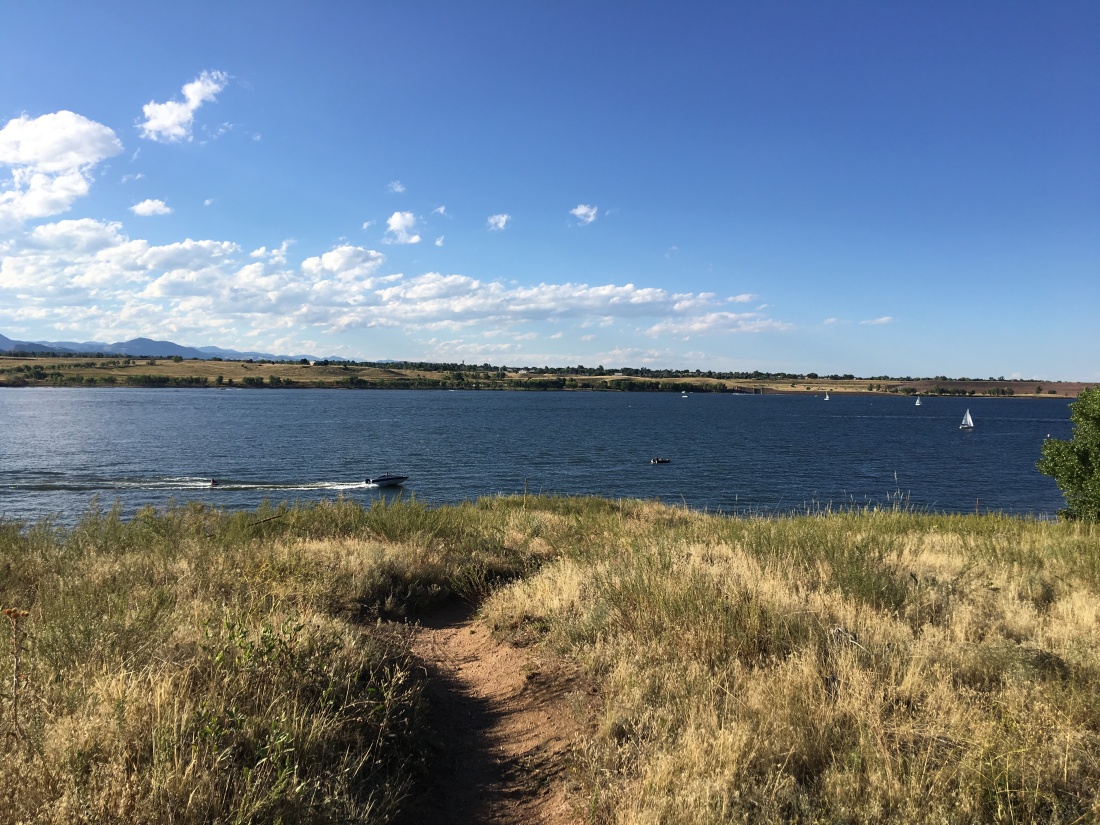
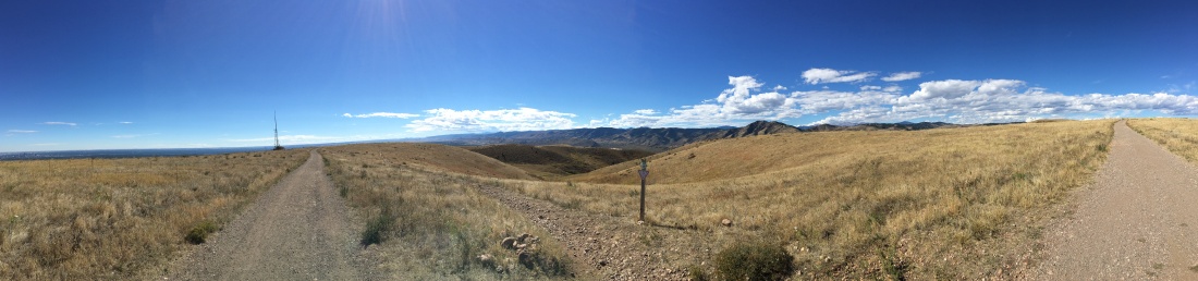
Chatfield Reservoir Dam Visible in the Background
Surrounding Activities
Activities around the park include kayaking , swimming, boating, hiking, fishing, bird-watching and biking. It pays to bring binoculars when possible as the wildlife in this area is prolific along the water line.
Owing to its immersion in the city, groceries are easily fetched from King Soopers in Highlands Ranch or King Soopers on South Wadsworth Blvd.
I also mentioned we were in Denver to drop the Airstream off at Windish RV, which we did immediately after staying here. Denver is a giant city, so you can find all your needs here from propane to trailer storage.
Ah yes, my favorite topic – mountain biking. The Denver area is bubbling over with mountain biking opportunities, some of which I mention below.
Waterton/South Platte Canyon & Wetlands Connector
The South Platte Canyon trail follows the South Platte River up into the Rocky Mountains and can be accessed via the Wetlands Connector Trail directly from within Chatfield. This ride is not even close to technical and beginning at the Waterton Trailhead riding here can become exceptionally congested, especially on the weekends. This trail also suffers frequent closures so perform your due diligence before showing up to a closed parking lot.
The ride is slow and lazy climbing an easy few-percent grade along a mild-mannered road that hugs the South Platte river, which feeds the famous High Line Canal.
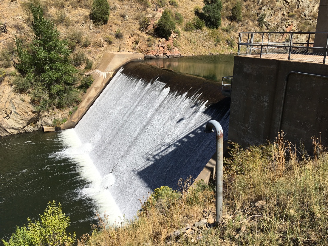
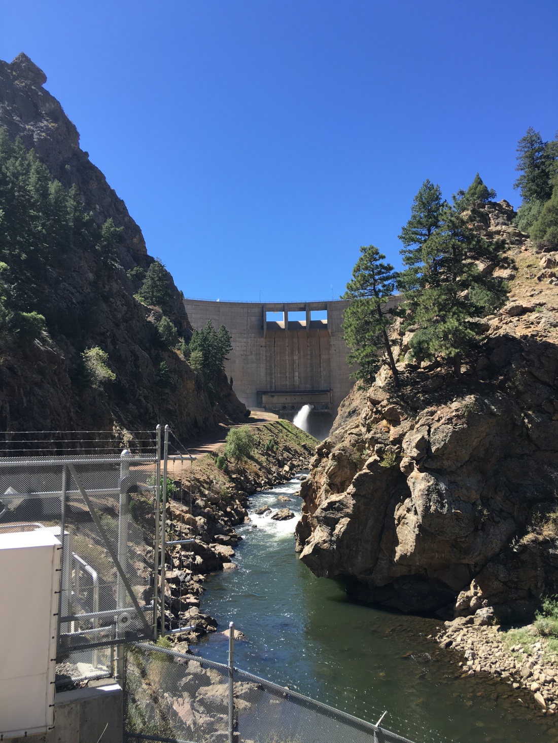
We rode this trail multiple times and turned around at the Strontia Springs Dam.
On the way back we often stopped on one of the bridges, ditched the bikes and stuck our tootsies into the cool water.
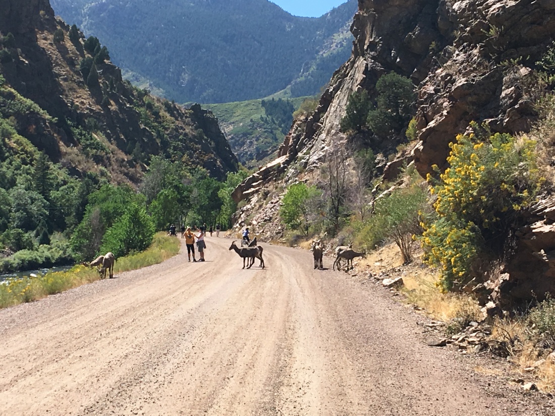
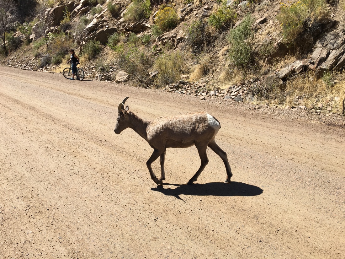
Another amazing feature of this ride is the bighorn sheep, which appear en masse.
The bighorn sheep are protected…
And there is extensive signage here alerting people not to interact with these guys in any way.
Buffalo Creek Trail System
The Buffalo Creek Trail System is roughly an hour from Chatfield by car though you can link into it directly from Chatfield via the Colorado Trail Segment 2 (which we did not do). This trail system is rich and complex allowing you to make your own loops, much of it threading through a former burn area, but still gorgeous and wonderful.
Though this trail system is not wildly technical nor crazy on the grades, for one reason or another I found it to require high fitness.
Staunton State Park
Staunton State Park is located just a little north of Buffalo Creek and it too offers a wide range of trail options.
Sadly I was somewhat ill on this expedition so we only rode Staunton Ranch Trail South to Bugling Elk Trail and back. I realized I was ill at the beginning of Border Line Trail so we only went up it a mile or so before bailing. Staunton Ranch and Bugling Elk were mild-mannered greens. Border Line is marked as a blue but I feel like it could easy be called black, at least owing to fitness.
The highlands ranch trail system is private, but we were granted access while staying with family. This is a twisty and satisfying system that forms complex loops through foothills scrub oak.
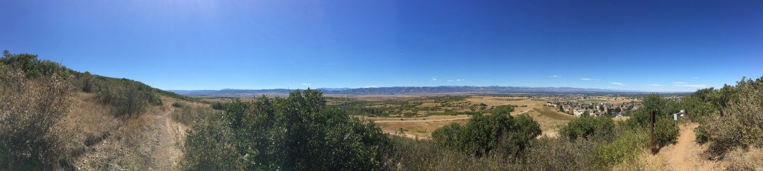
Even though highlands ranch is private, the trail system hooks directly into the Bluffs Regional Park which is open for all and has awesome views of Littleton, Centennial, Highlands Ranch and in the distance, Denver.
Green Mountain
Green Mountain overlooks the C470/70 interchange and provides jaw-dropping views of the Denver Metro area. We rode the Green Mountain Intermediate Loop multiple times and found it to be massively difficult on fitness and moderate technically. I highly recommend it though, the views are worth it.
Rollins Pass
Our final ride in the Denver area was up Rollins Pass. Make no mistake about it, Rollins Pass is primarily an OHV road but lots of mountain bikers ride there too. It takes a good two hours or more to get there from south Denver so I realize this might not be “the Denver area” in the strictest terms, but this stands out as the best mountain bike ride I have ever done. Ever.
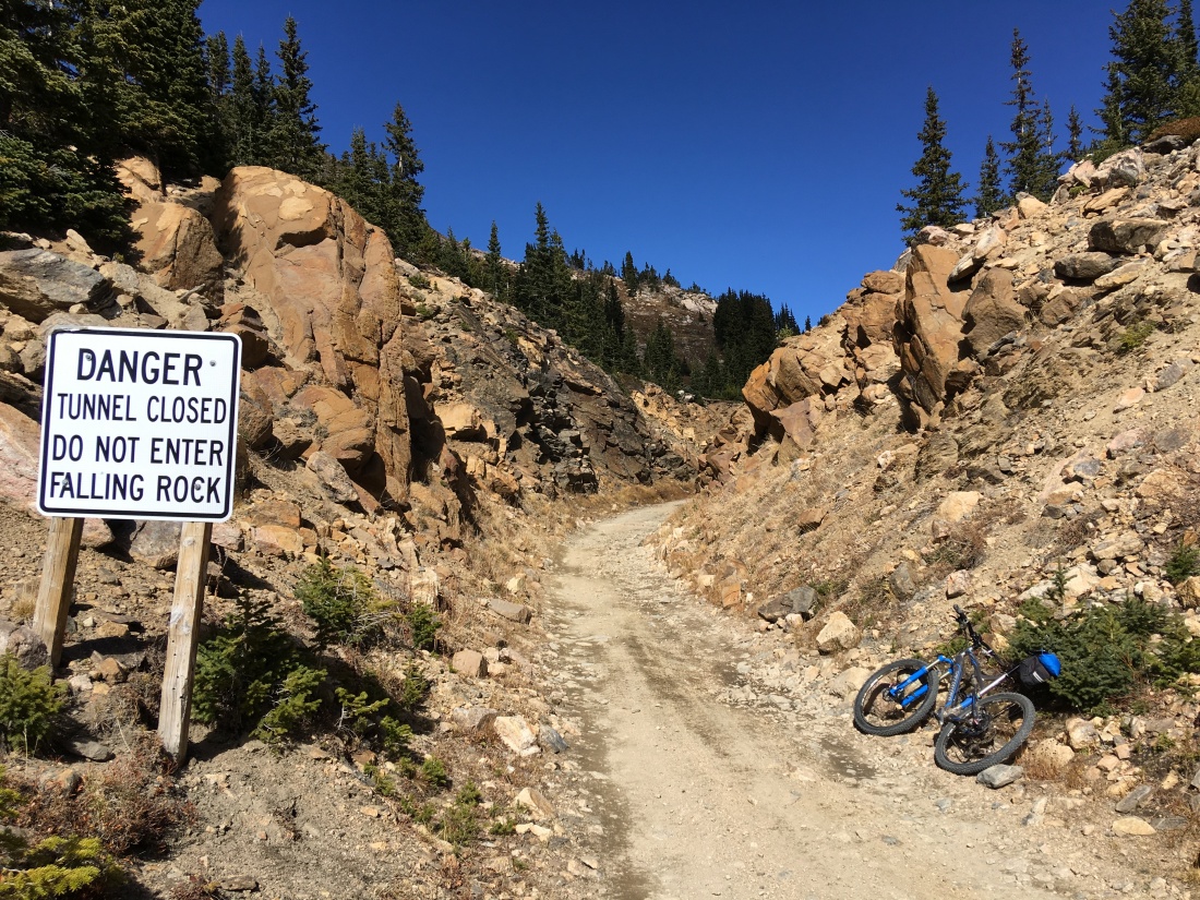
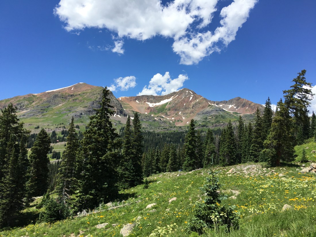
This is an eye-popping trail because it follows an old rail line over Corona Pass threading its way through spectacular Rocky Mountain vistas that straddle the continental divide. The “trail” begins at the Moffat Tunnel and tops out at the Needle’s Eye Tunnel which is at a comfy 11,600′ (3535 m). This entire ride is cloaked in thick forest until the last portion which is several hundred feet above timber line (the elevation at which there isn’t enough oxygen to support trees).
Our journey began in the early AM in Highlands Ranch.
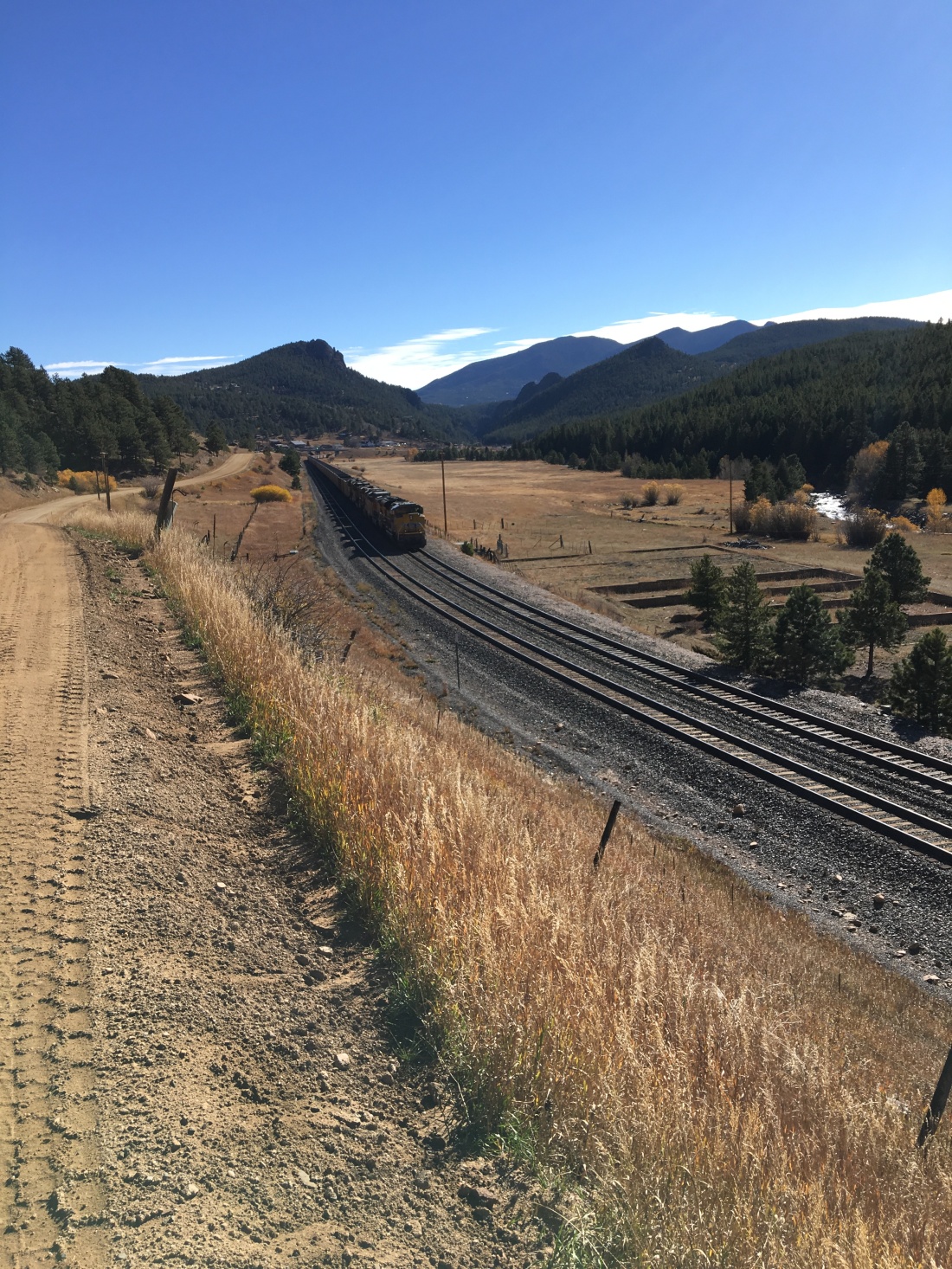
Shortly west of Rollinsville we followed the contemporary Union Pacific rail line to the Moffat Tunnel.
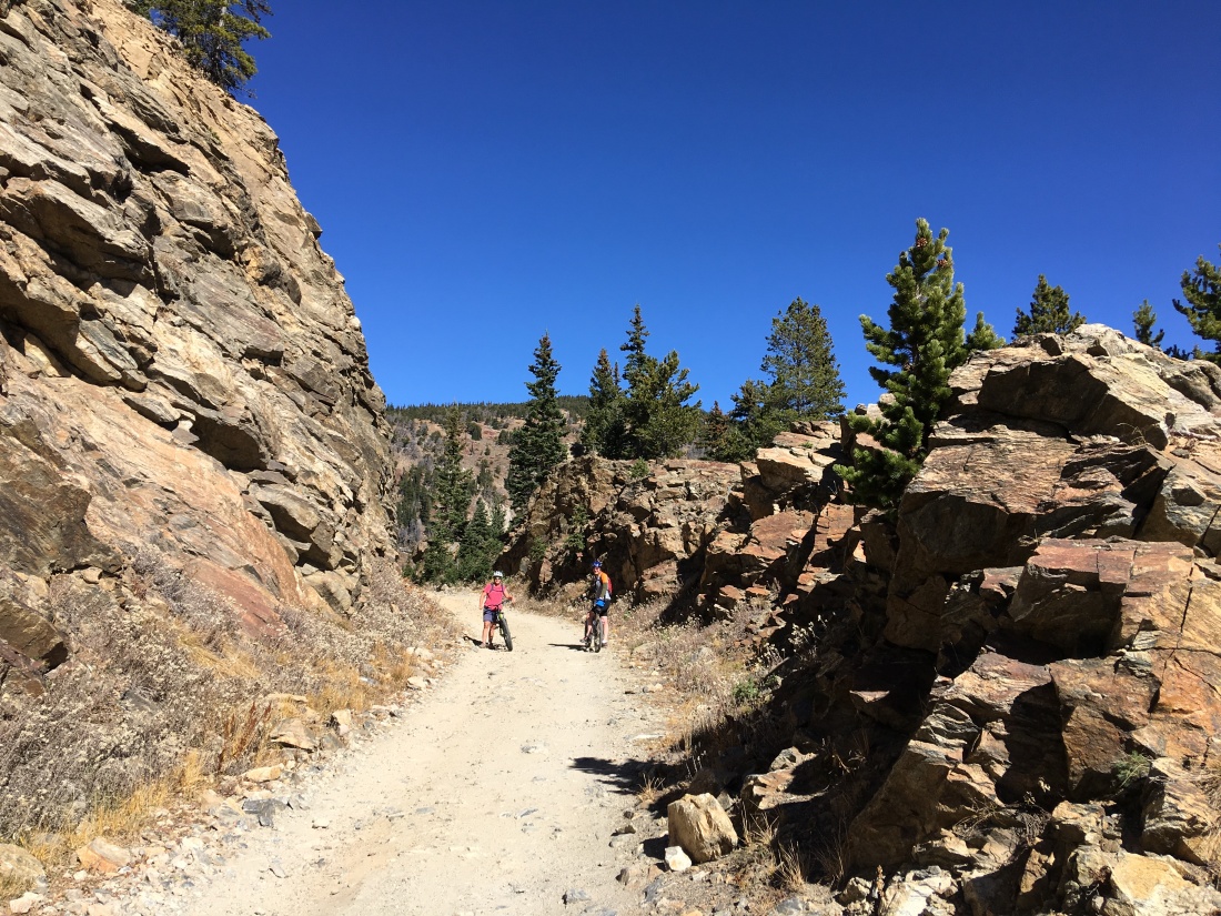
Because this grade was followed by steam engines or yore, it rarely exceeds 5% – making for an extended but doable climb. Much of the former rail line was blasted right out of the rock.
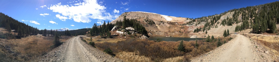
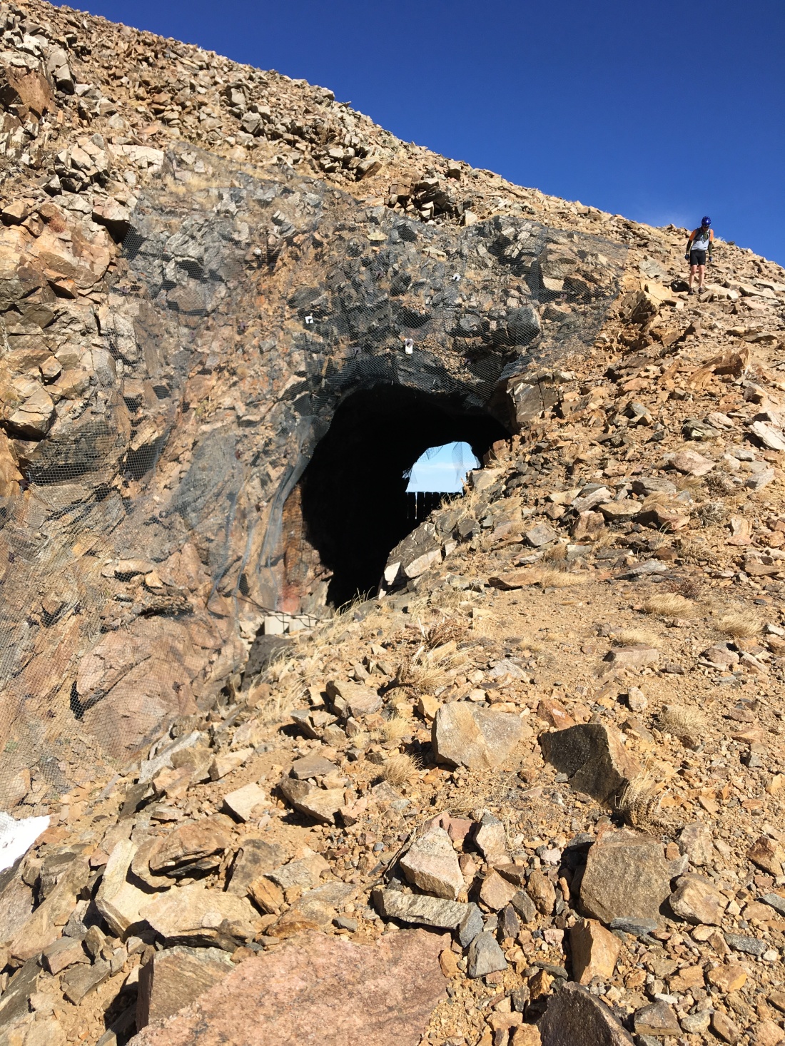
My favorite part of the climb began at Yankee Doodle Lake, as you can look up see a little dot where the Needle’s Eye Tunnel exits towards the west. Knowing you’re riding a bike up there is exhilarating.
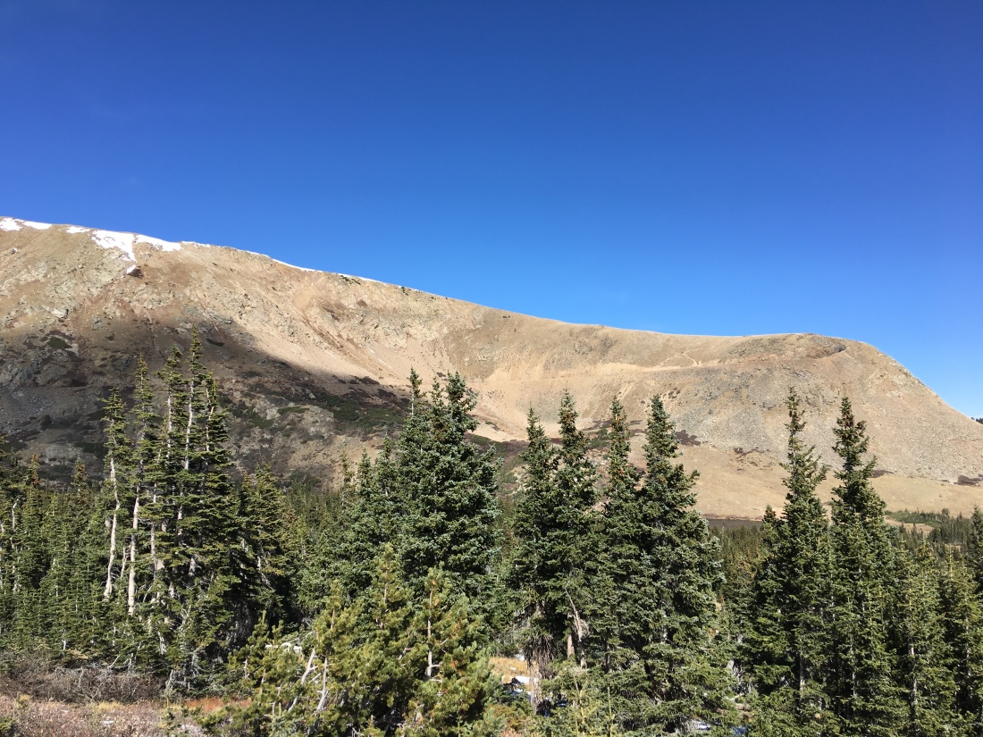
As the climb proceeds you are presented with the epic final grade where you can imagine old steam engines working hard to make the summit. Carefully examine this photo and you can see the tunnel up and to the right.
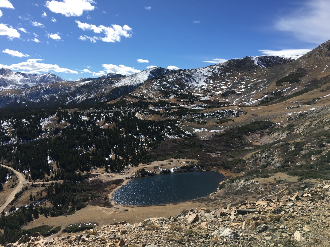
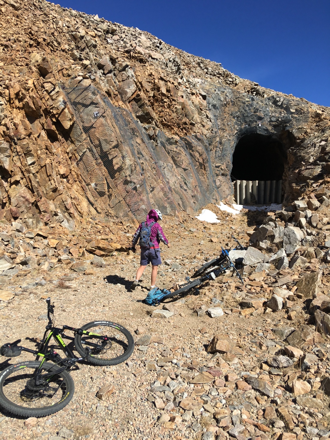
At the tunnel you can look down on the awesome climb.
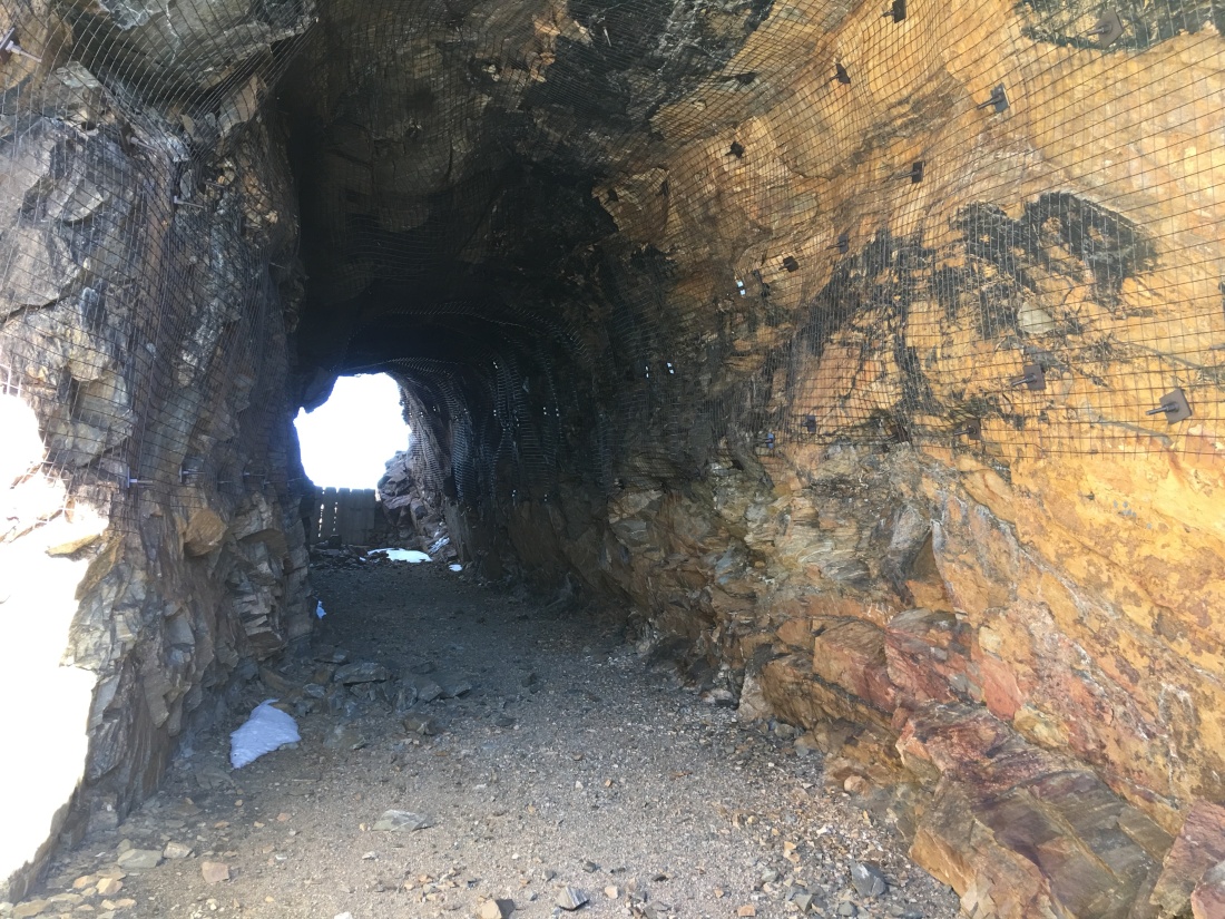
The tunnel is closed but still fun to look at.
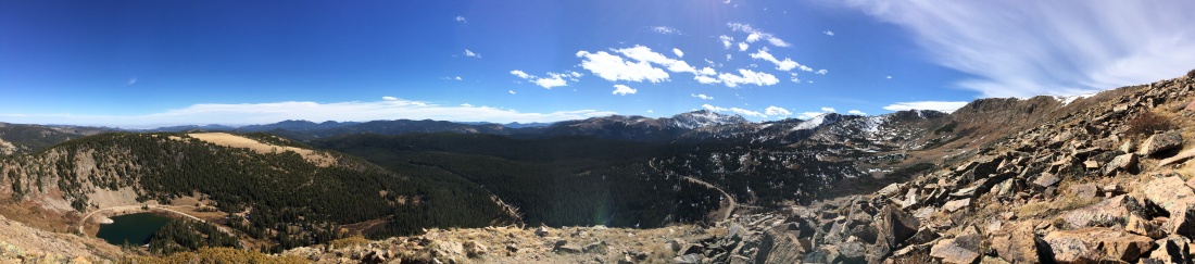
You can climb over the tunnel and look down on the aforementioned Yankee Doodle Lake.
This entire journey actually taught me the meaning of Rocky Mountain High.
What Could Go Right
I mentioned several times we got “caught” in Denver much longer than expected due to Airstream problems. But my god, look what it brought us. Windish RV did an awesome job on the trailer and their fixes got us back on the road. In the meantime while the trailer was undergoing repair we saw the most unbelievable side of Denver and surrounding area.
Recommendation
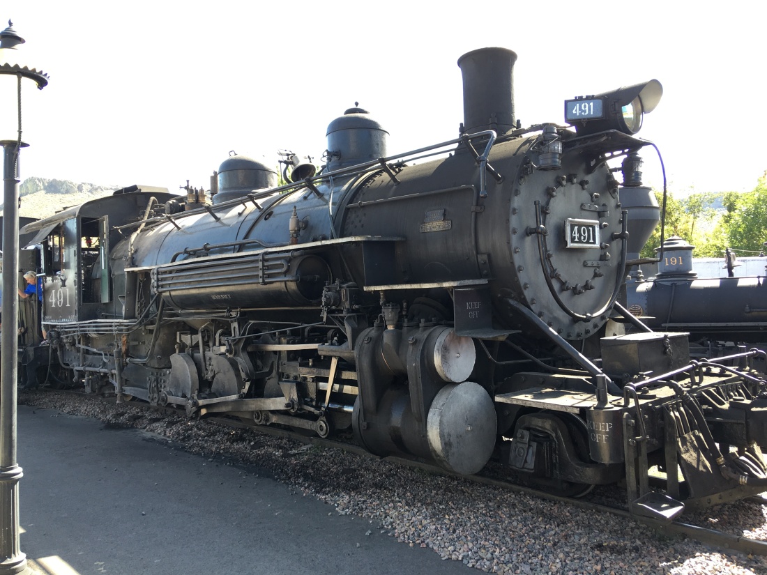
Yes, Chatfield State Park and the surrounding area has “it”! Go! Go for the water, go for the mountain biking and go for the trains and more trains!
In our continuing series on places we’ve stayed in the Airstream, I am proud to introduce Fruita Colorado.
*According to a local we spoke with, Fruita is pronounced “Froo”-“tah”. Apologies to any other locals reading this blog if we got that wrong.
Booking
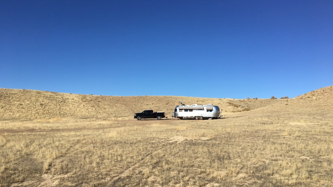
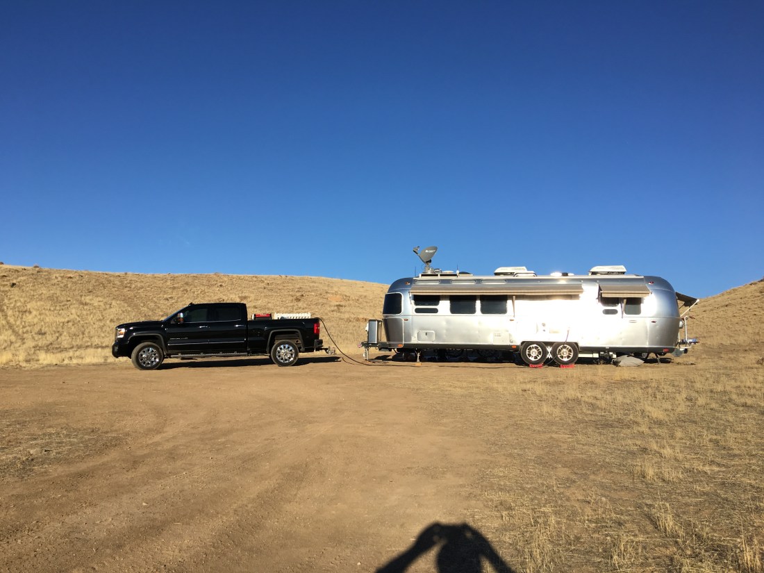
Free! That’s right – we boondocked on BLM land north of Fruita near the 18 Road Trailhead for free. As American citizens BLM land belongs to all of us so you can stay out here for up to 14 days at no charge. Etiquette suggests however, you try your very best to occupy only a campsite that has previously been established, pack out whatever you packed in, never dump water (not even gray water), be mindful of fires (as in dead out when unattended) and in general leave things better than they were when you got there.
Amenities & Activities
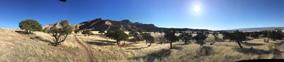
The 18 Road Trailhead is about 40 minutes north of town on a curiously non-linear route that threads itself among beautiful rural Colorado farmsteads and frustratingly slow school buses. Buses aside, the seemly endless series of lefts and rights eventually gives way to dirt as 18 road crosses onto BLM land; finally heading north uninterrupted.
We stayed at a dispersed spot slightly south-east of the trailhead and made use of a previously established fire ring and turn-around for the Airstream.
Since we were boondocking we were entirely cut off from services. Survival consisted, therefore, of a combination of solar and generator for power, our 50-gallon tank for water and every nook and cranny stuffed full of food for provisions. At the end of our stay we stopped by the Colorado Welcome Center, which offers a free dump station and water fill.
Our camp site was comprised of dense compressed clay and sadly we were also heavily surrounded by foxtails, an aggressive weed-like grass that is very harmful to pets. This heavily limited our dog-walking activities and definitely blemished the experience. The best thing about boondocking, though, are the stars, which are just unbelievable out there.
As remote as this spot felt, services were within easy reach. We utilized the Fruita Laundromat several times. Across the street is Judy’s Family Restaurant serving authentic delicious Americana at fair prices with genuine friendly service. We shopped at City Market for groceries and washed our bikes and truck at the Wildcat Car Wash.
This area is wildly popular for off-road enthusiasts and there seemed to be a good balance of roads and trails for everyone. We also saw some horseback riders and plenty of other mountain bikers, noise was low and everybody pretty much kept to themselves. Also best of all cell signal was strong.
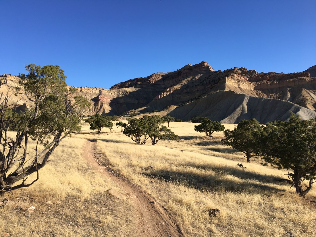
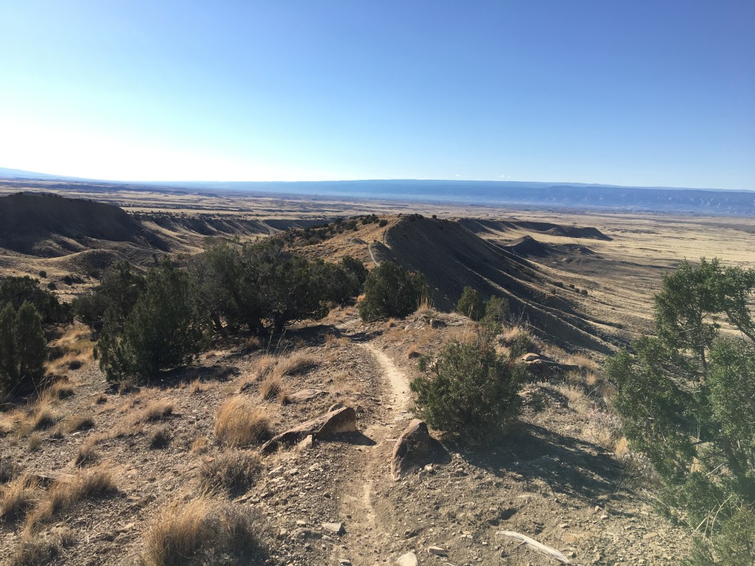
Mountain Biking
We came to this spot because Fruita is somewhat legendary in the mountain biking community, essentially right up there with Moab. Unfortunately, while we were staying there (early November) it rained quite a bit and I discovered on my first attempt to ride Western Zippity that the ground here is actually dried super glue, and when mixed with even the slightest amount of water, it turns into a dreadful slag that instantly cakes on wheels, gears, pedals and chains making riding impossible.
Cement in Disguise
Once the rain subsided I did finally squeeze in one ride on the Zippity Loop.
This trail is marked blue/black and I would agree this is an accurate designation. Altitude makes for moderate fitness and there was one intense hike-a-bike on the north portion of the ride.
The ride wasn’t wildly technical except for one downhill on these ridges where I dismounted due to a puckery incline. As you all know by now I ride to zen out, and I got that on the western part of the trail but had to reel it in so as not to die on the black part of the eastern leg.
What Could Go Wrong
No Airstream Issues!
We came through Fruita in mid November, a full month later than we’d intended. This was due to a massive six week delay in Denver while Windish RV replaced a broken A/C unit and addressed a dozen other quality issues. They did excellent work, though and the repairs have held to this day. I also would not recommend hanging out in the Rockies this late in the season, we got lucky with only some moderate rain but at those altitudes anything can happen.
No Riding in the Rain
Because of our November arrival we were on a bit of a schedule and moved through Fruita quickly. The rain caught up with us there really giving me only one day to explore. When I tried to ride in the rain anyway I was severely punished by the cement-in-disguise. My only takeaway is don’t try to ride in the rain here, as I had to carry my bike out a mile (1.6 km) and take it to a car wash to get all the crud off.
Foxtails
As I mentioned previously foxtails are harmful to pets. We had a severe incident with one of those little buggers embedding in one of our dachshund’s paws leading to an abscess. Because of this lesson we very carefully charted a course to walk the dogs and inspected them after each walk to remove any hitchhikers.
Recommendation
Fruita is an interesting stop on our journey because my silent partner and I almost always agree on what locations we liked, except for here. I loved the remoteness and the one trail I got to ride was gorgeous. My silent partner, on the other hand, thought it was too lunar in appearance and found the foxtails ruined dog-walking. I suppose this means this particular location in Fruita, for us, did not have “it”.
We still talk about it though, and if you’re in the area I say go for it and ride the rides! Just be very careful with your pets and please respect the land, we saw a fair amount of damage from ATVs, which seemed so senseless.
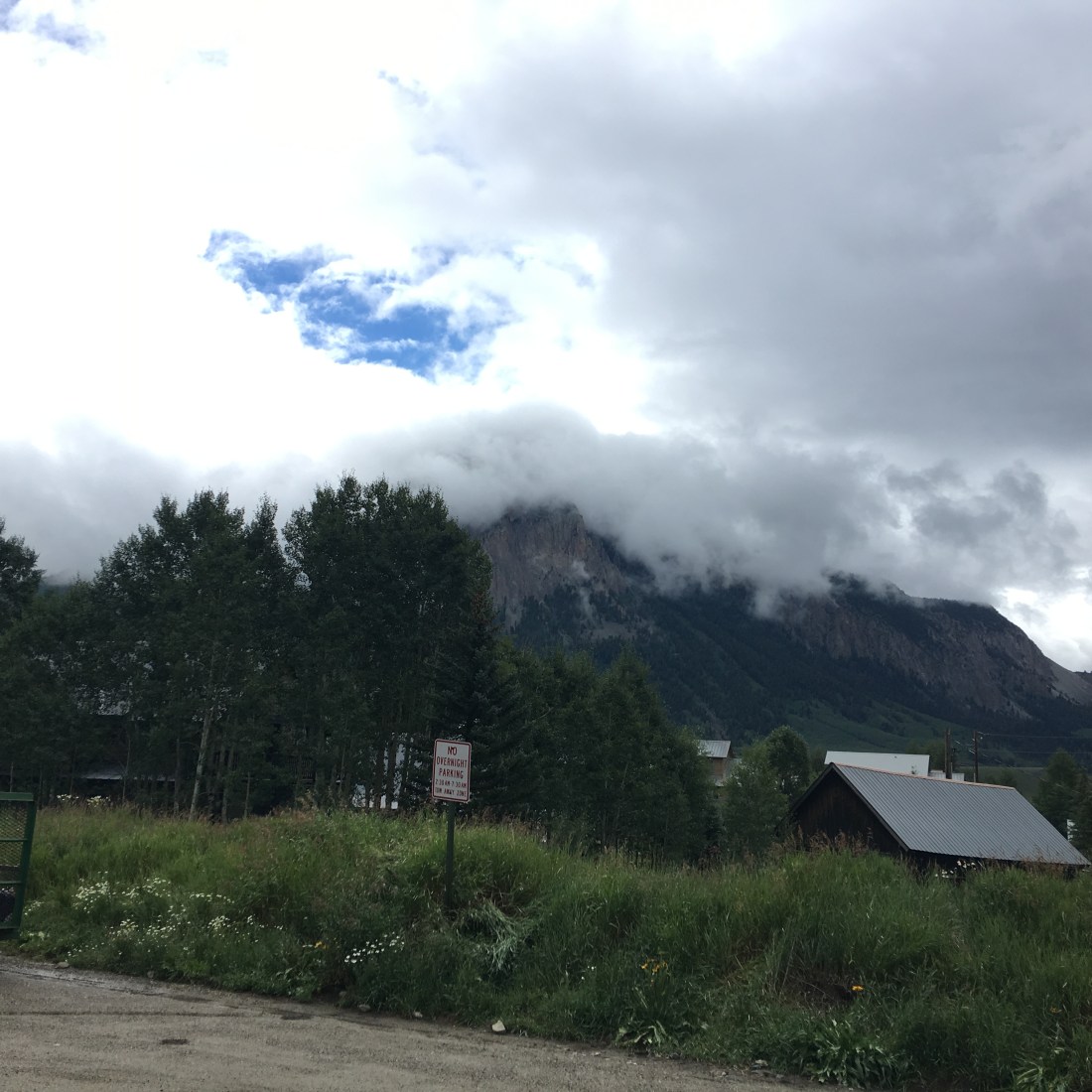
In our continuing series on places we’ve stayed in the Airstream, I am proud to introduce one of my favoritest places in the world, Crested Butte Colorado.
This post takes a slightly different format from the others, as we stayed in and around Crested Butte for so long it can’t be boiled down to a simple review.
Instead, settle in and enjoy a slow-roll through the “it” that makes this entire region so special.
Why Colorado
I lived in Colorado on and off for 15 years and ultimately got my degree at CU Boulder. After that I wandered off into the southwest to spread my wings, build my career and meet the love of my life. Maybe it’s because I lived in Colorado during my formative years, or maybe it’s because my parents took me on so many camping adventures to eat dirt and catch stuff on fire. Whatever the reason, Colorado stayed in my soul and I now it forms the core of my spiritual power source. Over the years I’ve always made my way back to visit, of course, but the Airstream gave us the chance to explore Colorado in more depth than I ever did when I lived there.
The Plan
After I bought the Airstream and secured the opportunity from my employer to travel full-time, my thoughts immediately turned to Colorado. Specifically, Crested Butte. Very crudely speaking, if you were to stick a pin in the middle of Colorado, that’s Crested Butte.
But why there? The reason is simple – Crested Butte and the surrounding area straddles the most iconic ranges in the Rocky Mountains called the Collegiate Peaks. This range forms a savage chain of “14ers” that literally materialize the term “rocky” mountains. Here you can travel to incredible altitudes, see some of the most brutal terrain in the state, soak up primal forests, camp next to lakes, rivers and streams and mingle with alpine critters.
And of course, you can do all these things mountain biking!
The plan, therefore, was to launch our full-time Airstream living from Phoenix, and then work our way north – quickly.
The Route
Leaving Phoenix we stayed briefly in Flagstaff, AZ:
Then Cortez, CO.
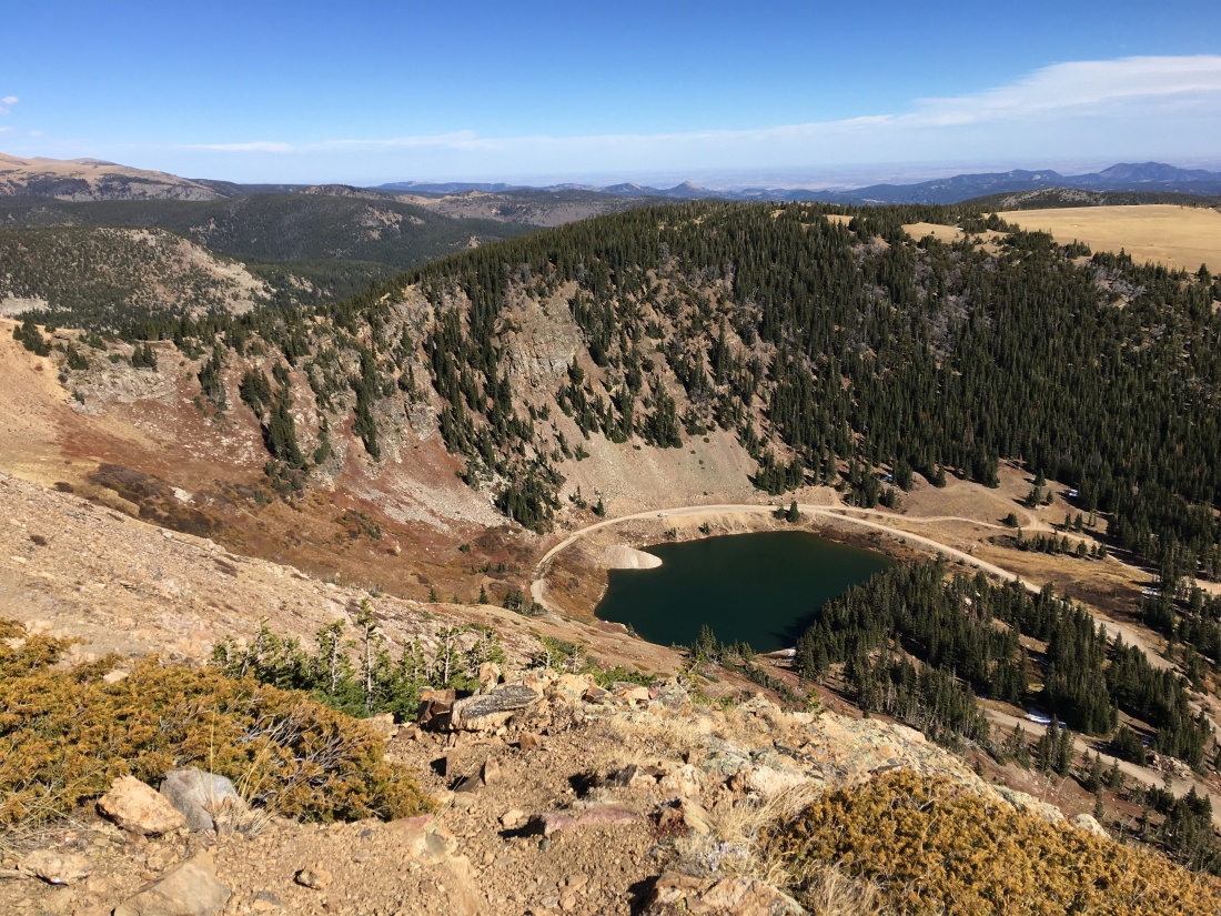
Phil’s World Mountain Bike Trailhead
Then Silverton, CO.
And finally the Crested Butte area.
In & Around “CB”
We talked a lot about financial resources, and how much time to spend there and ultimately decided we wanted to spend an entire summer in the mountains. As a result we stayed in Gunnison, CO (which is ~1/2 hour south of Crested Butte) for a month, then two weeks near Lake Irwin (which is about ~1/2 hour west of Crested Butte) and finally six weeks in Crested Butte (aka “CB”) itself.
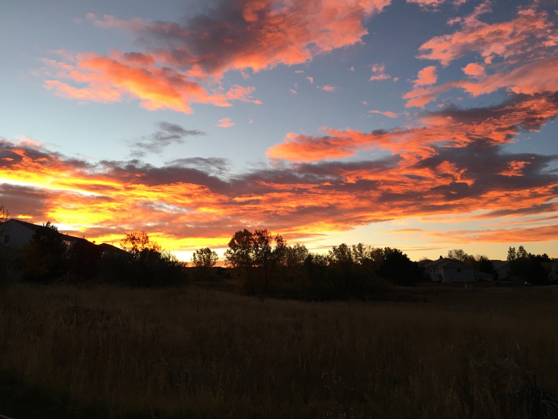
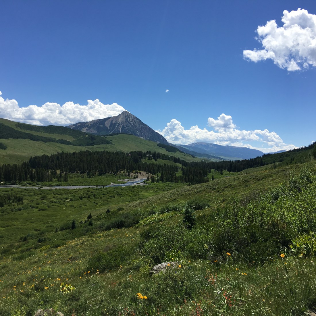
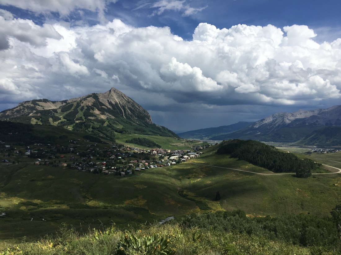
Colorful Colorado
Colorado means “The Color Red” though some people choose to interpret it simply as “Colorful”. I subscribe to the latter and invite you to really take your time when looking at my photos. In particular, pay attention to the sky. Oh my gosh that blue!
Gunnison
As we worked our way north from Silverton we passed through Montrose, CO staying one night at the Montrose KOA.
Then finally into Gunnison, a smallish college town about 1/2 hour south of Crested Butte. This lovely mountain community is home to Western State Colorado University and also has an airport which caters largely to vacationers. According to the internets, it has ~6000 residents.
Camping here was comfortable, though when the cottonwoods shed it did cause a little trouble with satellite reception.
Mountain Biking
Gunnison has exceptional mountain biking, both north of town and south of town.
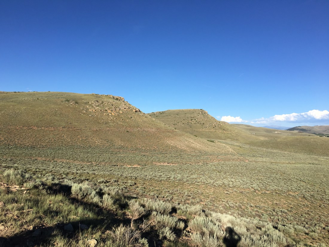
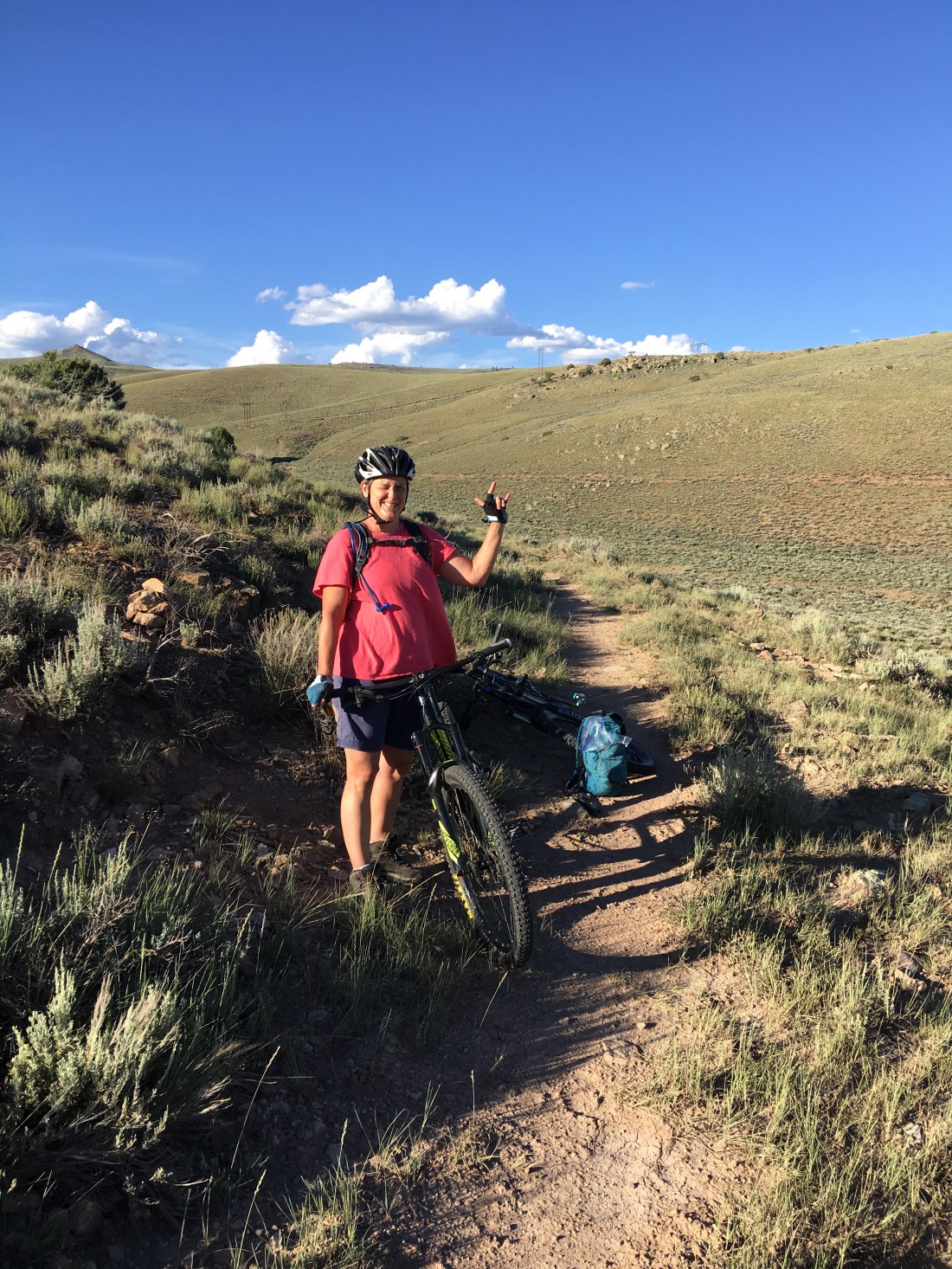
North Side
The north side of Gunnison has a tangled rats nest of trails that concentrate more or less around the university. I explored these trails extensively on my lunch-time rides and wound up forming my own loops much of the time.
My favorite trail though is Contour, so named as it follows the contours of the local geography with very little climbing.
Even though the trail is an easy green, riding here was zen-like, quiet, fulfilling, and wonderful.
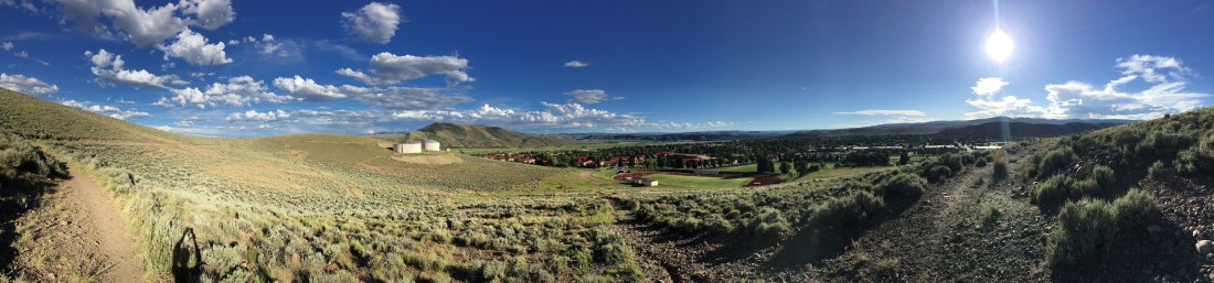
South Side
The south side of Gunnison has an extensive trail system collectively referred to as Hartman Rocks. I’m entirely competent on technical terrain but I generally stick to technical blues and low-end blacks. At my age I really just don’t need a broken collar bone or shattered wrist.
That said, I immediately went out there and rode The Ridge, a black diamond, and then cut into part of the Hartman Rocks featured ride. I found the Lower Jack’s drop-in to be somewhat of a lung-buster and quite a high cost of admission just to get up there, and The Ridge was just a little more technical than I like so I dismounted plenty of times. This area is BLM land so it’s also shared with a lot of ATV enthusiasts and I was dodging some off-roaders on my way back.
The Altitude
Gunnison is over 7600′ (2347m) in elevation, that’s over a mile (2.3km)! At these altitudes flat-landers begin to appreciate the local advice – if you’re not habituated to the altitude plan for rides halfas long as you normally would. The general wisdom suggests that it takes about six weeks to adjust to high altitude and that is about what we experienced.
The Cost of Groceries, OMFG!
One misfire on our trip arguably would be the cost of groceries. It’s no surprise in retrospect that groceries are absolutely lunatic expensive in Gunnison, given that it’s far from everything and all roads are twisty and mountainous. We learned, however, that expensive as things are in Gunnison, they’re positively bonkers in Crested Butte. That would be, of course, because Crested Butte is even more Rocky Mountainish, snuggled way up into a valley with essentially one way out.
We learned, therefore, even when we stayed in Crested Butte to make a bi-weekly migration down to Gunnison where our groceries ran us “only” triple what we were used to in Phoenix.
Surrounding Activities
The Gunnison area offers endless outdoor activities but one of our favorite weekenders was exploration. In particular we made several excursions north out of Gunnison, took a right in Almont and followed county road 742 to Taylor Park Reservoir. This drive is slow and winding and we wanted it that way.
We saw bighorn sheep on this drive though there are also purported to be mountain goats, bears, moose and mountain lions readily seen here too. There’s so much wildlife to see on this drive it’s punctuated with paved pull-offs to let you enjoy the critter ‘watchin.
Once at the reservoir we explored some of the 4WD trails on the north side of the lake and drove over to check out the Colorado Dream Ranch RV Park. The unbelievable Cottonwood Pass is also close by, though we did not drive it this time.
One of the other more amazing parts of Colorado is the ghost town of St. Elmo, which is on the east side of Tin Cup Pass. If you have the fortitude to drive this road (I do not) the west end of this road ends at the unincorporated community of Tincup.
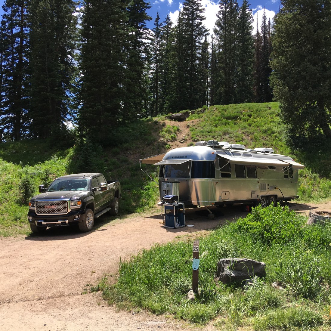
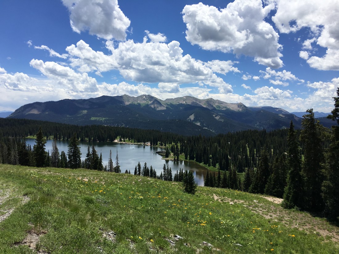
Lake Irwin
After spending a month in Gunnison it was time to pull up stakes and move along to Lake Irwin Campground, Colorado. This campground is mostly reservation only on the federal portal, though there are a few first-come-first-served sites, which we were lucky enough to snag for almost two weeks.
It should be noted this is an incredibly busy campground so reservations are tough to get. There is an extensive amount of dispersed camping on county road 826 after the lake. While that area is easily 4WD accessible I would never attempt to pull the Airstream up there. We asked the host on a previous weekend what the best day was to snag a walk-up site and she said Thursdays – which turned out to be exactly right.
The campground is located west of Crested Butte deep in the craggy, intense middle-earth like Ruby Range. This range is part of the Maroon Formation which gives the mountains their characteristically red color.
The Lake
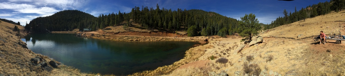
Lake Irwin is a placid body of water brimming with fish and ideal for zenning, dog-walking, fishing and of course kayaking.
I rode up to the Irwin Lodge on my mountain bike for this incredible view.
Mountain Biking
Lake Irwin is the headwaters for some excellent mountain biking. Keeping in mind this lake is at 10,000ft (3108m) we planned for the extreme altitude but found by then we’d pretty much acclimated and didn’t have any trouble.
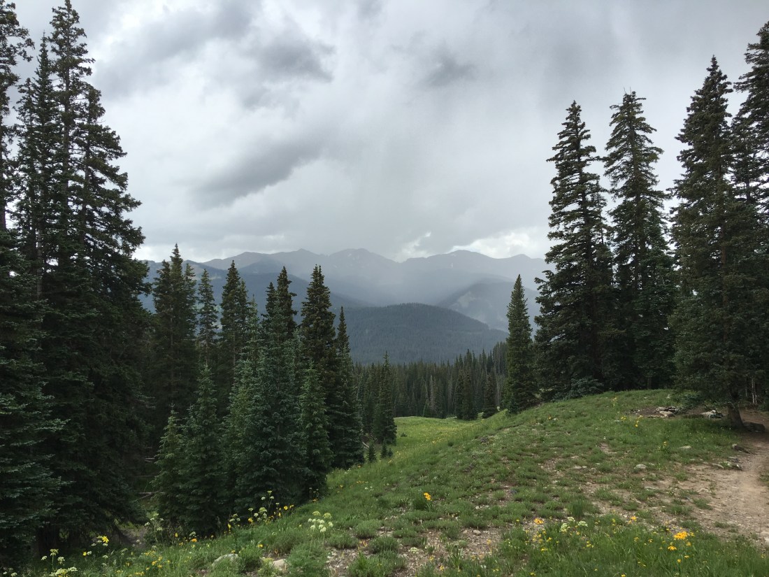
I would also point out the weather here is incredibly testy. It pays off to get out and do your activities before noon as the rains and hail usually move in by then.
Dyke Trail
The Dyke Trail departs directly from Lake Irwin (the trailhead is a tiny bit west on county road 826) and, I believe, earns its black diamond rating more from fitness than tech. The mountain biking season here is incredibly short so we found the trail was also muddy and filled with post-holes from horseback riders. Once you reach the east trailhead you can, if you have the fortitude (we did not), ride east on county road 12 and back to lake Irwin.
Kebler Pass
My partner and I made our own loop from Lake Irwin down the dirt county road 826 from the lake to county road 12, then rode west towards Kebler Pass.
We also caught some of the 4WD drive offshoots around Irwin Cemetery in a free-range lazy day of exploring.
Kebler Wagon Trail 606
While staying at Lake Irwin we also rode the Kebler Wagon Trail 606 beginning at the campground, again rolling down county road 826 from the lake and then left at county road 12. This isn’t an especially technical trail, and it follows road, but still fun.
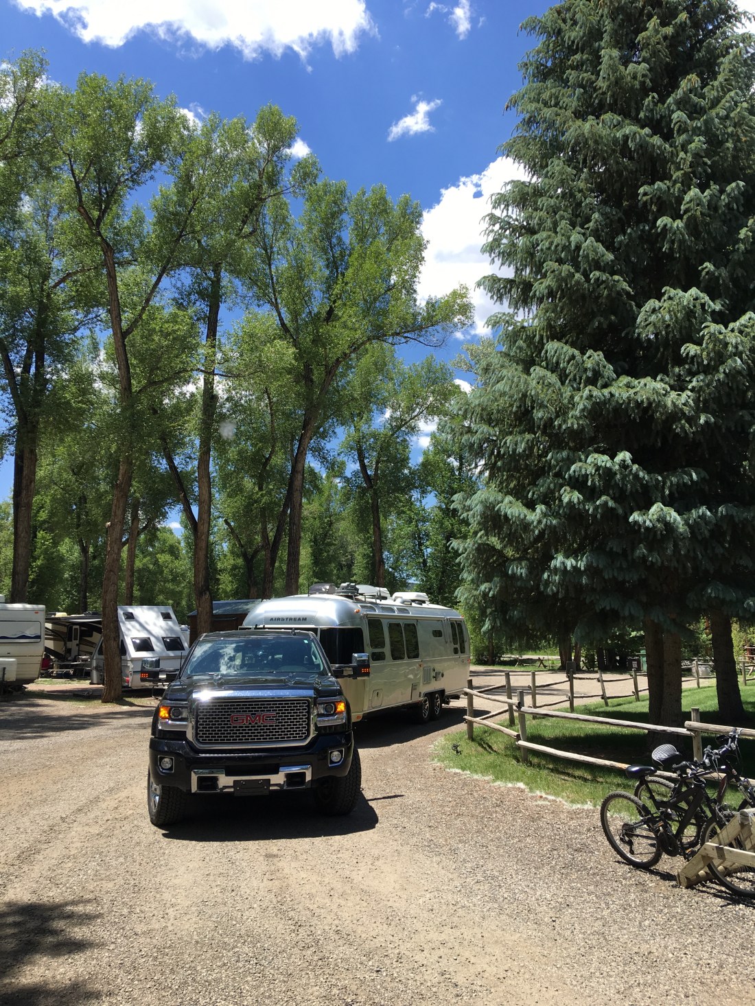
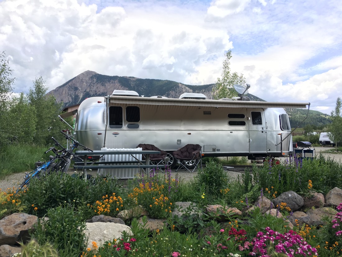
Crested Butte
After two weeks at Lake Irwin it was time to move on to Crested Butte proper. We splurged on six weeks at the Crested Butte RV Resort. The owners were incredibly pleasant and offered us a discount for the extended stay. They also once ran a landscaping business and it shows, look at those flowers!
Also it would seem the city of Crested Butte was less than enthusiastic about the idea of an RV part so they didn’t cooperate much on the zoning. They allowed the park to be built, they allowed a bath house (which was glorious by the way), but they prohibited site sewer lines due to “proximity to the Slate River”.
We found this more or less astonishing, considering the Slate River runs directly behind the industrial park in which the RV resort is located. Nonetheless, this meant we had to tow once a week to a public dump station in town.
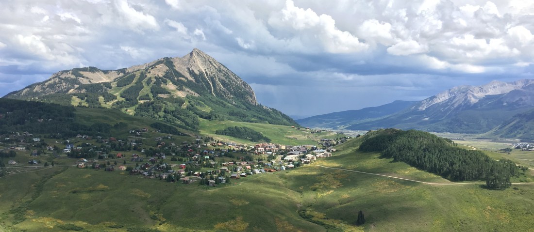
The Town
Crested Butte is (bleeping) awesome. If I was a millionaire I would live here no questions asked. It has the small town Colorado feel.
This is how the locals commute.
There are regular art fairs, music festivals, and artwork scattered around the city.
Mountain Biking
Mountain biking, mountain biking and more mountain biking. We biked our butts off here!
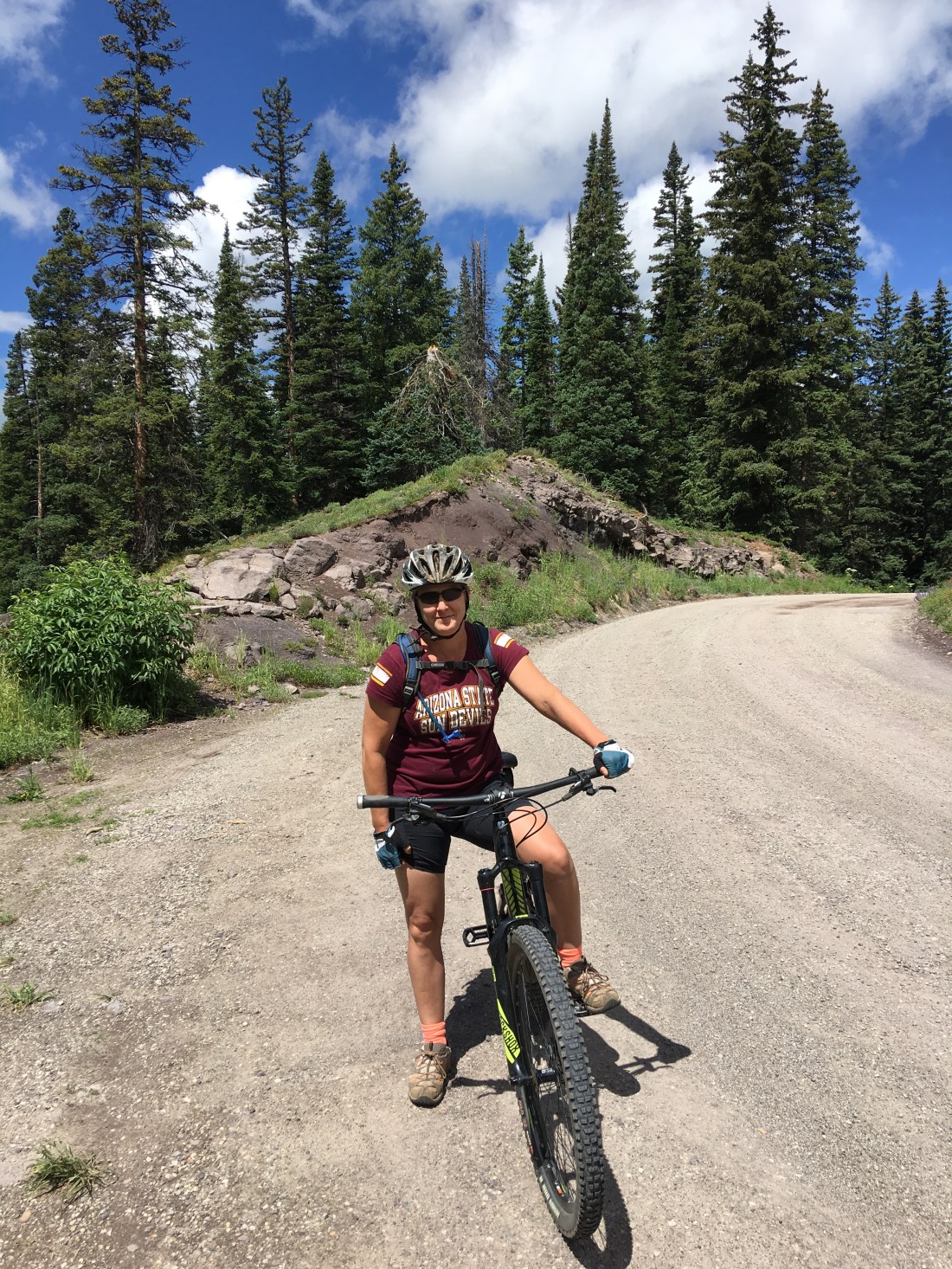
Airstream Trailhead
One of the most extraordinary aspects of our Airstreaming and mountain biking experience was “riding to the ride”. We made strategic choices on our entire cross-America trip to make sure we could always ride from the Airstream to our destination.
In Crested Butte our RV park was located in the Riverland Industrial Park, which is a little bit south of town. To get into town, and virtually every ride therefore, we always began with a northerly ride on New Deli Trail. This connector gave us a traffic-free interstate from the Airstream into the heart of Crested Butte, where we branched out on dozens of rides.
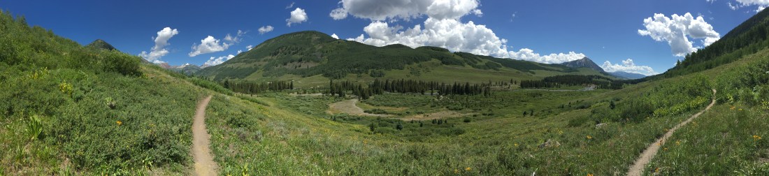
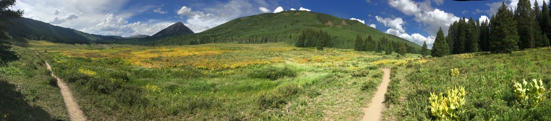
Upper Lower Loop
Beginning in the heart of Crested Butte, the Upper Lower Loop forms one leg of nearly the only easy going ride in Crested Butte. This portion of the trail hugs the mountains in a thin ribbon of single-track looking out across a valley.
You lose exactly nothing in the majesty of the Rockies even though this trail is rated green, proving you don’t need a lung-buster to enjoy the trails here.
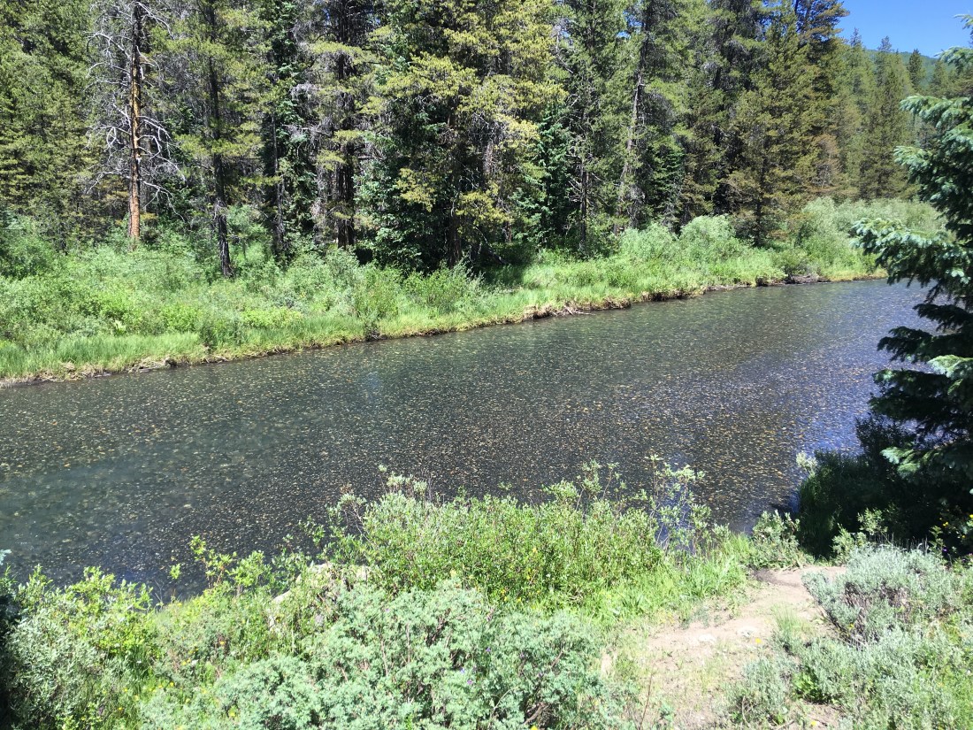
Lower Loop
The Lower Loop trail is the second half of the Upper Lower Loop. It runs along the Slate River and you can ride clockwise or counter. I did both to mix it up.
Evolution Bike Park
When it comes to mountain biking, I am a “eat your veggies and then desert” kind of girl. I like a tough climb then a rewarding downhill at the end.
Or….
You can saw screw it, eat desert and no vegetables and ride an entire day of insane heart-stopping gravity filled adventure at the Evolution Bike Park. The entrance fee was pricey but well worth it for the hoursand hours of clamper cramps and smiles we had to surgically remove from our faces.
The park has too many trails to really list individually but suffices to say we rode about 6 hours (including lunch break) and we did all the greens and blues.
I highlyrecommend the experience.
Upper Upper Loop
The Upper Upper Loop runs directly across the west face of Mt. Crested Butte offering breathtaking views of the granite face before you are enveloped by the forest. Taking Tony’s Trail to drop in you can even see people practicing their rock-climbing skills on nearby boulders that have clearly broken free from the face.
The Upper Upper Loop is a blue-black and indeed I found it to be fairly technical and heavily demanding on fitness. Sadly I dismounted a handful of times. Still I deeply enjoyed the thick forests of Aspen trees and joined up with the south part of Deer Creek Loop to get back to the Airstream.
Snodgrass
The Snodgrass trail is so named for the family owned land it crosses. Luckily at the time we were there it was open and dry. This trail has a massive price of admission fitness-wise and demands a huge lung-busting ride up to Mt. Crested Butte (the ski town just north of Crested Butte) then up grades in excess of 10%.
The reward however, is mind-boggling views of the city below, sweet-smelling Aspen and awesome downhills on the other side.
Lupine
The Lupine trail, so named for a local flower, offers the same lung-busting ride up to Mt. Crested Butte as Snodgrass but only a small heart-attack inducing climb after that. As this trail is somewhat in the same area as Snodgrass it too dives into Aspen groves and supplies a glorious descent on the other side.
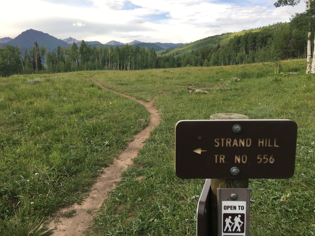
Strand Hill
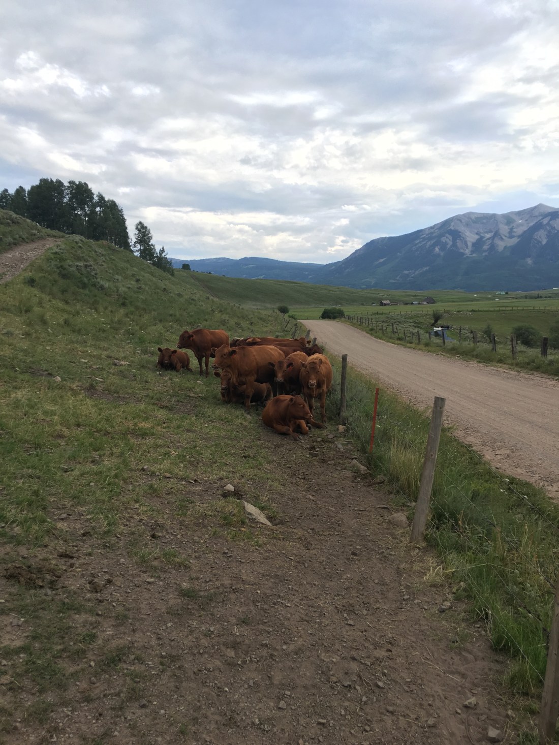
The Strand Hill trail was directly east of the Airstream on county road 738, about 4mi (6.4km). As with many other trails in this area the price of admission was intense – the climb starts with some four-legged observers.
But then turns into a sustained 10% climb for about 3mi (4.8km). The reward being an alpine meadow surrounded by Aspen groves.
Once at the top Strand Hill offers an awesome sustained mildly technical descent and joins into the Canal trail. This portion of Canal is benign and makes for a nice wind-down but I discovered in a later ride upper Canal offered near death.
Brush Creek
The Brush Creek trail is also located on county road 738, though only in about 3mi (4.8km). Other than Lower Loop this is really the only non-chairlift assisted trail in the Crested Butte area I would describe as easy. The trail is remarkable owing to the fact it’s the only trail directly on the east side of Mt. Crested Butte. It makes for an easy out-and-back with the turn-around dead-ending at the East River.
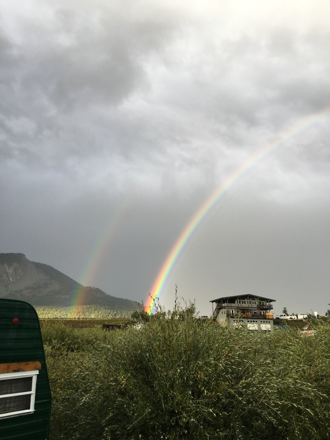
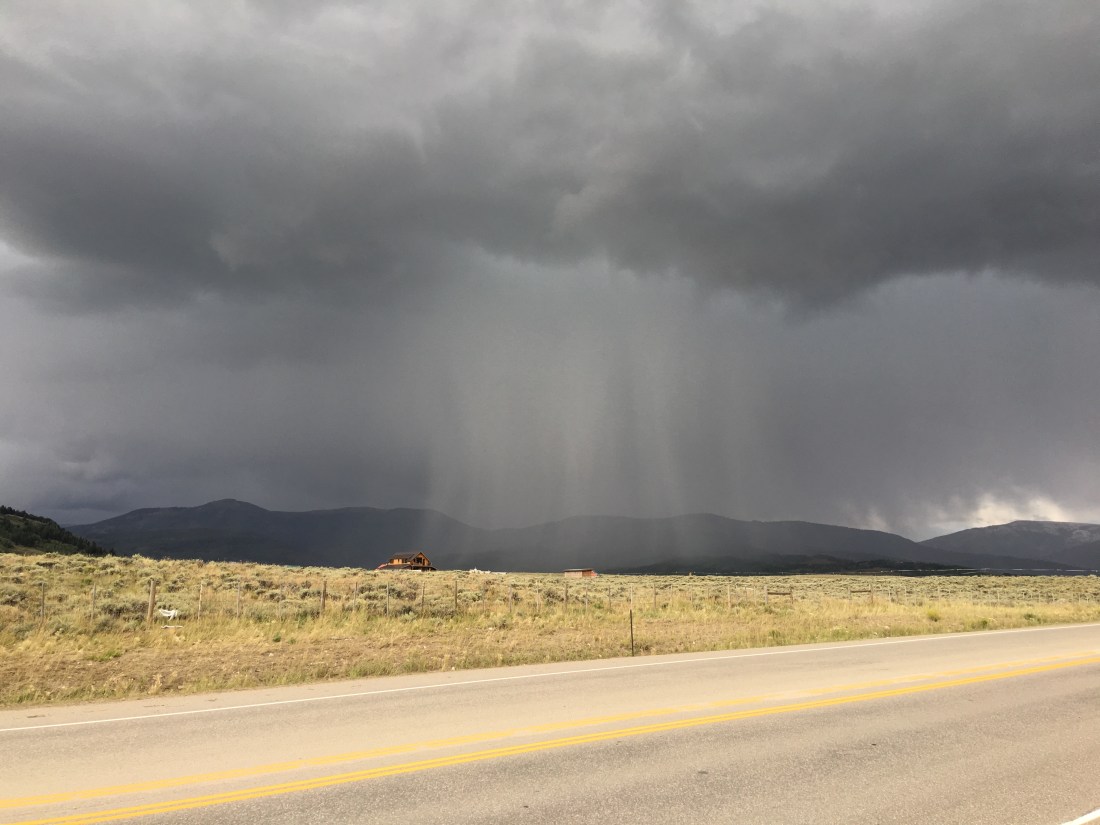
Rain Sucks
I mentioned earlier the weather in Crested Butte is unbelievably temperamental. The weather report was essentially worthless, I assume owing to the complex geology of the Rockies. We hit an unfortunate skid of about a week of heavy rain that drove me to depression at all the rides I was missing.
And in keeping with Colorado’s mantra, “If you don’t like the weather then just wait for 15 minutes” it freaking snowed, in August!
Farris Creek (one of those rides)
The Farris Creek trail is one of those rides you can look back on and see the things you did wrong. I’m still glad I rode it, but this trail is rated as black and that’s for a reason – it’s highly demanding in fitness and on the last third very very technical. I also made assumptions about the return leg of the trip, but we’ll get to that in a bit.
I set this ominous tone because it had been raining for days and I was near to chewing my own legs off when the weather finally broke.
People who know me would say I might not be the best at exercising patience (understatement). Instead of waiting a couple days for the trails to dry out I headed out the very next day, determined to ride Farris Creek before we left Crested Butte, or the Earth was struck by a meteor.
Though of course the outset was fine, I found on the far side of Strand Hill (which is close to Farris Creek) the trail was epically muddy and churned into a black soupy pudding by cattle. Not to be deterred I soldiered on at which point it began to rain. Again. As time went by the pudding-like trail got more pudding-like. My tires caked with mud and I walked/rode large segments of the final climb.
Now every mountain biker can empathize with me: Near the summit I stood there in a rain jacket, shivering, and wondering if I should turn around. Looking at the phone I could see I was half-way, or so I thought by distance. I could also see I should be on the “easy” part of the trail, the downhill. I decided it would be better to do the downhill rather than go back through the black-goo pond that alleged to be a trail.
While I didn’t die descending that last mile of Farris Creek, it left me rattled. The descent on the north side was intense, easily exceeding 14%. Mix in rain, mud and cold and it was an extremely dodgy way down, even for a very experienced technical rider with a very good rig. When I finally made it down I was muddy, wet, cold and annoyed at dismounting on the downhill, which I rarely do. I was also a bit surprised that I popped out on a forest road instead of dumping directly into the Canal trail, which is not what I was expecting on the map.
Reorienting myself I found that I needed to follow what I believe was Pearl Pass Road until I hooked back into the Canal trail. This entailed more climbing, which I wasn’t mentally prepared for, and then I finally met back up with the Canal trail.
Keep in mind while this is going down it’s raining, and the temperatures are not much above freezing.
So, back to the assumptions I mentioned at the beginning. I assumed that the Canal trail would be the mild-mannered kitten I had experienced when hooking into it from Strand Hill. Instead I find this trail crawls along the side of extreme mountain exposures with long certain-death drops into Brush Creek. To further enhance the fun I came to find that this trail had been washed over in a half dozen spots by landslides. Not a good situation to be in, alone, wet, cold and probably making risky decisions.
Ok, I am blogging so obviously I made it out alive. I very carefully picked my way along the Canal trail and finally decided it was too risky so I bailed back to the forest road and took it out. By the time I hooked back into county road 738 and rode home at least four hours had gone by, possibly more. My partner was near hysteria and I did get a good talking to.
Food
I should throw a couple shout-outs for the food in Crested Butte, which was excellent.
Paradise Cafe. Awesome lunch and breakfasts and incredibly affordable for the locale.
Gas Cafe One Stop. Yes, it’s a gas station. Best food ever after a mega-ride like Snodgrass or Lupine.
Mountain Earth Whole Foods. Good local grocery store carrying natural products.
Crested Butte Mountain Bike Association
The Crested Butte Mountain Bike Association is responsible for the incredible number of trails in Crested Butte and their amazing condition. I dropped them some cash as my own way of saying thank you!
Laundry
Our RV park did not have laundry, owing to the Riverland Industrial park’s limited electrical capacity. We used the Crested Butte Lodge & Hostel, which has a laundromat next door. The hours weren’t great though, and they were expensive so if you can hump your laundry down to One Stop Wash & Laundry in Gunnison while you’re there on a grocery run anyway, then all the better.
Dump Station
I mentioned early on that Crested Butte RV Resort was not allowed by code to install sewer lines so the sites had city water and electric (some 30 amp, some 50 amp) but no sewer. As a result we used the publicly available Septic Dump Station located at the southeast corner of 800 Butte Avenue. The system operates on an honor system and for a small fee you can dump and fill with fresh water.
Also keep in mind when you exit you can simply continue east on Butte Ave and then take a right on 9th then right again on Teocalli Ave; not sure why so many drivers were intent on u-turning right there.
What Could Go Wrong
Considering we were only full-timing in the Airstream for four months by this time we encountered a few problems. We found out we had a pretty bad leak.
It was also sometime here we discovered that one of the Dometic A/C units had failed. Getting that fixed lead us to a six week layover in Denver while Windish RV got a replacement.
Thank god we had family in Denver, we were not prepared to incur the costs of a hotel for that long.
Parting Thoughts
By now you know, Colorado has “it”. Actually, I think “it” was born here. Go to Crested Butte if you have the means, stay a while, ride the rides and enjoy the people. I just can’t say anything better about this entire region.
Remember though, this is savage country. Bring cold-weather gear even in summer, do your rides with a buddy if you can, and if you are not acclimated to the altitude plan for halfwhat you would normally do.
Unlike the previous Florida state parks we’ve blogged about, this campground is in a national park and therefore searched and booked on the federal portal. The park is located in the Ocala National Forest in north-central Florida which places it within easy driving distance of Orlando, Ocala and Gainesville.
Due to this urban proximity we found this park to be exceptionally busy and loud. As you might expect, most of the action takes place over the weekend as visitors let off steam, then it quiets down during the week. Despite the high traffic the park is quite expansive so we found one site for a week with no issues. Cell phone service was very strong and fast, which was a desperate relief from Manatee Springs.
Amenities & Activities
Alexander Springs Recreation Area sits off of a relatively remote portion of Florida County Road 445, which winds its way haphazardly around the southern part of the Ocala National Forest. The drive is beautiful and surrounded on all sides by sand pine, and longleaf pine and numerous water features. The entrance is closed at night and secured with a code supplied at check-in time.
Pads were asphalt, campsites were very sandy and there were no services – though our loop had strategically placed water taps that could be reached with a long hose. We only stayed a week so we used the dump station on our departure day. There were a variety of bath houses placed centrally to most loops but no laundry facilities. Satellite reception was easy owing to the tall thin pines around camp.
Snorkeling
As with Manatee Springs the primary reason we visited this park was the springs.
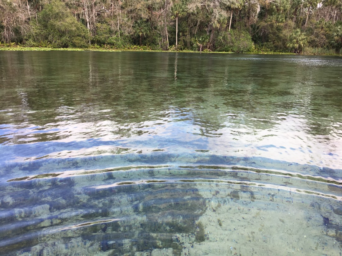
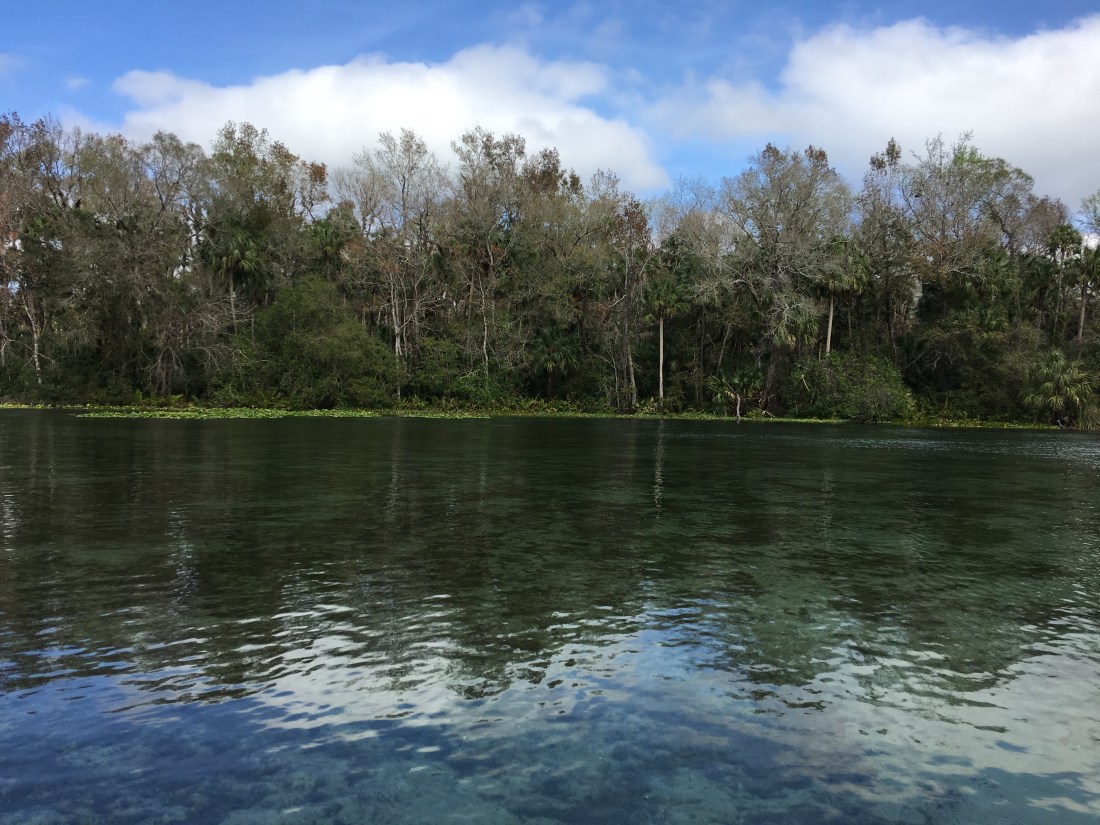
Alexander Springs is a first magnitude spring and produces 100 million or more gallons (378 million L) of fresh water daily. The water offers a constant temperature around 72 °F (23 °C) making it thoroughly enjoyable with our 3mm wetsuits.
Snorkeling the springs was very different from Manatee springs, which offered stairs and a steep approach to a relatively small body of water. Here the expansive body of water started warm, clear and shallow at the shore and stayed that way for quite a distance until dramatically dropping off into a deep abyss.
The spring itself gushes out of a violent gash in the underlying white limestone and offers endless diving opportunities and creature watching. A thick and vibrant forest of sea grass formed habitat right at this boundary attracting a wide range of fish and turtles. I spent quite a bit of time just zenning out to the complex light patterns cast on the waving grasses.
Surrounding Activities
Alexander Springs offers a wide range of other activities including scuba diving, kayaking, hiking, bird watching and my favorite, mountain biking. Also serving somewhat as a study in contrast, though Alexander Springs is very busy it is also remote when it comes to groceries. We drove to Umatilla for fuel and groceries, which took well over an hour round trip.
Mountain Biking
The mountain biking at Alexander Springs was exceptional!
There’s also a small connector between the Paisley Woods trail and West trail at the mid-point which breaks this trail system into a crude hourglass shape. This hourglass connector made these trails ideal for quick(ish) lunch-time loop rides, which I did every day.
The entire trail system bobs and weaves mostly between softwood longleaf pine and then playfully dips now and again into small hardwood clusters.
The trail was sandy single track and certainly would be best enjoyed on a 27+ or fat tire rig, but was still easily ridden on a standard 27/29 2.3″ tire. As with all my riding in Florida the trails we entirely bereft of riders. This was fine by me and allowed me to selfishly soak up my alone time with the forest.
On a parting note, one of the more amazing features of this trail system was the climbing, which you wouldn’t normally expect on a Florida ride. The trail glides among and ancient island ridge and you would be forgiven for thinking these were rolling hills belonging more appropriately to southern Arkansas. You won’t find intense climbing here of course, but it really was magical.
What Could Go Wrong
Strangely not too much went wrong at Alexander Springs, at least not RV-wise. Instead an unexpected family emergency forced us back to the desert southwest, so this was our last retreat in Florida.
Recommendation
As I mentioned previously, Alexander Springs was extremely busy and quite crowded on the weekends. But the water was enjoyable and the mountain biking the best we had in Florida. And jumping in the water after mountain biking, now that was priceless. I wouldn’t exactly say Alexander Springs has the “it” factor, but I definitely would say that about the mountain biking. That said, I would easily recommend staying here, or even anywhere close to the trails, the riding was truly amazing and left me wanting more.
Ok, we didn’t actually take the Airstream to the renaissance festival, but that’s the kind of truth in advertising you get on a free blog so call your congressman!
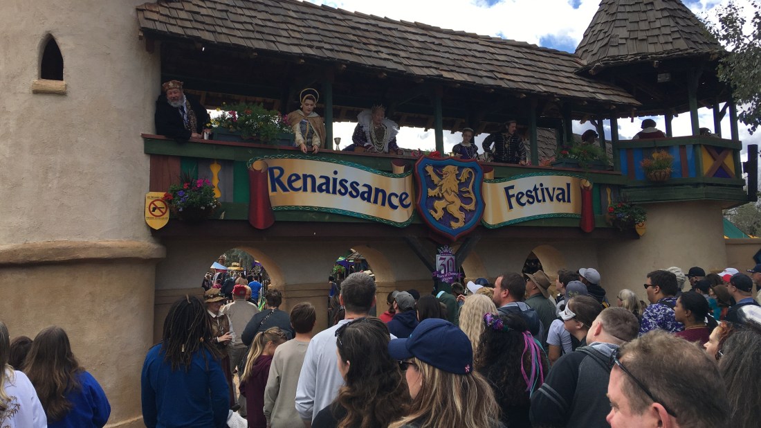
The Festival
I’m a nerd – so sue me. I’ve been going to the Arizona Renaissance Festival for 20 years. I like it because this festival essentially signals the beginning of spring in Arizona. I also like it because I can go if I want to. There aren’t any corporations telling me it’s time to give thanks, then to give gifts, and then to give chocolate. Instead I feel the urge to be with my peeps, soak up the atmosphere and revel in good food and bad accents.
Things you can expect at the Arizona Renaissance Festival include:
Unbelievable food
Countless live shows & performances
An artisan marketplace that would take days to fully absorb
Jousting!
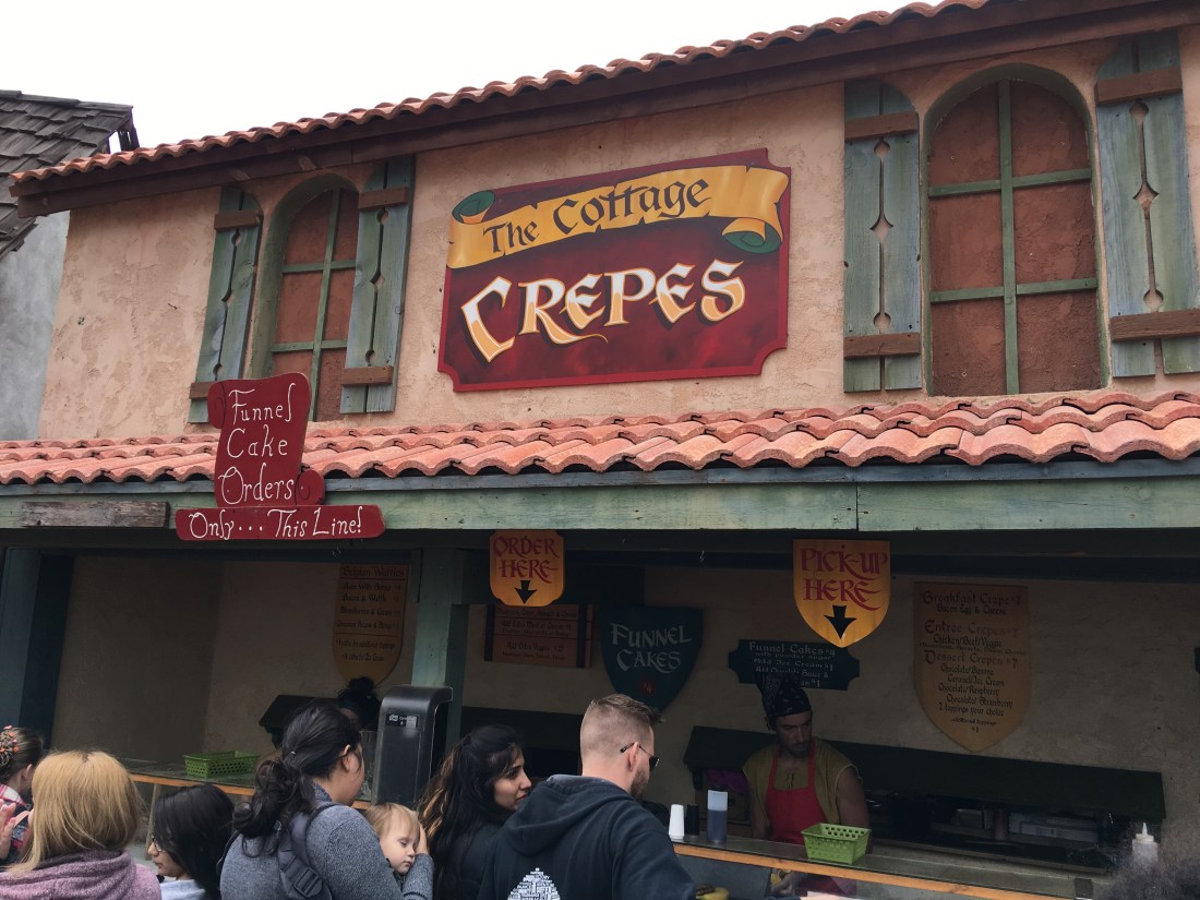
The Food
Arguably the Arizona Renaissance Festival is defined by its food. At least, it is for me. You can find every possible delight here. In no particular order this includes alcohol, turkey legs, mediterranean, soups in bread bows, confections, pizza, jerky, snow-cones, and more.
I alwayshit the crepe stand, it’s my kryptonite.
Just to reiterate this – the food is good! It isn’t your typical overpriced event gruel either. It’s fresh, satisfying, and honestly, for food in the middle of a Renaissance throwback in the middle of the desert, not a bad price either.
The Shows
Along with the amazing food, the Arizona Renaissance Festival is boiling over with amazing acts, shows and performers.
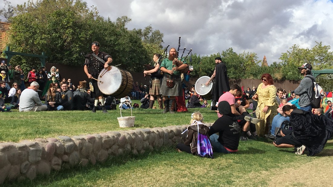
Tartanic
My favorite act by far is Tartanic. I’ve been watching these guys for 13 years and they just keep getting better. They are self-described “Renaissance Rock Stars” or more commonly “Men Without Pants”.
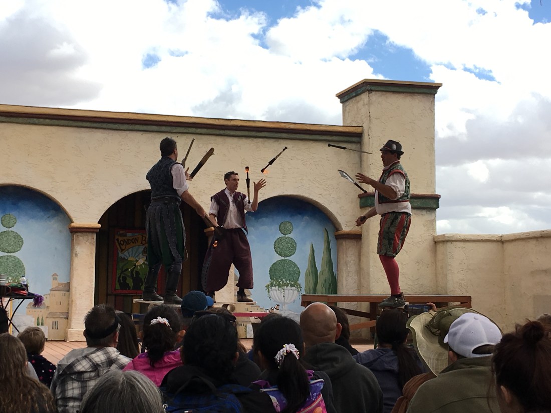
This year we caught The London Broil Show, a comedy ensemble that happens to juggle…with fire. Given there were epic winds today these guys has the audience rolling.
Check out the wind on the tent up to the right (and the juggling of course).
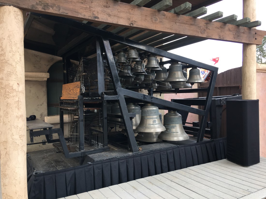
The Carillon & Cast in Bronze
This thing is called a carillon. It’s an instrument played by Cast in Bronze. Unbelievable.
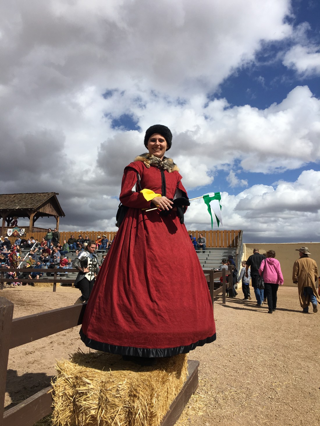
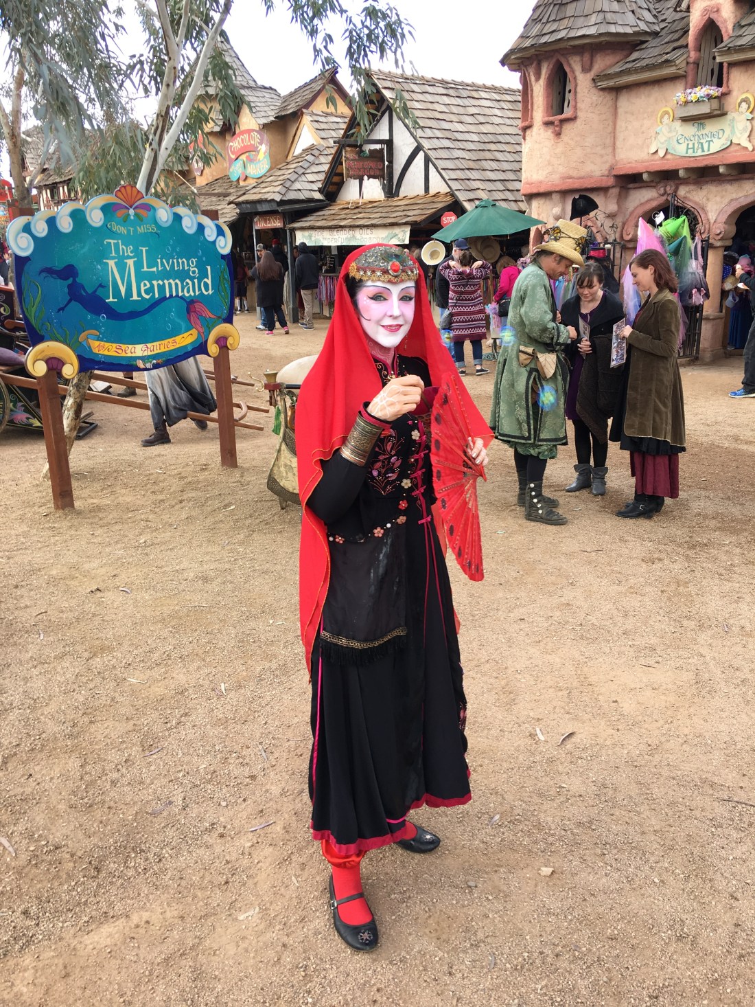
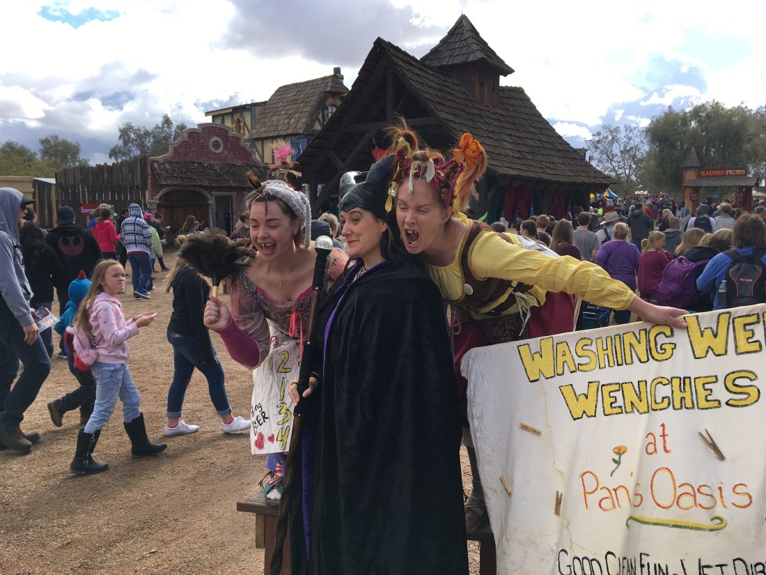
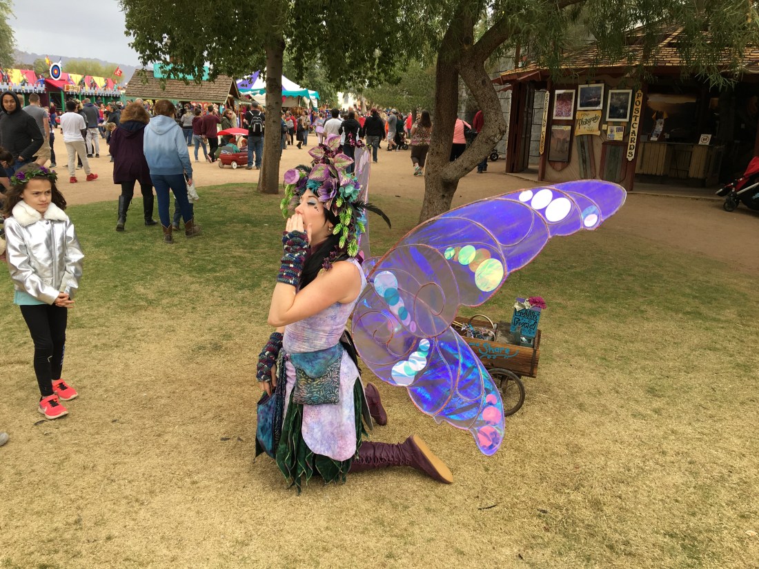
Performers
The festival is filled with incredible costumes and performers. They of course depend on tips so we are happy to drop a few bucks here and there.
The Marketplace
One of the incredible things about the Arizona Renaissance Festival is the size. Over the 20 years I’ve been coming they just keep improving it. According to the Wikipedia it sits on 30 acres and routinely sees attendance north of 250,000 visitors. That’s a lot of space and they’ve filled every nook and cranny with a vibrant artisan marketplace.
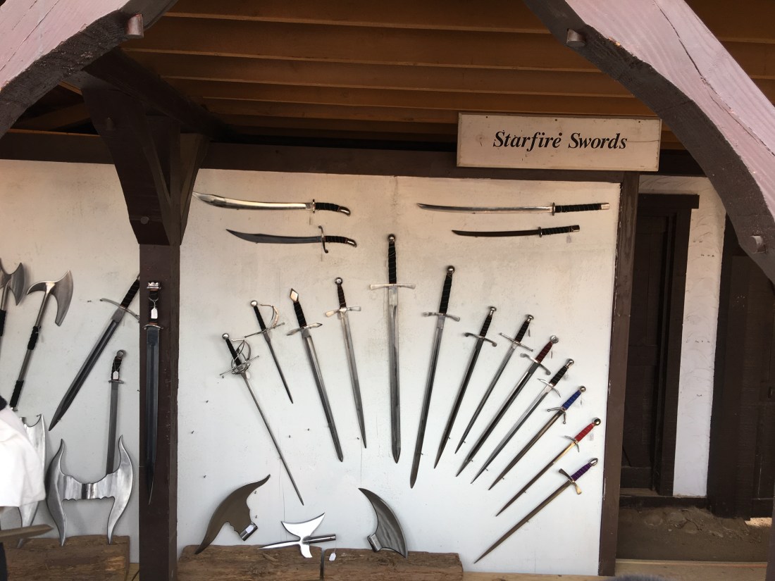
Swords-a-Plenty
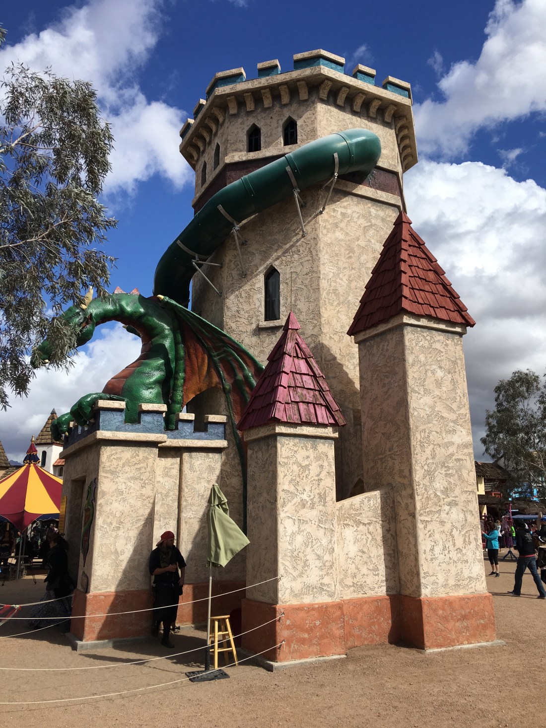
Dragon Slide
Who doesn’t like a good dragon slide?
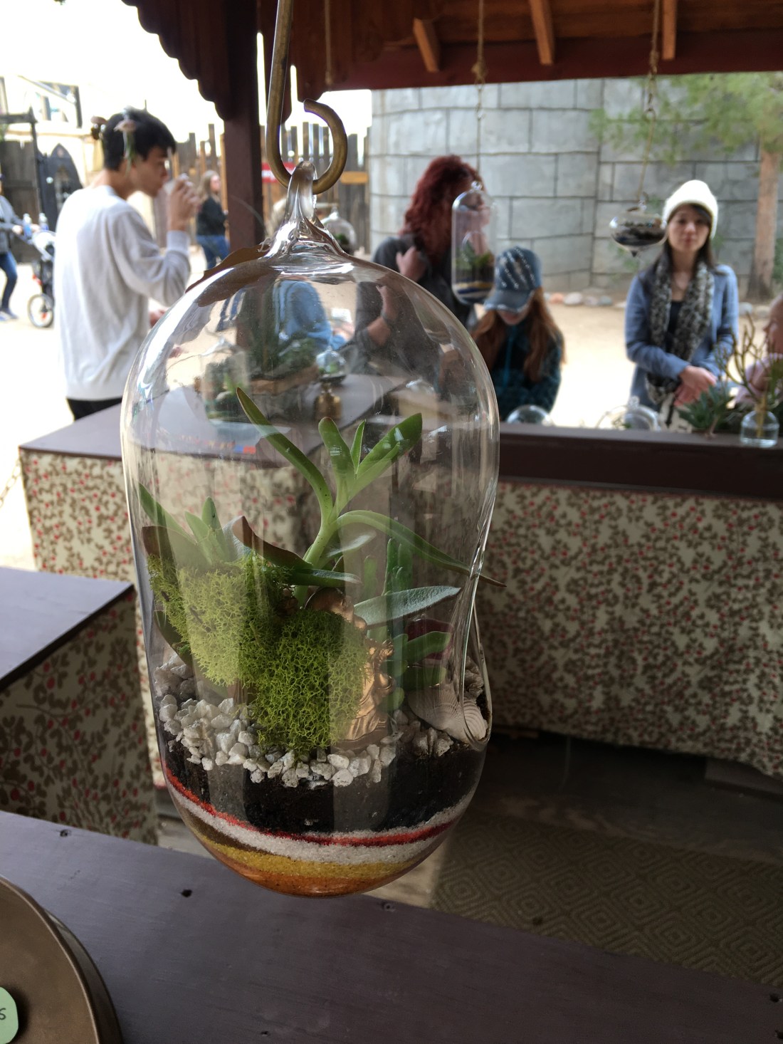
Terrariums
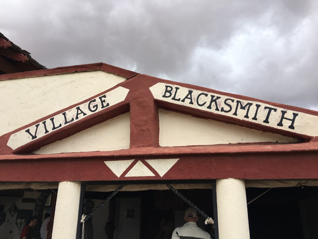
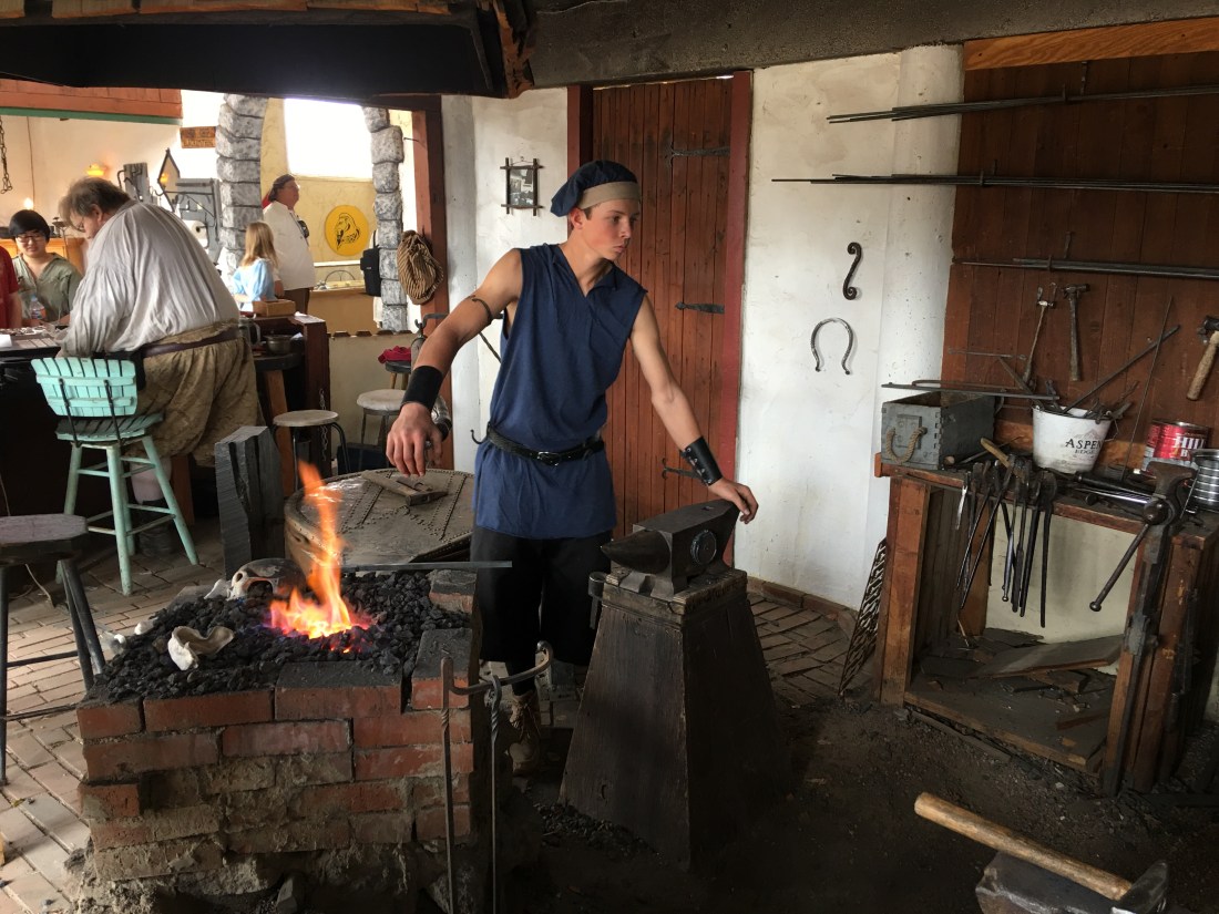
Blacksmith
Note Sure
Wind Chimes
Morbid Dungeon Stuff
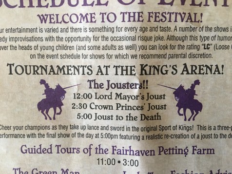
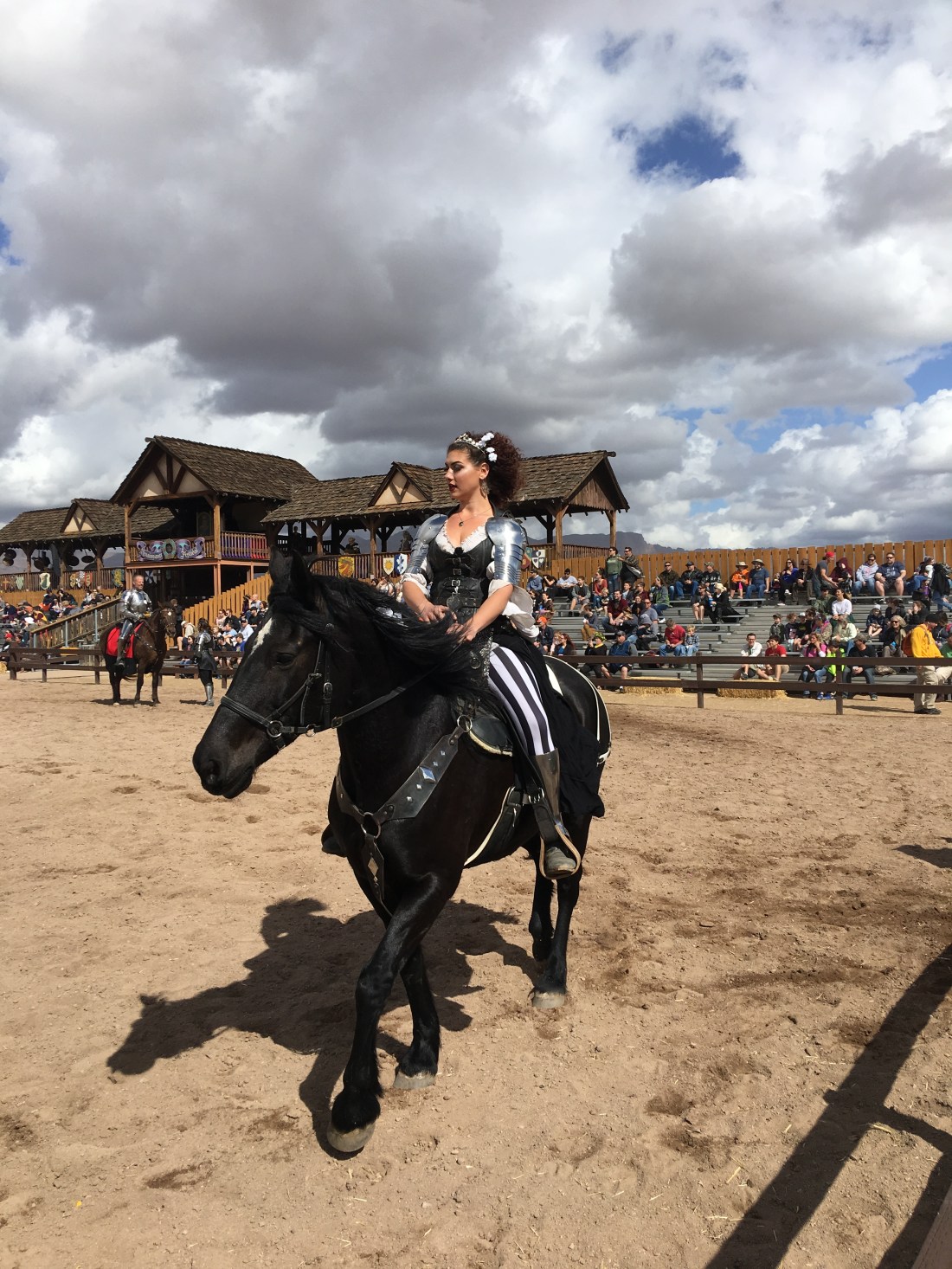
The Jousting!
Ah yes…
The jousting. The jousting goes on all day so this is the most important schedule to glance at when you get in.
The weather was so misserable today we left earlier than normal, but we caught the Lord Mayor’s Joust run by the mistress of ceremony.
You can also torment the opposing team.
Our knight was fifteen! He is a trainee.
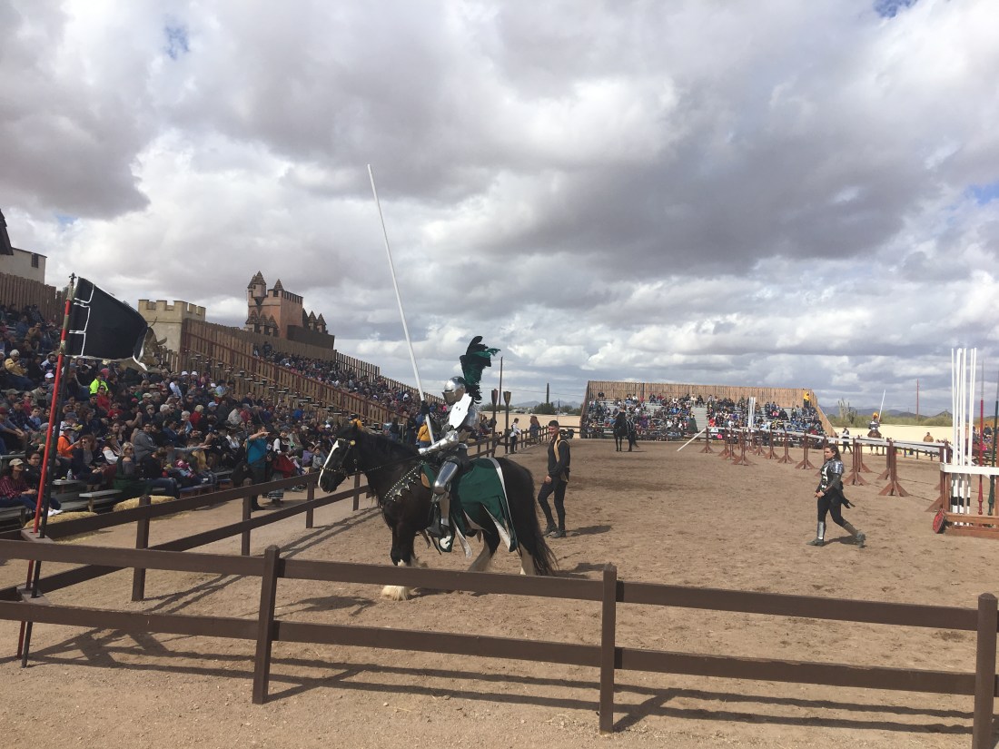
And then the pros rush at each other with lances!
And finally, a winner!
Conclusion
What else is there to say.
Great food, great performances, great market and great jousting! All for the price of $26. I should point out we scored a 2-for-1 coupon for our Presidents Day visit, but I still think the admission is well worth the price.
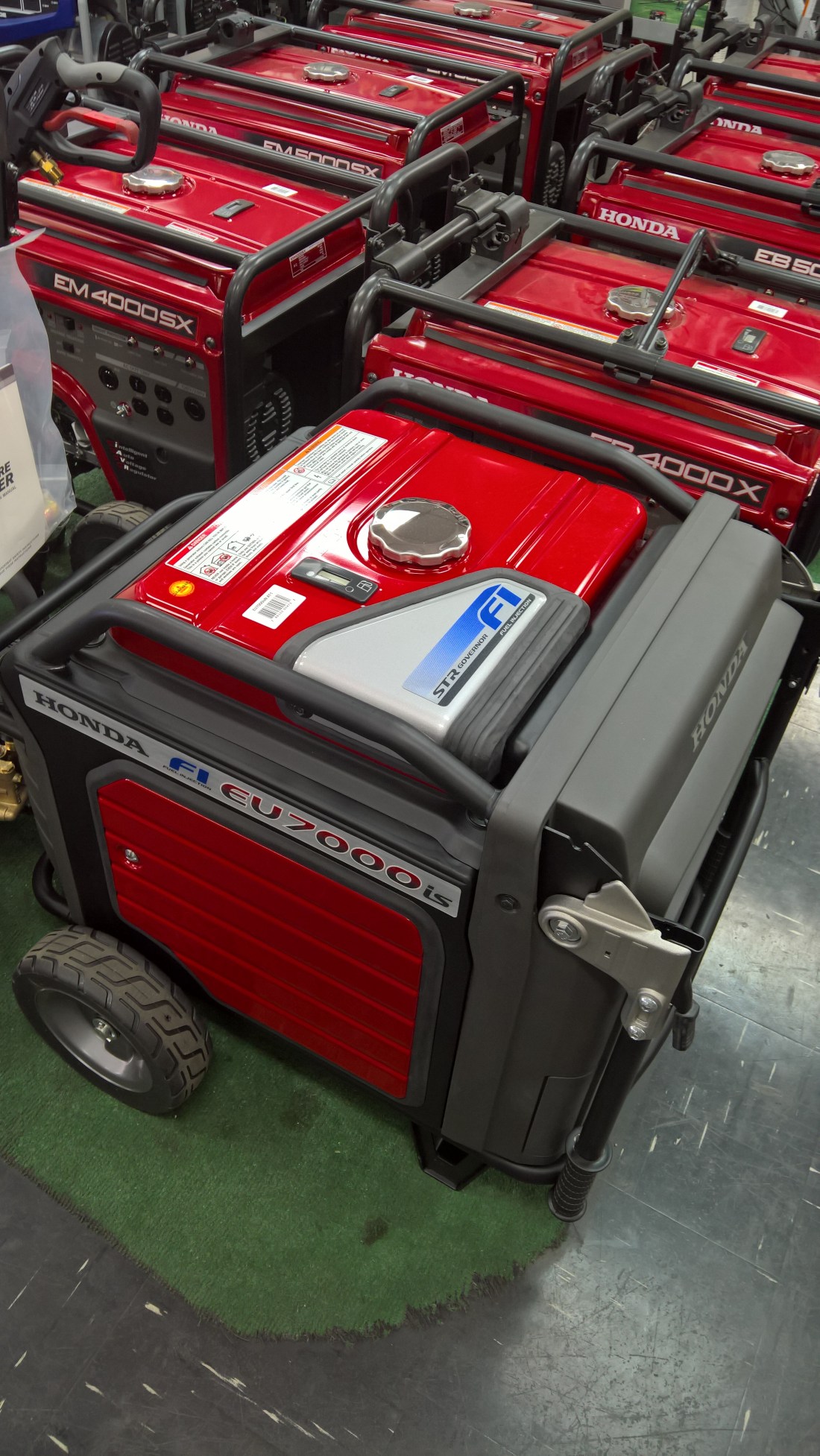
We’re pleased to announce the first edition of generator talk on our YouTube channel. Sit down with a warm Cup of Joe and settle in as we tell you everything you ever wanted to know about Airstreaming with the Honda EU7000is generator.
Please post your questions here or add comments to the video!
Thank you to everyone who took our ride roulette survey. The survey is closed and the results tallied below.
The winner is Gold Canyon Lost Goldmine! Believe it or not we’ve never been there so we’re excited for a new Sunday Ride adventure. We’ll post our review on YouTube soon.
In our continuing series on places we’ve stayed in the Airstream, I am proud to introduce Manatee Springs State Park.
Booking
Florida’s state park system portal can be used for searching availability and making reservations here. This park is located near the bucolic town of Chiefland, which itself is roughly a 2 1/2 hour drive from Tampa and 1 hour from Gainesville. This park was extremely busy and we had one night where we thought we might wind up at Walmart due to overcrowding. This is also the first place I dented the Airstream. More on both issues later.
Amenities & Activities
Manatee Springs State Park has one entrance off of Manatee Springs Road a few miles west of Chiefland. The road is rural and offers a beautiful drive through quintessential Florida farmland. The entrance is closed at night and secured with a code supplied at check-in time, though at the time we stayed there the gate had been destroyed in a crash.
There are two campgrounds in this park, Hickory to the north and Magnolia to the south. The Hickory campground is the smallest one forming a rough circle around an old but well maintained bath house.
The Magnolia campground is split into an older set of sites on the west side called Magnolia 2 and a loop of newer and larger sites on the east side called Magnolia 1. Both Marnolias circle around their respective bath houses. Magnolia 1 far and away offered the newest and nicest bath house. Sadly none of the campgrounds offered laundry so we did our laundry at Market Place Laundry.
We had the pleasure of staying in all three loops and found they all sat deep in mixed softwoood/hardwood forest. As with the other Florida parks we stayed at, this kind of foliage uniformly interfered with satellite reception. Our sites varied between 50 and 30 Amp electric and all supplied city water but no sewer so we towed to the dump station once a week. There was also zero cell phone reception which turned into a headache for me and my work. All the sites we stayed at were on fine sand so again we spent plenty of time cleaning the Airstream.
Though the park was very busy, especially on the weekends, the traffic on the campground loops seemed light and the noise low. Traffic on the main road and the day use area was heavy. Nighttime was particularly special as this is when the deer, owls and armadillos came out to play. It was somewhat routine, though discouraged by the staff, for people to place corn cobs and other offerings to attract the critters. We refrained from this and simply enjoyed whatever visitors came our way. Armadillos are a hoot!
Snorkeling
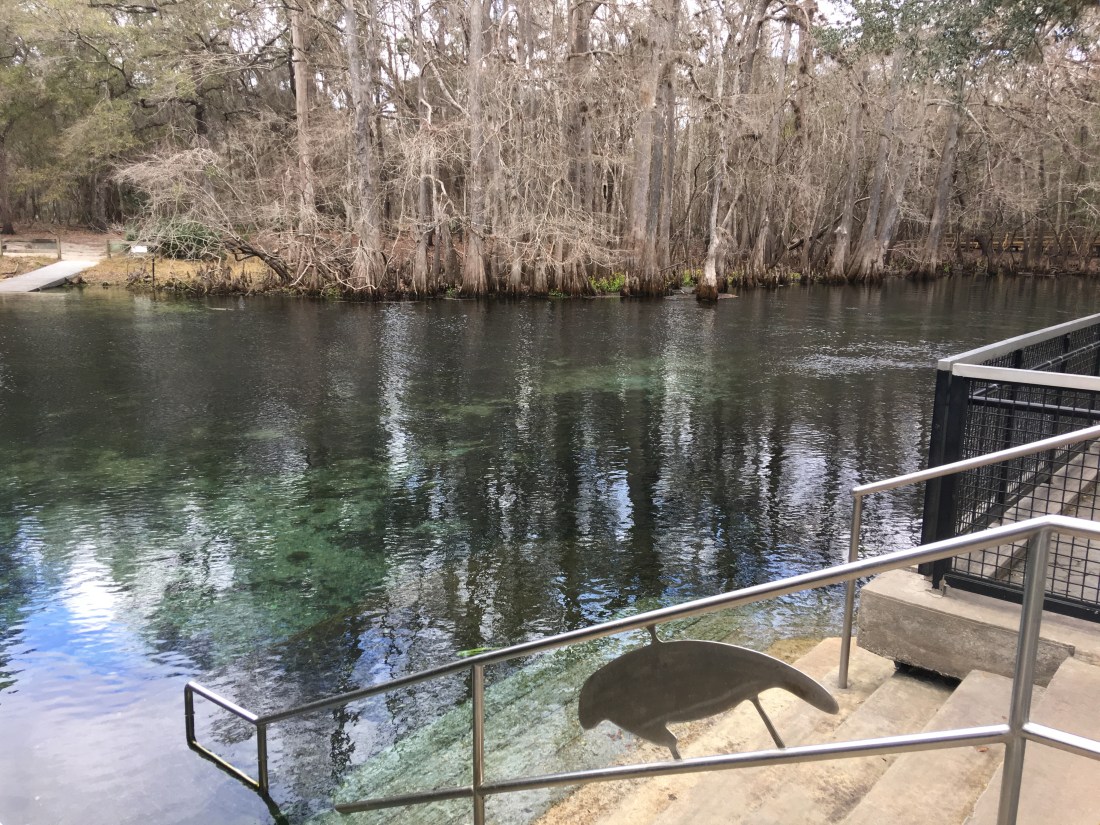
The primary reason we visited this park is, of course, the springs.
Manatee Springs is a first magnitude spring producing up to 100 million gallons of fresh water daily, which subsequently feeds into the Suwannee River. I learned to scuba dive with my dad here back in the 80’s though this time my partner and I only snorkeled there. The springs are warm but still required a 3mm wetsuit to stay comfortable. The water is positively teeming with life including turtles, fish and many kinds of aquatic plants and offered hours of wonderful diving.
Manatee Springs is so named not only for the springs, but for the manatees that can frequently be found here as the water from the springs offers a constant temperature around 72 °F (23 °C). We had the pleasure of diving while several manatees were visiting and watched them watch us. The are incredibly gentle and also surprisingly white!
Surrounding Activities
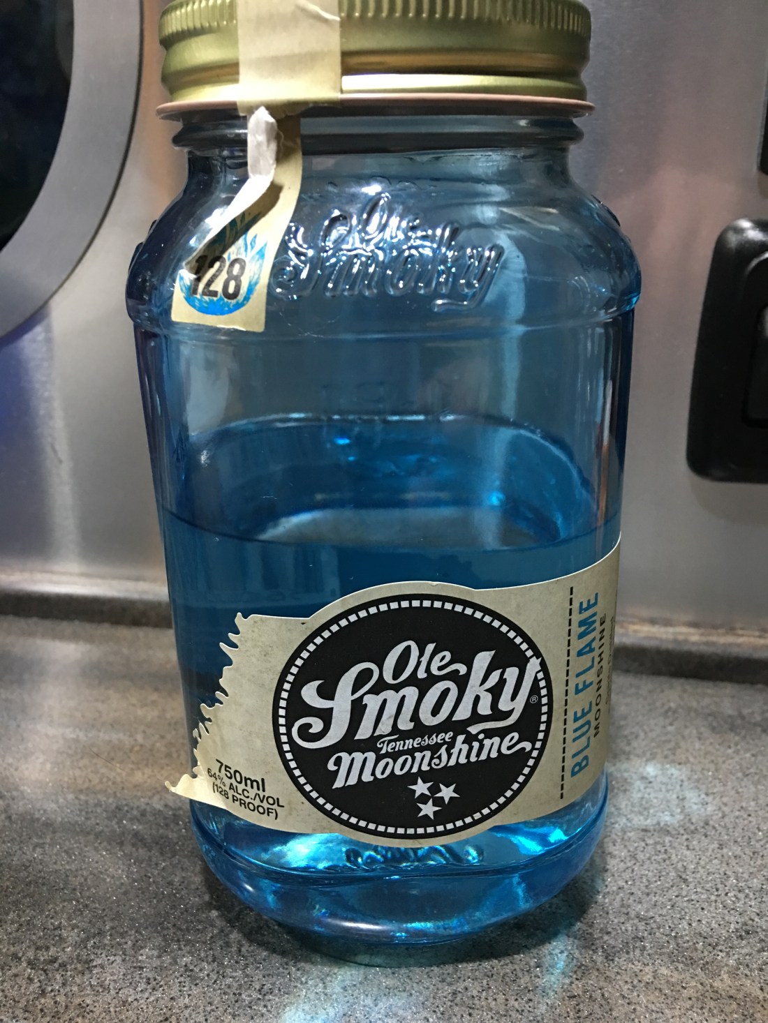
Manatee Springs offers a wide range of other activities including scuba diving, kayaking, boating, hiking, bird watching and yes, mountain biking. While we were there I also managed to pick up a little liquid entertainment.
Mountain Biking
Manatee Springs offered superb mountain biking across miles of trails on the north end of the park. I made time to ride a couple hours a day constructing my own loops out of the Scenic Trail, Shacklefoot Trail, Clay Trail, Hornet Trail and a wide range of offshoots and connectors. The trails are very sandy but entirely enjoyable on a standard 29er/27.5 2.3″ tire.
I found the trails to be nearly deserted regardless of how busy the park itself was. This gave me deeply enjoyable quiet time swooping through the gently rolling forest, though I nearly had a heart attack coming upon a flock of wild turkeys. I also saw what I believe to be a rare Eastern Indigo Snake, but I could be wrong. On these rides I also saw black vultures and found evidence of, but never saw, wild pigs.
What Could Go Wrong
I’ve mentioned before, lots of thing go wrong RVing.
Lots.
It was about this time I had to laugh or I would cry. It was also about this time I was beginning to realize we’d need to visit a dealer, too much stuff was breaking (and being broken by me).
Cell Coverage
I use a iOS application called Coverage to assess the suitability of a camp site before we book there, as my living depends on the internet. This application clearly shows Manatee Springs has terrible coverage but for one reason or another I convinced myself the booster would save us.
It didn’t.
At best the booster got us 1x signal which was sufficient for voice but not data. There is a small concession near the springs that offers WiFi and I tried to work there a couple times but everyone else realized this too and by lunchtime the service was unusable.
Because of this I had to commute into Chiefland every day and squat at a Dunkin’ Donuts. I didn’t leech their WiFi though, I brought the MiFi. I also bought plenty of donuts and coffee to say thank you.
Sewer Cap
Why would a sewer cap snap? I don’t know.
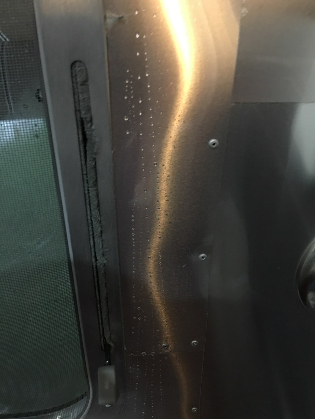
Shower Door
Manatee Springs is when we began to realize our shower door was possessed. The glass was sliding out the bottom of the frame! More on that little gem in later posts.
My ‘Expert’ Parking Skills – And $3600 Later
There are two kinds of RV’ers – those that have accidents and those that lie about it. *Emily, 2016
We stayed at Manatee Springs State Park for two weeks but for one of those 14 days I simply could not find an open site. My partner and I routinely stay at Walmart while on the road and we decided one night at the Chieftan store would be just fine.
As luck would have it, though, on the Friday we were supposed to leave I was coming back from Dunkin’ and a very nice ranger at the entrance told me they’d had a cancellation. I raced over to the site and took a cursory look, decided it would be fine, then raced over to the concession with my laptop to make the reservation (because I couldn’t get cell phone coverage).
This is a super annoying feature of the Florida park system: The rangers can’t make reservations. I was stressed out by the crappy WiFi signal and struggled with the reservation system but ultimately snagged the site.
At this point I raced over to the trailer, hooked up and towed us over to the site. You can see where this is going. Going fast, rushing and not thinking with an RV does not go well.
It was at this point I began to realize this site was a little strange, owing to some peculiar wooden bumpers the park had clearly recently installed that limited my turning radius on the back-in. The site also had some poorly placed coral boulders that seem to have been there to convert the site from a pull-through into a back-in. They forced me into a strange angle.
Regardless of the reasons, I found myself in a very technical back-up scenario. I was going very very slow, and paying very careful attention to the nose of my truck. But not to the trailer. At a walking pace, or even slower, I jackknifed the trailer.
Though I wish now I had more pictures I just couldn’t bear to take any. I felt like an idiot. In the end I dented the driver side road segment and the rock guard. Total repair cost: $3600.
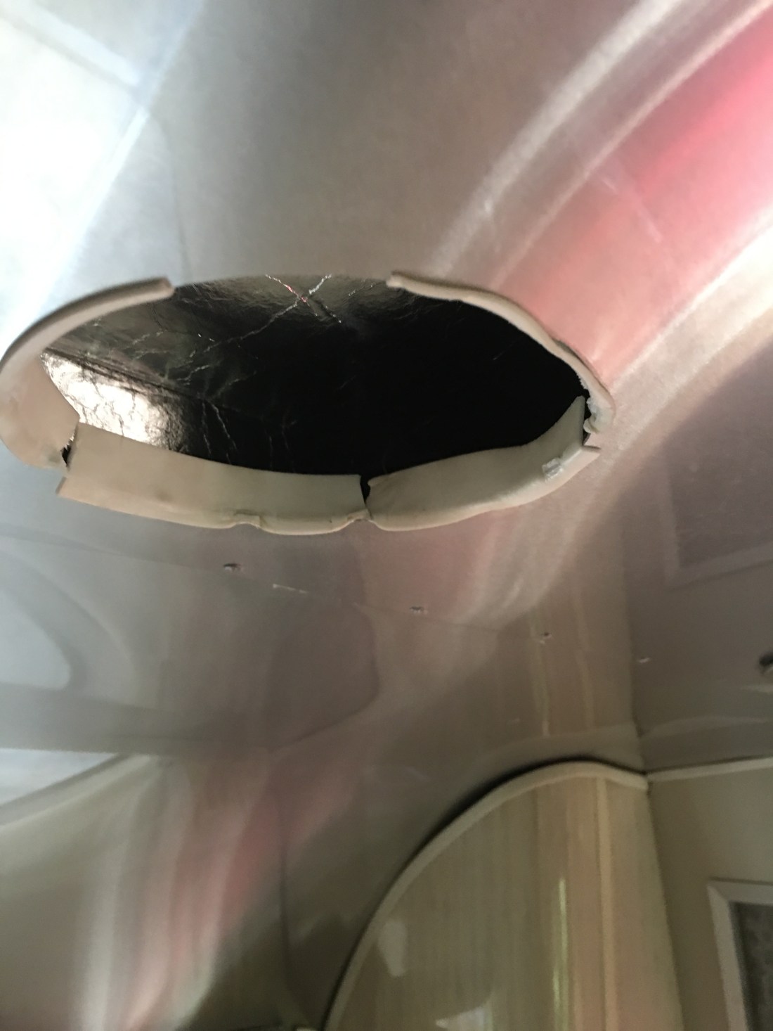
Airstream Build Quality
I’ve said many times before I love my Airstream. Still, the Airstream doesn’t always love me back. One of the more amazing problems with this model Airstream is the vents in the ceiling have a habit of dropping out at strange times…. like the middle of the night… and falling on you.
Recommendation
Manatee Springs State Park has ‘it’. Oh yes it does. Manatees, clear water, swimming, darn good hot dogs at the concession, miles of biking and unbelievable wildlife. We deeply enjoyed our stay here and often talk of returning. Should you find yourself in the area I highly recommend you stay a while, enjoy the critters and explore the trails!