Fred
Evening, Peeps.
Check out Fred’s review of the 2018 Trek Stache 5 here!
That is all.

Emily & Silent Partner
Evening, Peeps.
My heart is heavy as we are now back in Phoenix….and therefore, not Moab. As I work my way back into my professional life, it occurs to me there are a few additional thoughts to share about Moab from previous trips, so enjoy some random musings.
I find it totally fitting that even the name Moab is somewhat mysterious. For me the Paiute origin story, referring to the word moapa, meaning “mosquito”, has the most resonance. Still if Moab was instead named Vina or Uvadalia I suspect it would have exactly the same energy and feel.
Yes, Arches National Park is pretty amazing.

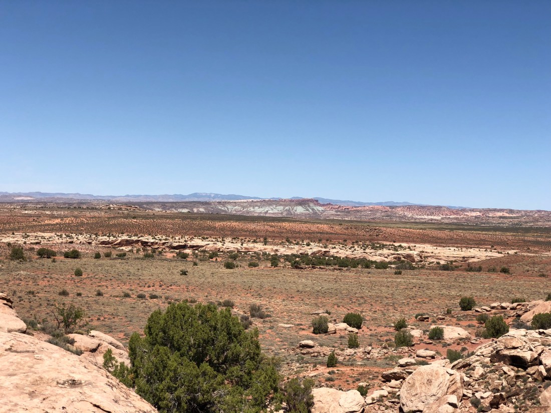
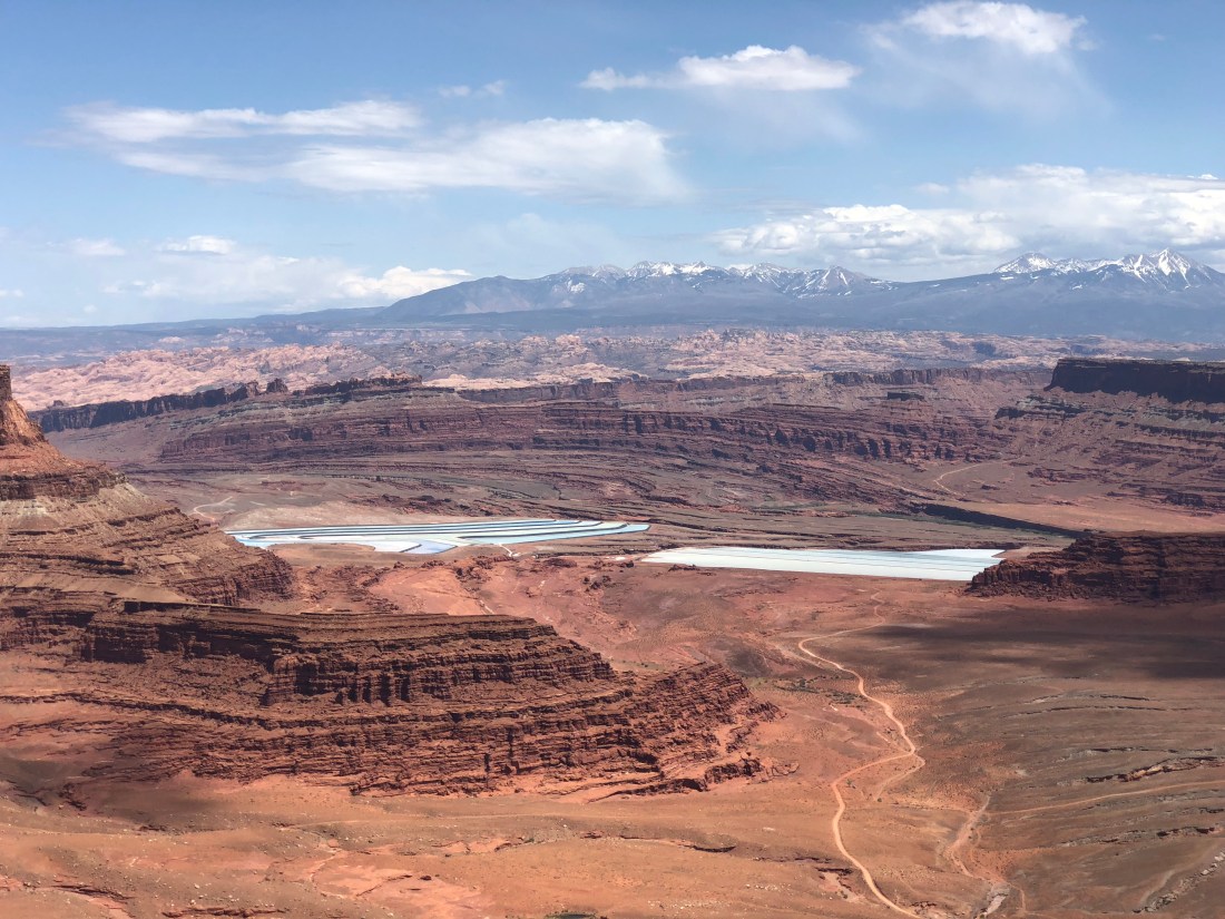
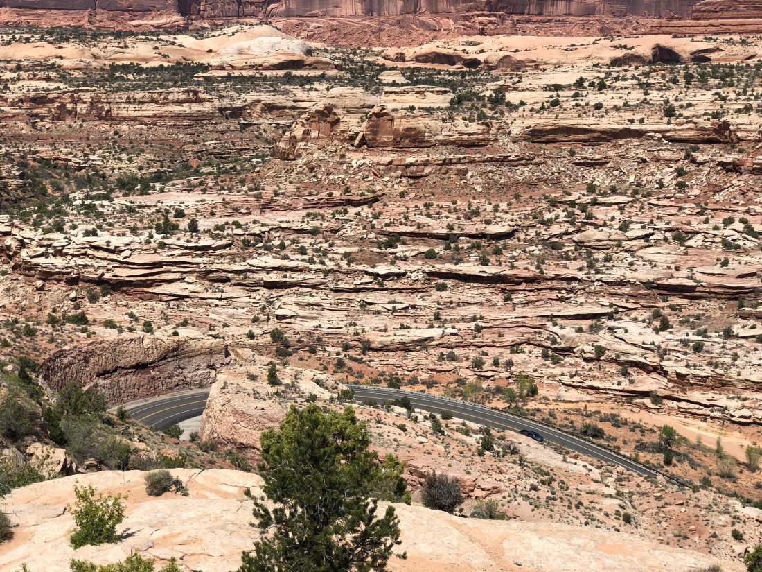
But keep in mind – all of Moab and surrounding area is amazing. Do you really need to pay for it, when everything is amazing? For example, drive up Utah 128 from Moab to Interstate 70 along the Colorado River, it’ll blow your mind. Or, Utah 313 to Dead Horse Point. I happen to find the drive through Canyonlands more rewarding, and the view at the point equal to the task (though yes you do have to pay for that too). Or for free you can ride the Zephyr trail (mentioned later) that crosses into the north end of the park.
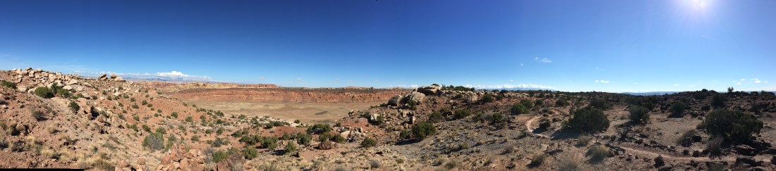
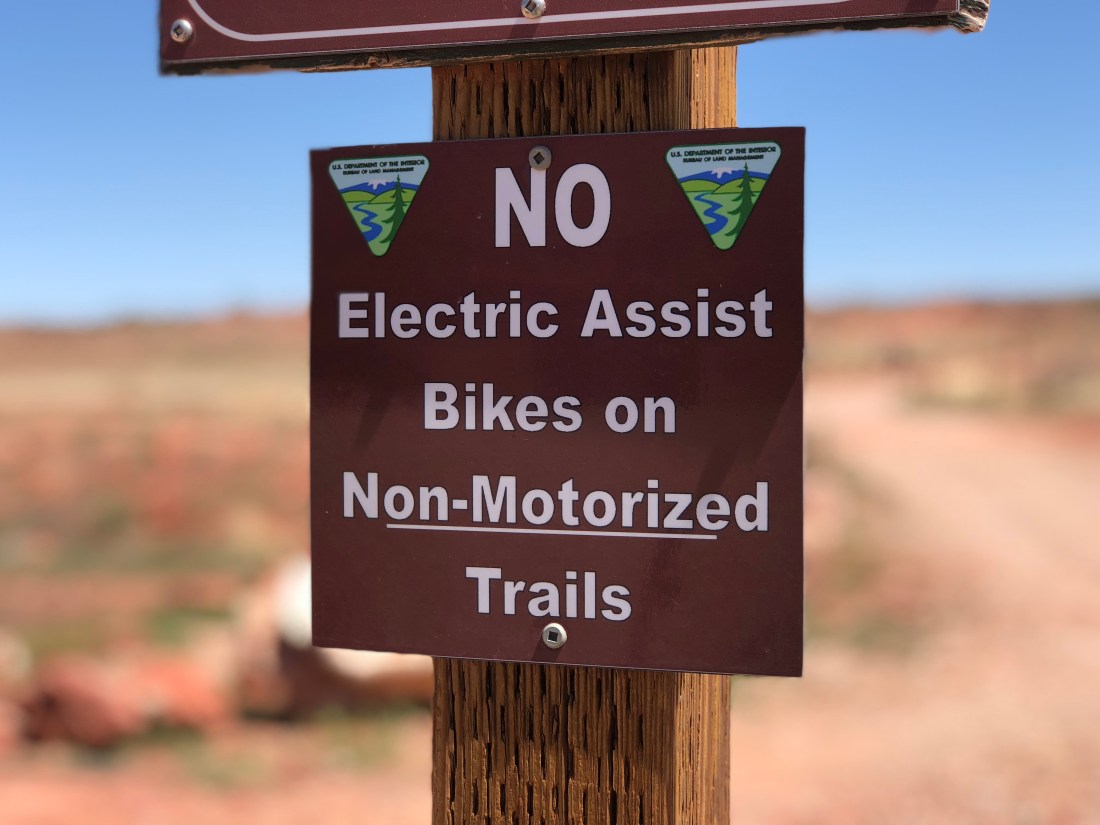
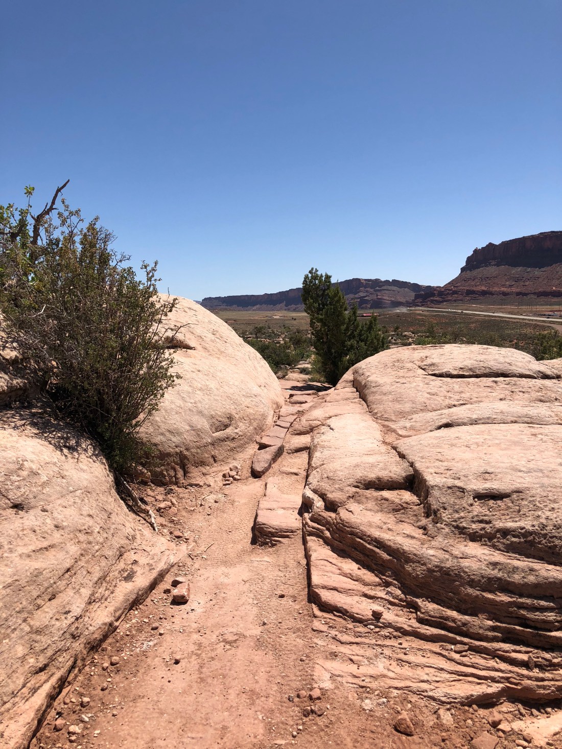
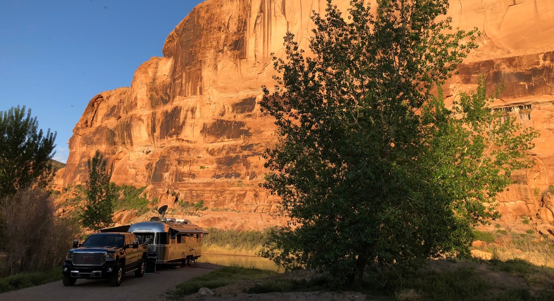
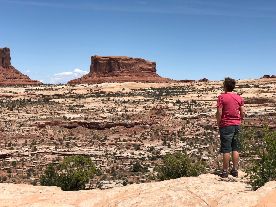
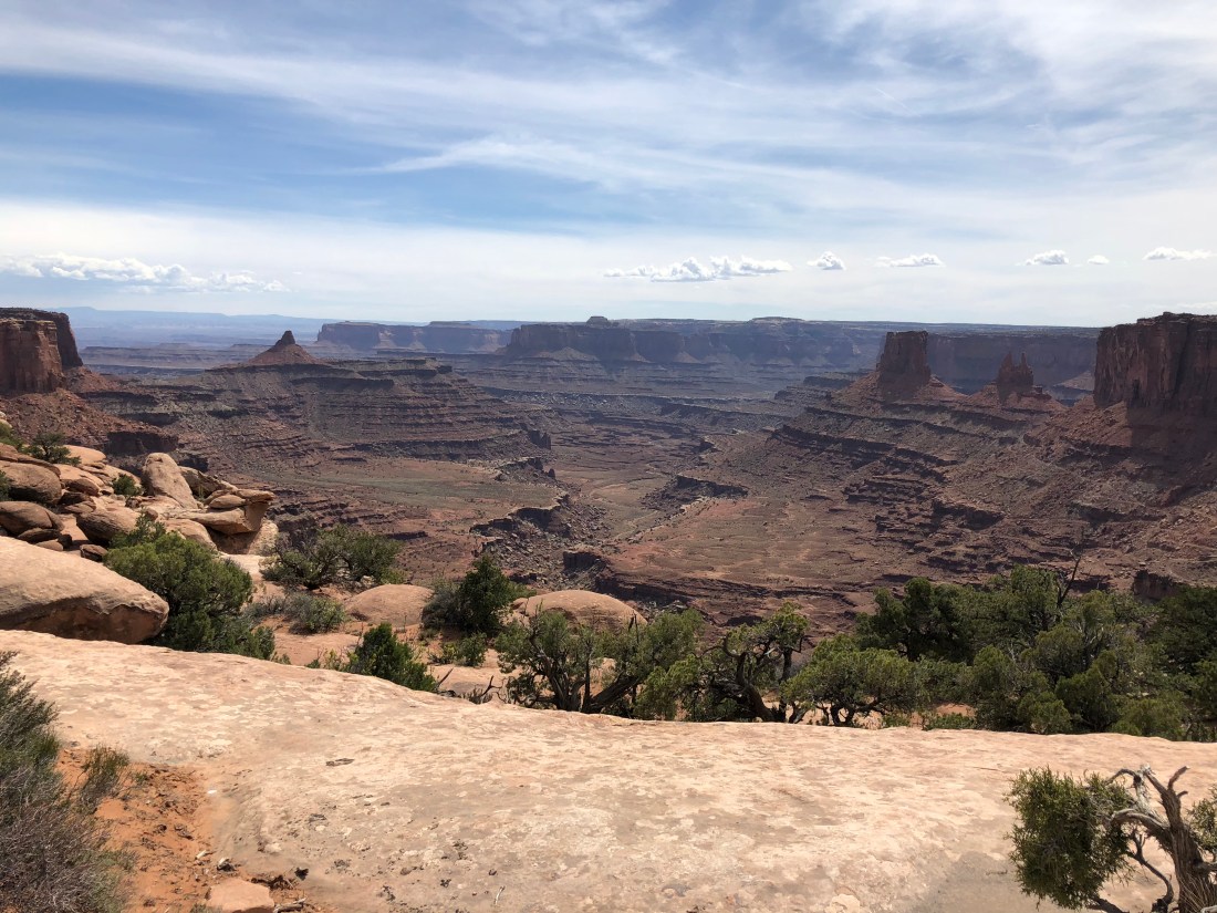
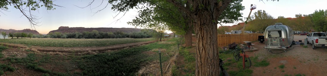
Still, we stayed in Arches one time (see the featured image) because, well, everyone said it was the thing to do. The park has essentially one road that you can drive for an out-and-back, at the low low fee of $25, or, you can pay the low-low fee of $25, drag your trailer all the way to the end of the 28mi (45km) road and maybe get a camping spot.
A year ago we made a point to get to the park early and found the front gate can’t (or won’t) tell you whether the campground is full, so we paid the stupid fee and drove the 28mi (45km) and we discovered that almost no sites fit the Airstream, and ones that did were occupied. You can’t mountain bike the park, you can’t take your dogs out anywhere except on the streets & campground and cell coverage is terrible.
Despite these setbacks the campground host took pity on us and offered us a one-night stay in the host’s spot because they were staying in the ranger’s cabin. For this we are profoundly grateful, but my take on Arches National Park is that the park is pretty cool but the fee is outrageous for what you get.
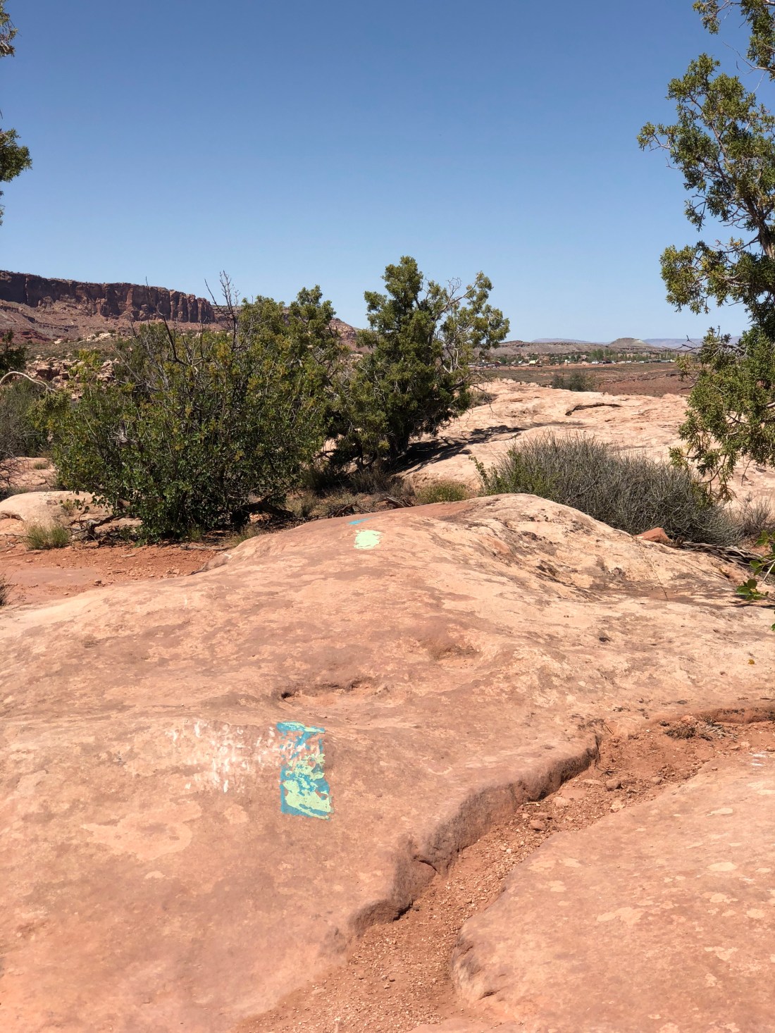
Pipe Dream is a blue/black trail that runs directly along the western edge of town. I found this trail more black than blue so I never got any zen here owing to the habitual dabbing and dismounts. I can still see it being a handy go-to trail if you lived in Moab as an excellent “work on your skills” destination.
Zephyr is considered more of a connector than a destination trail, but nevertheless we rode it once to see what’s there.

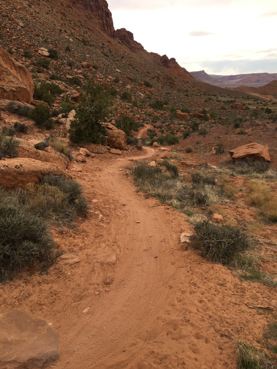
The oddity about this trail is is crosses briefly into Arches National Park for free, and it offers some truly heart-stopping landscapes such as these. Though this looks like an undulating landscape of routine slickrock, look closer and you’ll notice the beginnings of a verdant canyon filled with water, green trees and birds. Though the trail itself was, for me, entirely forgettable the “Planet of the Apes” like scenery absolutely made it worthwhile.
The La Sal mountains just blow my mind. I just can’t get over the juxtaposition of looking up at the mountains and seeing snow when it’s 100° F (38° C) in the canyons.
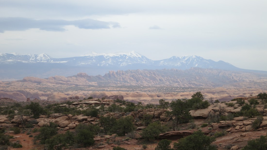
Also I don’t know why this amazes me, by the La Sals are considered part of the Rocky Mountains and a source of Uranium.
Fred and I rode The Whole Enchilada a couple years ago, which starts high up in a snowy aspen grove and bottoms out on the Colorado river. We caught a shuttle from the previously mentioned Poison Spider Bicycles, but honestly, the shuttle should go two hours earlier – it was hot as hell and I wound up with early signs of heat stroke at the end of the ride.
Overall we both found the ride a little too extreme for our sensibilities, and agreed that the Porcupine Rim portion of the ride was the most enjoyable and least deathy. The final segment down to the river, though, was way more than either of us would do again.
Still, it is pretty amazing to start a ride in snow and wind up over 100°!

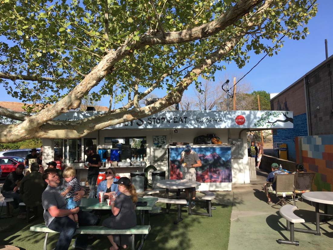
I forgot to mention Milt’s Stop N’ Eat in our previous blogs. Milt’s is a kitschy actual 50’s era diner located on Moab’s former main drag. They serve exactly the right food for after mountain biking including delicious burgers and yummy salty fries. We highly recommend the experience, though sadly they’re closed Mondays.
But Emily, you didn’t mention the most Moab of all Moab mountain bike trails, Slickrock!
I’d have some pictures for you if my crappy Buffalo NAS hadn’t taken them to the briny deep, but I’ll commit heresy here: We didn’t like Slickrock.
Stone ● Cold ● Silence
Here’s why – the trail is blue/black. Fred and I tried Slickrock a few years ago really before we should have. Specifically, Slickrock is steep – like 100% grade steep. That requires massive fitness, and we found we just didn’t have it at the time. And fitness is important when you’re pumping your way up this massive incline with your eyeballs exploding out your face and there’s just no place to bail. If you stop your’re sliding to god knows where.
Someday we’ll do it again, especially now that we have the fitness and the skills. But I still remember it, and I suspect I’ll like Klondike Bluffs better (gasp). We’ll see!
And that, my friends, is what Moab is all about. There’s always more to come back for and great stories to tell (someday ask me about Magnificent 7 and almost dying in a Uranium tornado).
Cheers!

Emily & Silent Partner
Morning, Peeps.
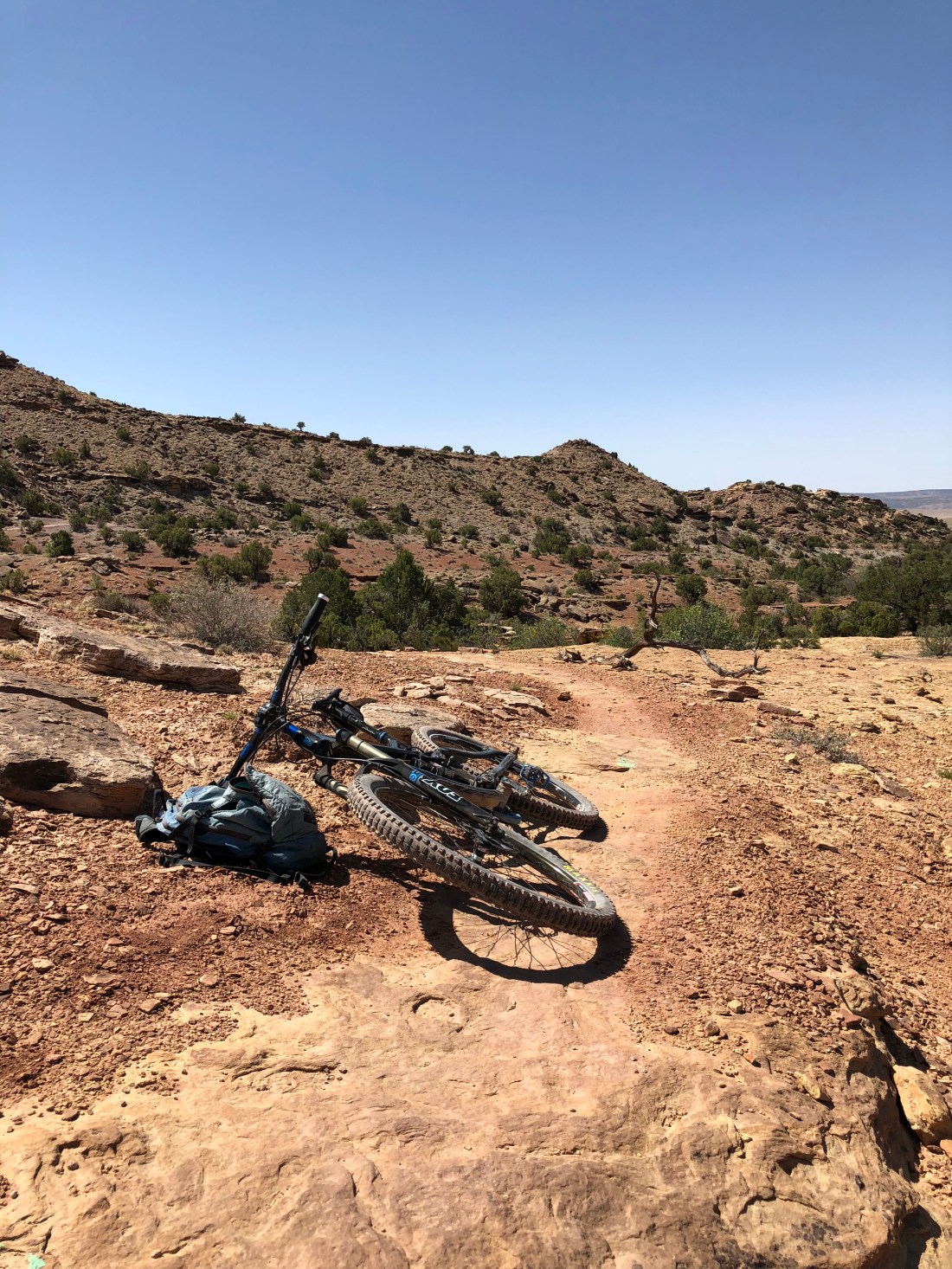
Yesterday was an early start with but one objective – mountain bike Klondike Bluffs. Even though temperatures this time of year hover in the 50’s (10C) in the morning and low 80’s (27C) in the afternoon something about slickrock reflects a lot of sunlight making it seem much hotter than it is. We wanted to eliminate any chance of dehydration and/or heat stroke since I’ve gotten myself into trouble here in the past.
Reaching Klondike Bluffs in the AM we set off.

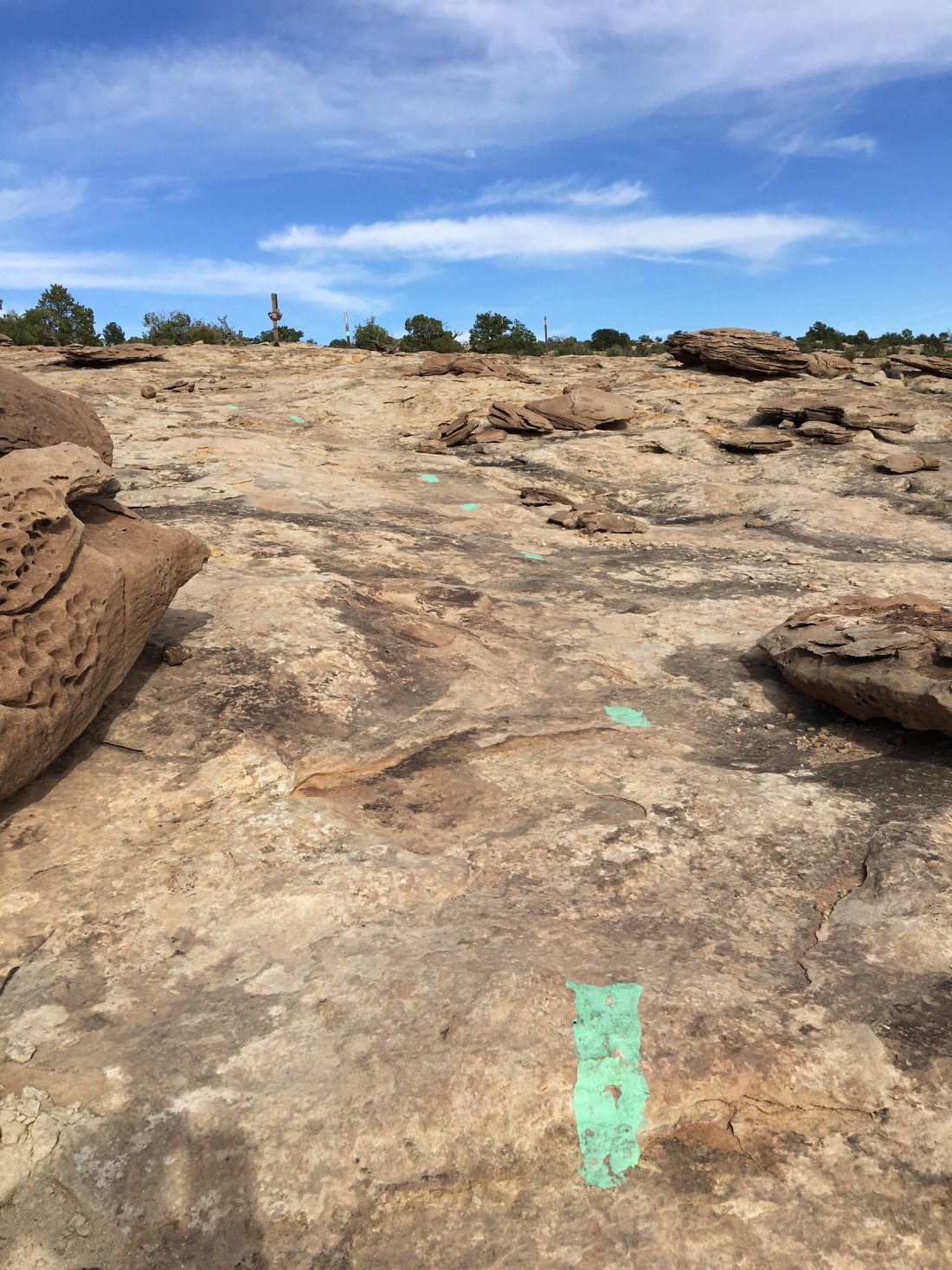
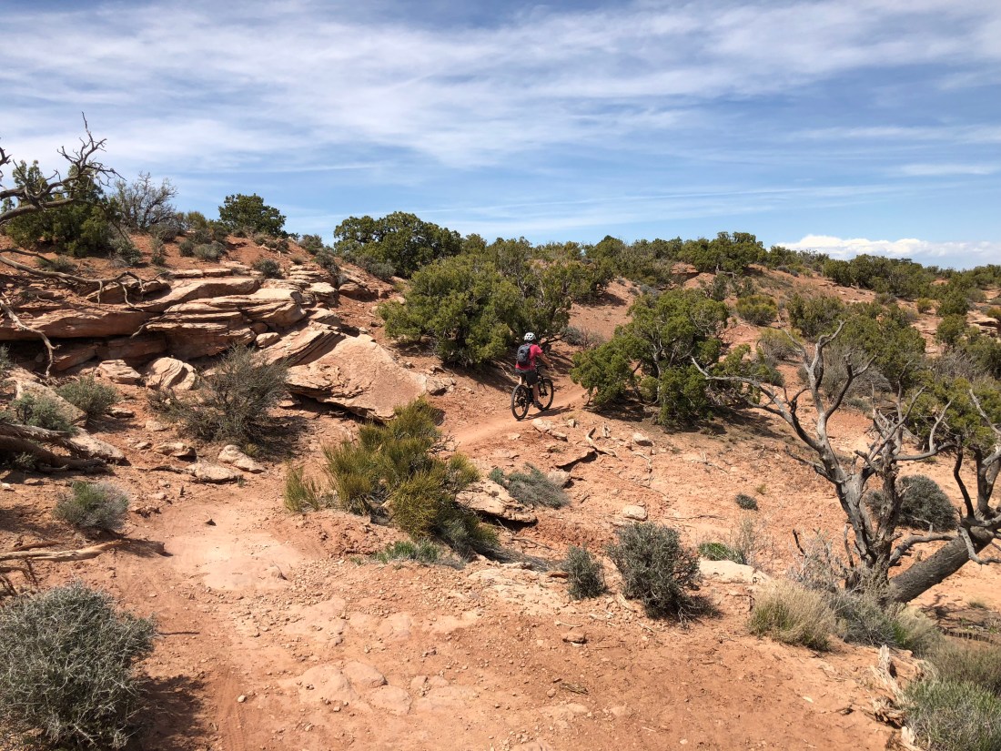
Klodike Bluffs is so named because of these.
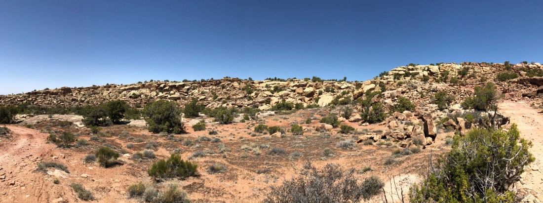
The trail system is a brilliant arrangement of easy to hard trails where you can make your own adventure across amazing terrain. Crudely speaking the bluffs is a large rectangle with the long sides running north to south. The rectangle is bisected by multiple east/west downhill runs rated in the blue/black category.
My favorite make-your-own-adventure is:
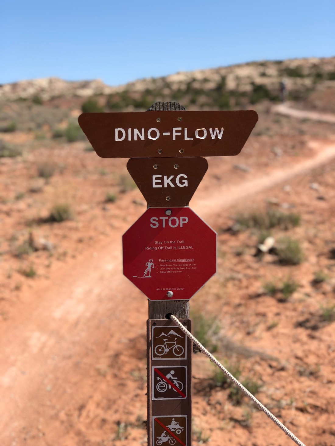
Dino Flow is a nice green/blue trail where you can get get warmed up.
The trail flirts with portions of slickrock but also follows plenty of hardpack and has a half-dozen features that make you work your skills so you can never quite get complacent.
Dino Flow is also undulated which gets your heart rate at just about the right level before diving into Mega Steps.
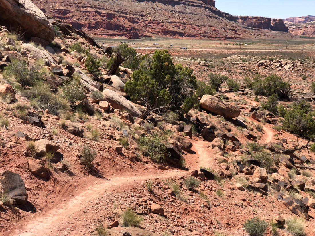
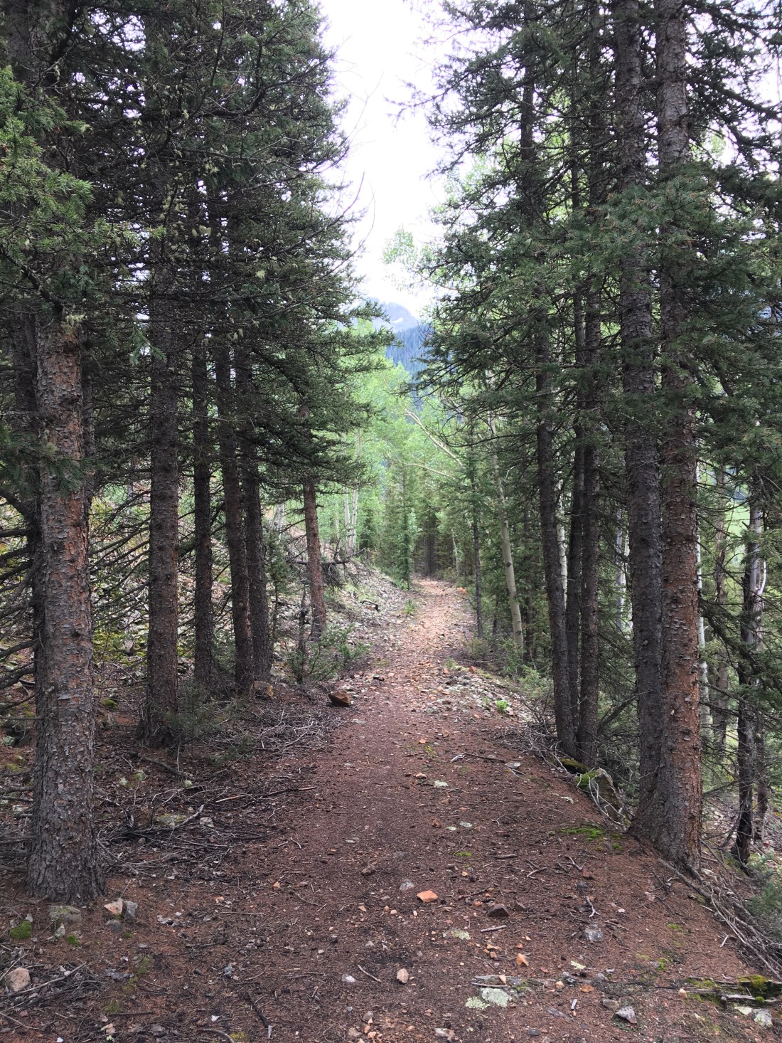
Mega Steps is one of several blue/black trails that run east to west forming dramatic downhills (or climbs), depending on your direction of travel.

We find the Mega Steps climb to be lung-busting but the least lung-busting of all the options out there.
In Moab parlance a “step” is a natural slickrock feature resembling human steps. Mega Steps, as shown in the featured image, look like steps more suited to Godzilla. Personally I feel like climbing Mega Steps is what the bottom of an empty swimming pool would be like like to an ant.
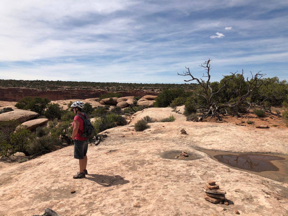
At the top of the steps we took a breather.
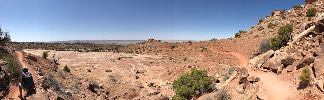
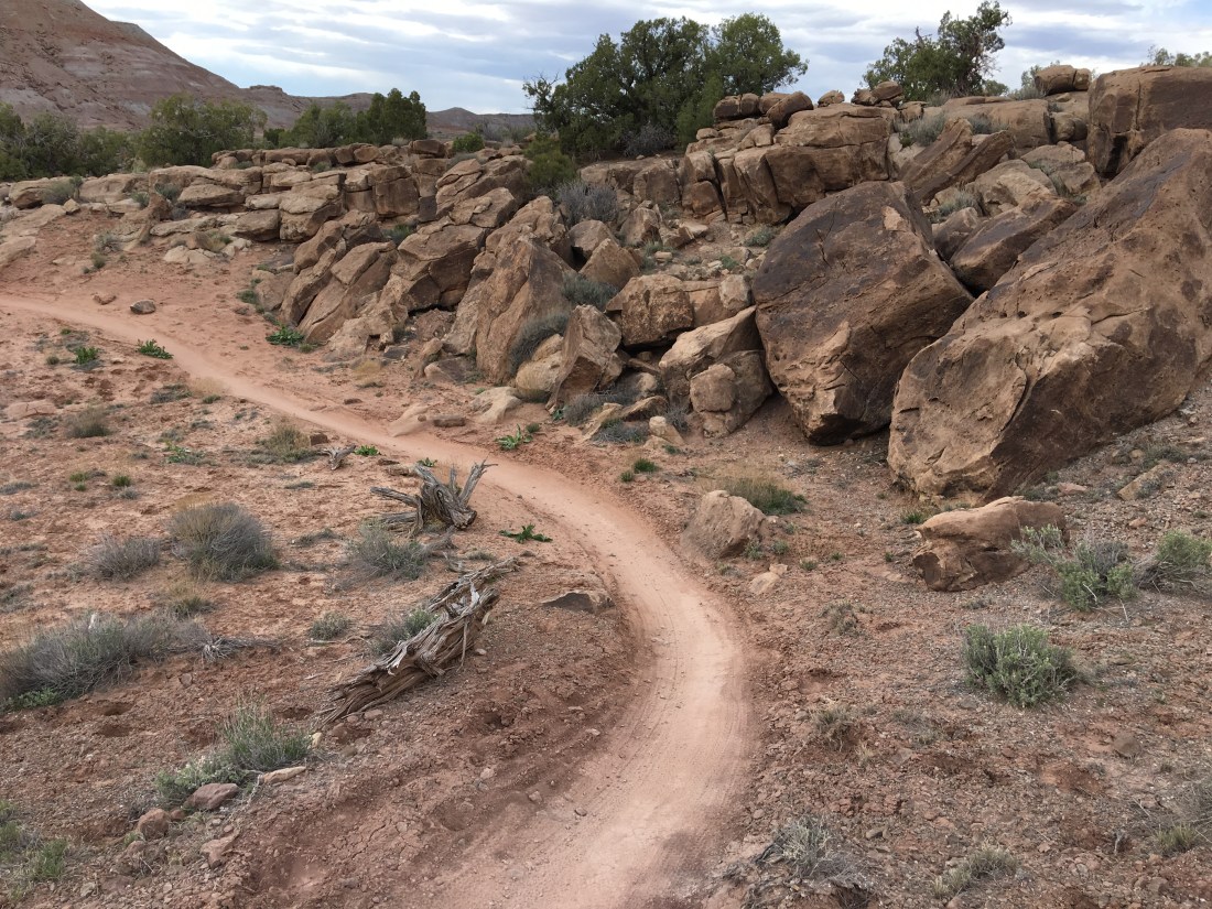
Mega Steps joins into the Klondike Bluff Outer loop before splitting onto Little Salty.

This is a blue connector that at times shares a 4×4 trail. Yes this is a jeep trail.

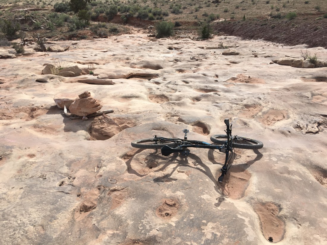
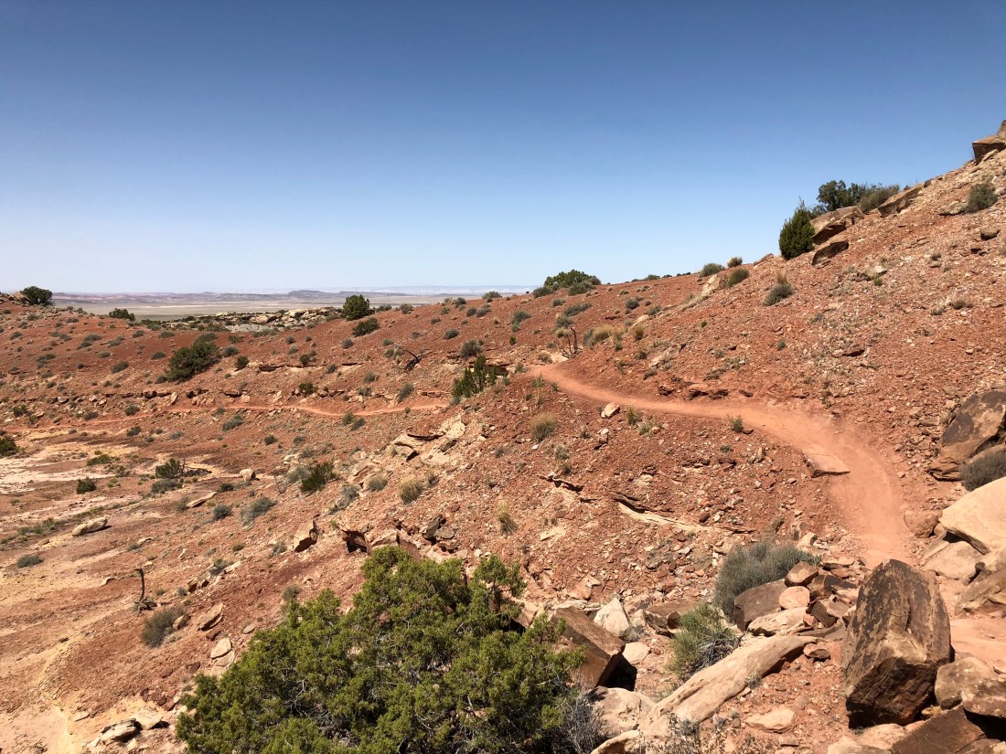
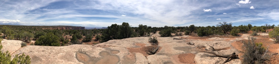
Time got away from me on the tie-in to little salty so I didn’t catch more pictures, but the Little Salty is a blue/black decent of about 50% hardpack then 50% fairly intense downhill slickrock like so.
For one reason or another this kind of slickrock descent puts me in a deep zen mode, picking lines and following the dots. By far Klondike Bluffs is my favorite ride out here. At least, until I ride more of the dozens of trails out here that I have yet to explore.
Sadly yesterday was our last day of riding, and tomorrow we prepare to go back home …and back to work. I’ve mentioned “it” as a recurring theme in this blog – and Moab has a thousand different kinds of “it”. Should you decide to visit, keep in mind everybody else knows Moab has “it” too – plan your lodging well, be prepare for crowds, but also be prepared for vistas and experiences so gorgeous they’ll break your hear.
Emily & Silent Partner
Evening, Peeps.
Welcome to day 5 of our Moab musings! See what I did there? A little alliteration – pretty fancy right? Today was another mountain bike ride and lazing about and gazing wistfully into the Colorado while eating Doritos, drinking beer and reading my book.
And wondering why cell coverage is so bad…
But anyway, because of all that belly button gazing today’s blog is shorter but that’s ok, enjoy the pictures.
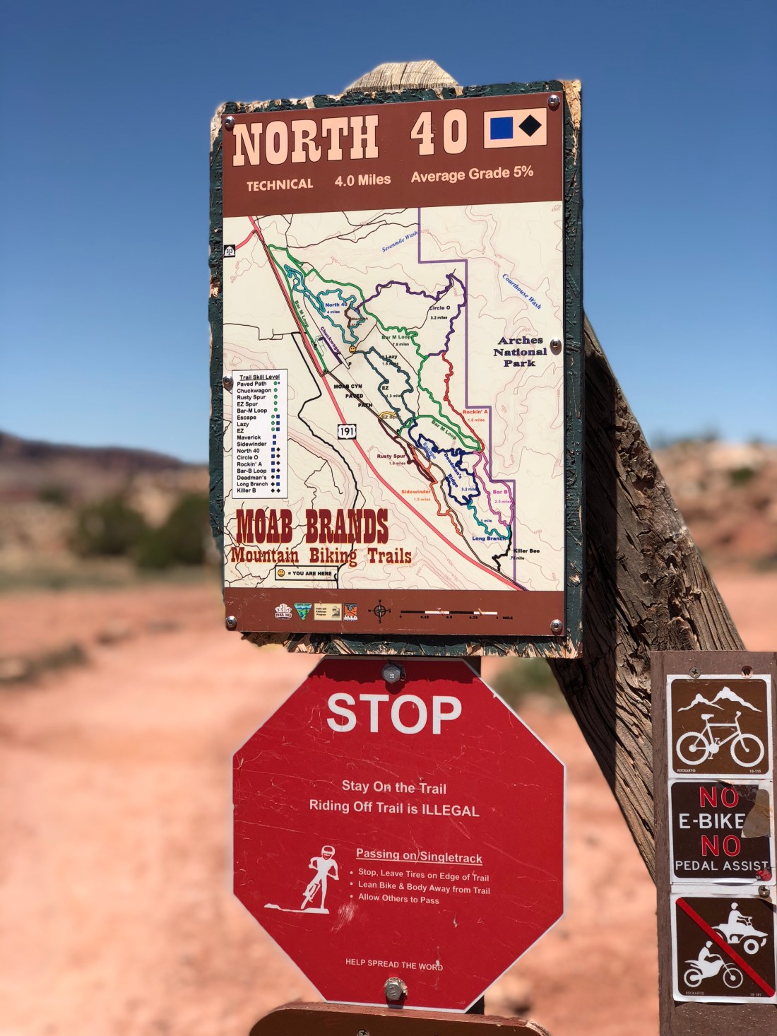
The North 40 is a short and fairly laid back blue/black trail north of town in what is referred to the as the “Bar M” trail system.
Before I tell you more about this trail, I should mention I love geeking out over how people build their “adventure machines”, some of which were in the parking lot.

I wonder how much difference that roof rack really makes in the scheme of things?
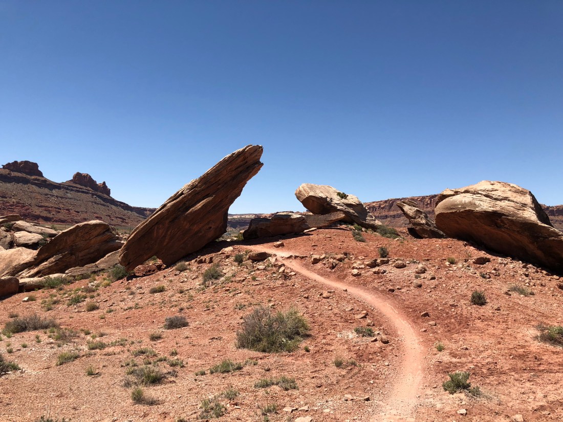
The North 40 is kind of like when your own dog bites you. You’re thinking- but – you love me. You know me. Why would you bite me? North 40 seems so tame as it climbs some easy going slickrock and hardpack.
But then it starts throwing this kind of stuff at you.
Now that’s ok. I mean, I don’t want my dog biting me – but a trail like this keeps you honest. It makes you a better rider, and the risk is generally well constrained. I dismounted a half-dozen times, but I think laying down your Moab neural network would make internalizing those lines a snap if you were lucky enough to ride here all the time.
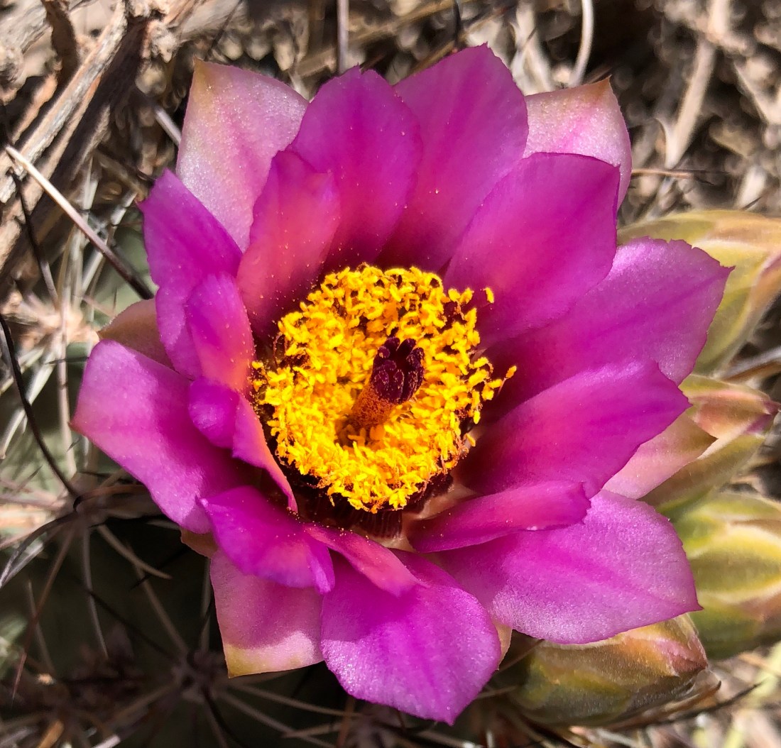
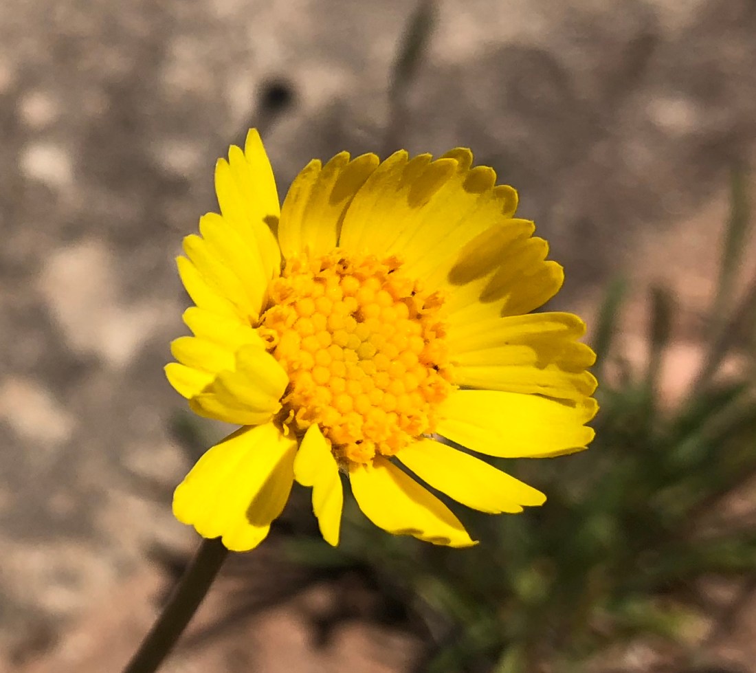
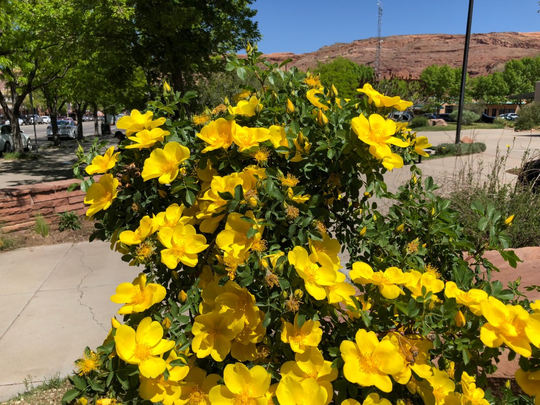
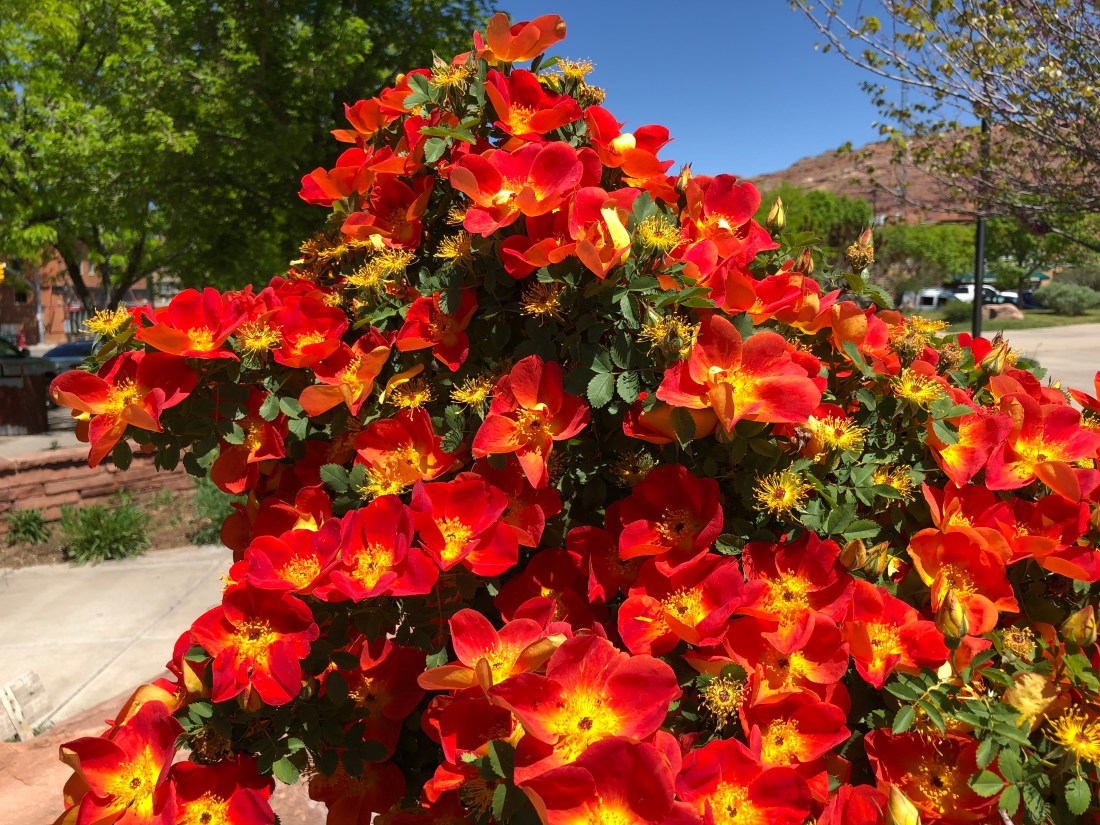
I’m not sure why, but flowers in the desert amaze me. I think it’s because of the contrast – in a terribly hostile place like the Utah desert where almost nothing lives you find this!
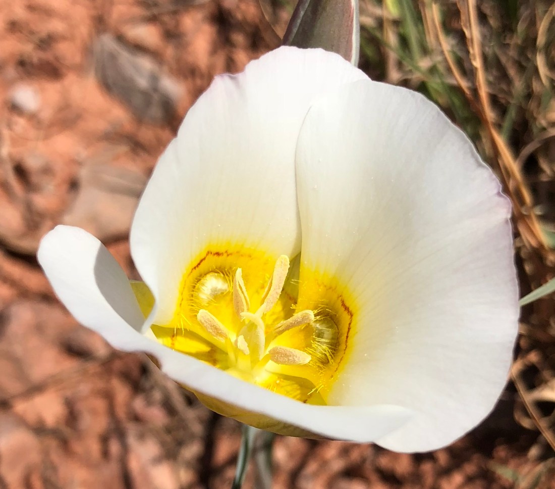
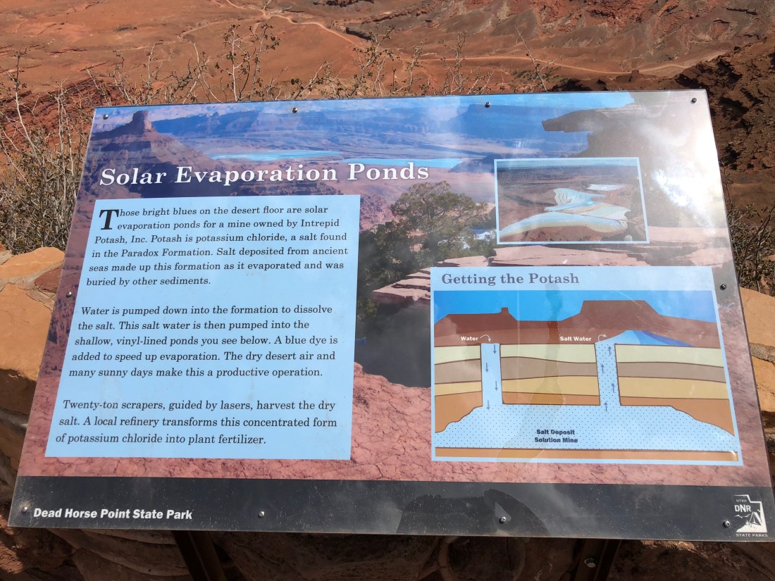
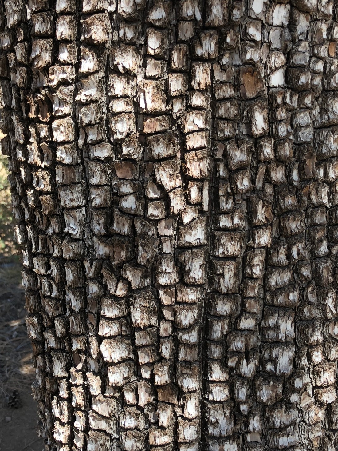
Evidently Mighty Manganese is responsible for the black coloration on the rocks in Moab. We read that on a sign in canyon lands. Well – ok they didn’t say “mighty”, I added that part, probably from too much Sesame Street in the 70’s, but my statement is still accurate.
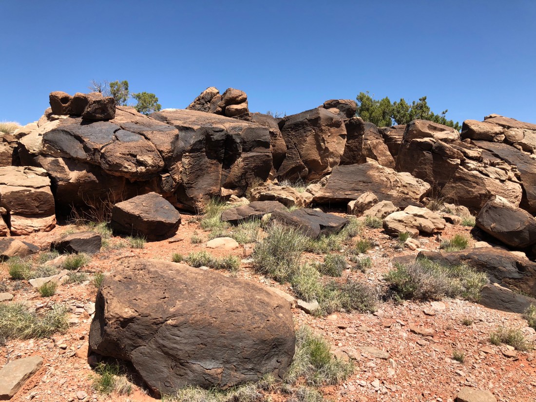
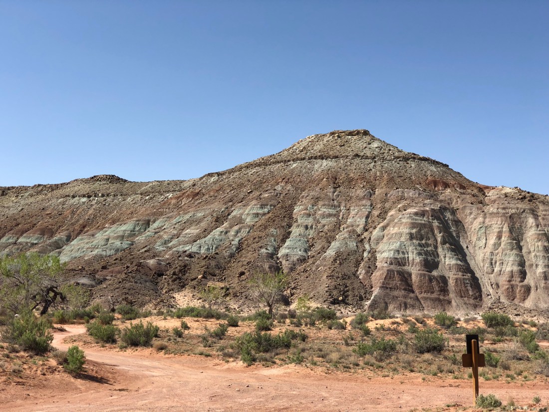
The distinctive green color in many of the hills around here is, according to the fine folks at the Utah Geological Survey, caused by chlorite or clay consisting of iron silicate.
Tomorrow we’re riding the Klondike Bluffs. Peace out my friends, one more day of riding to come.
Emily & Silent Partner
Morning, Peeps.
Welcome to day 3 and 4 of our not-quite-as-live-as-I’d-like blog from Moab. Today we’re coming to you from the Eklecticafe where exceptional eats and coffees are found aplenty.

I’m blogging from here because cell coverage on the Colorado stinks, even with the booster. So we took a nice lazy morning to imbibe some flavored caffeine, eat some delicious strudel and share the past couple days in photos and prose.
We left Slickrock campground but not before a furry-friend sendoff.

I have some ambiguity about this campground. The prices were high, but possibly not out of line when you consider being in the heart of town. The facilities were used – hard – but the staff was friendly, and they sold beer at the front desk. The electrical connections at the site bordered on a fire hazard, but the pads were clean, shade covered and otherwise well maintained.
I suppose my conclusion is I would come back, but probably again just as a mid-point while trying to land a better location on the Colorado.
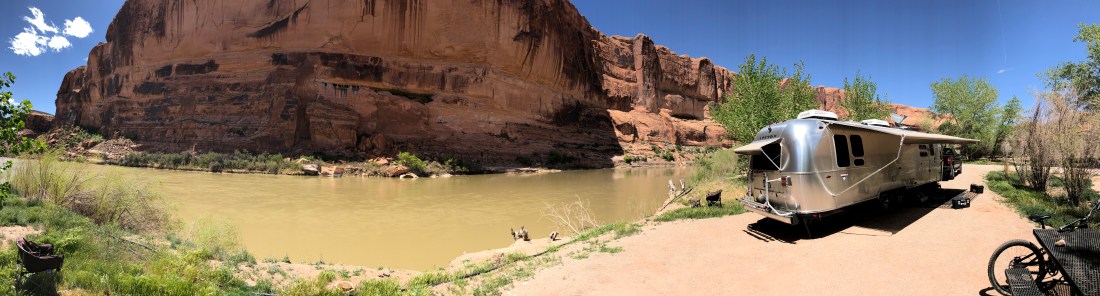
On day 3 of our adventure we moved to Goose Island Campground.
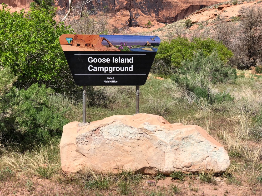
Goose Island is a remarkable BLM facility located not much more than a mile east of Moab on Utah 126.


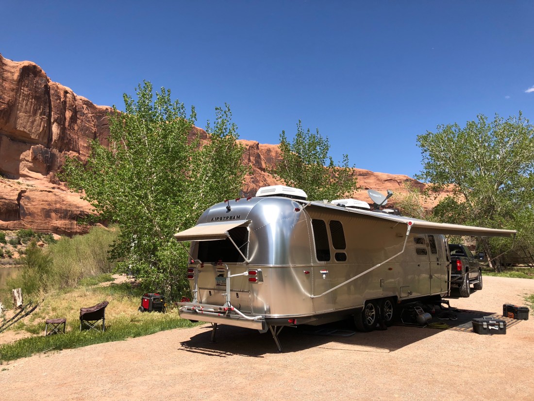
We like this campground because it’s close to town yet limited to a couple dozen sites nestled up against a dramatic bend in the Colorado River. For $15/night you get unbelievable views of the river and epic sandstone cliffs worked meticulously by water and wind.
The campground offers trash collection and immaculately kept vault toilets but no water. Generator hours are a little odd at 8AM to 8PM, though we understand everyone wants to enjoy the outdoors in quiet.
Being so close to town this campground is busy. All sites are walk-ups so prospective campers (including ourselves) troll the area at all hours trying to score a spot. It’s also not entirely unusual for outside campers to stop by and drop trash in the receptacles, though there not supposed to. Given the amount of activity around here it’s understandable.
As I mentioned earlier, cell coverage here stinks. With the booster I can get internet but it’s too flaky to upload pictures for the blog. Still it’s entirely sufficient for texts and email.
Lastly as seen above foliage is light making satellite reception a snap.
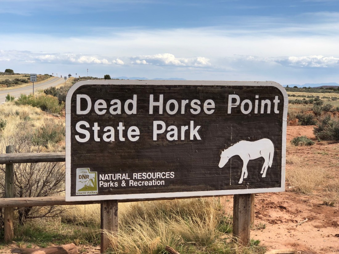
In an effort to economize on our three-day pass to Dead Horse Point State Park, we rode there again on Day 4. You can read up on the trail details in our previous post here. Below are a few more non-mountain biking highlights.


The point of the point is this.
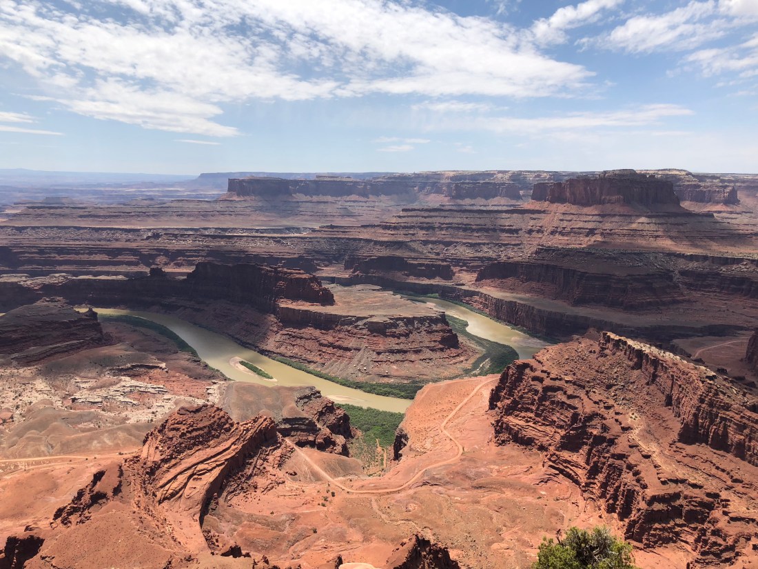
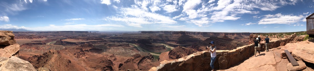
I’ve been to the Grand Canyon numerous times but I find this view infinitely more rewarding. It’s still grand, but somehow more intimate.
On Day 3 we spent some time in Moab grabbing food and groceries. We highly recommend the Moab Brewery. Patio seating is the best.

Eddie McStiff’s has awesome Pizza, though oddly not until after 3.

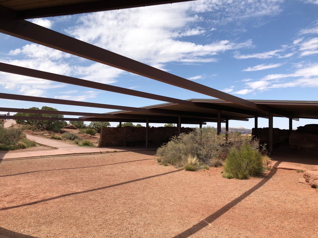
The Moab Information Center right next door has a gorgeous garden.
We’re lazing around today, I might ride North 40 if I can get out of vacation mode – you’ll find out tomorrow. Peace!
Emily & Silent Partner
Evening, Peeps.
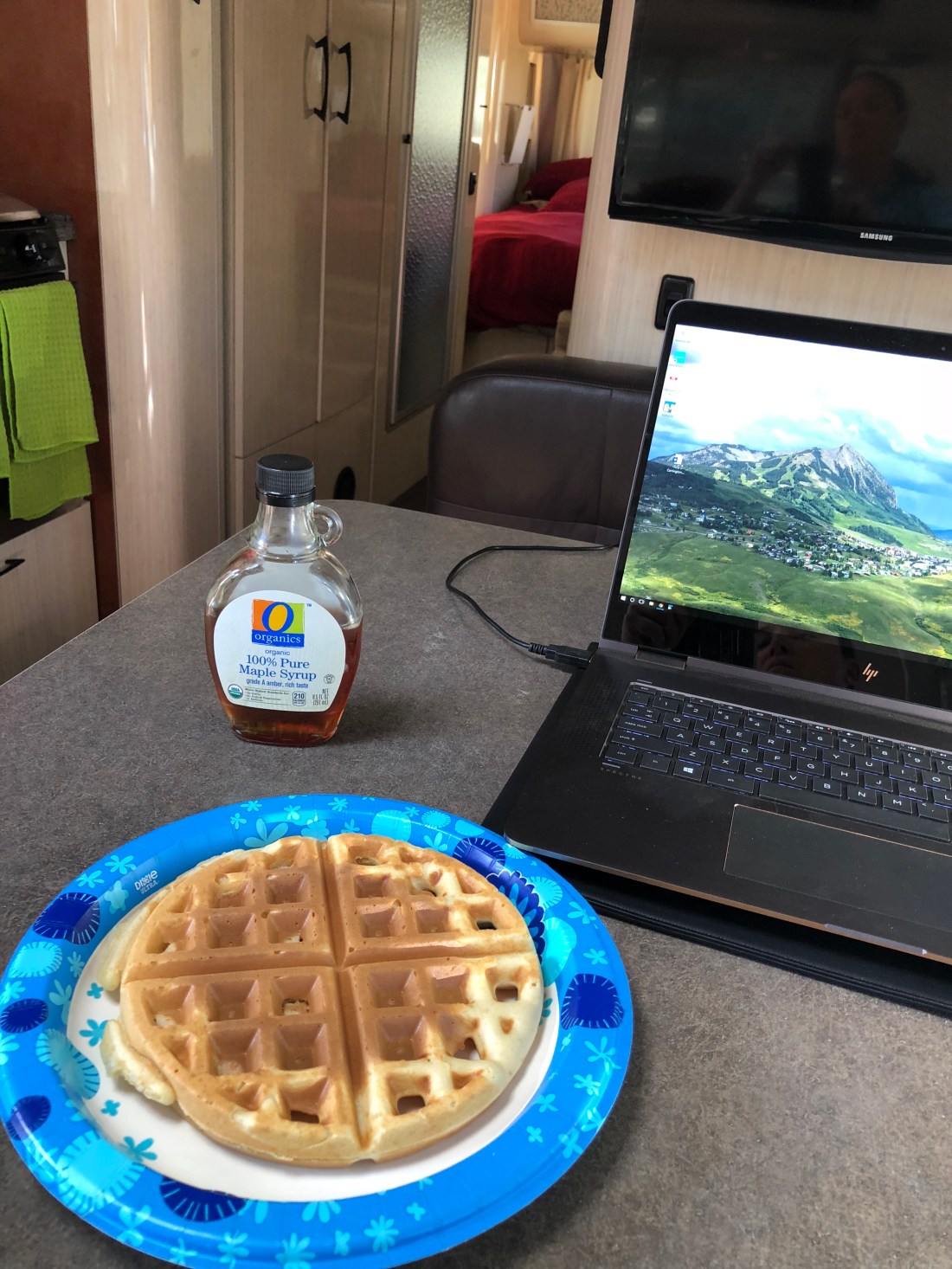
Welcome to day two of our live blog from Moab! So to begin, how else do you start a day in Moab but with WAFFLES!!!
I mentioned yesterday that Moab is an outdoor Disney Land. Witness the temple to capitalism that is Moab’s main drag!


A quick shout out to Poison Spider Bicycles.

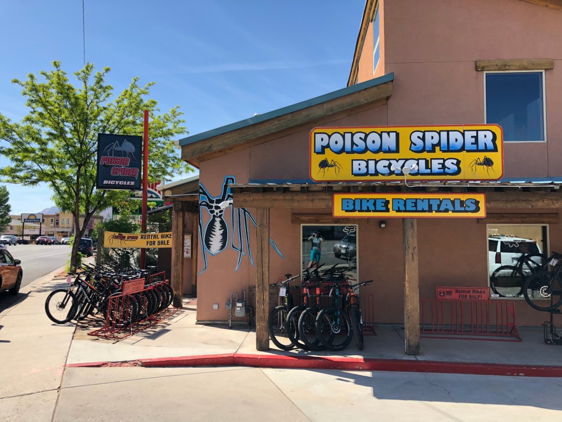
These guys are polite and professional, and have repaired massive damage on my rig fast. They also run a fleet a shuttles all over Moab and rent out a shower for dirty riders. Prices are fair and the service is impeccable.
Stop by for some swag if you have time.
Moab abuts the Colorado river and this swollen aquatic byway underpins a huge portion of “things to do” here. Of interest to us, BLM built multiple campgrounds along the river with limited services but great prices. We’re moving to one of those campgrounds tomorrow.
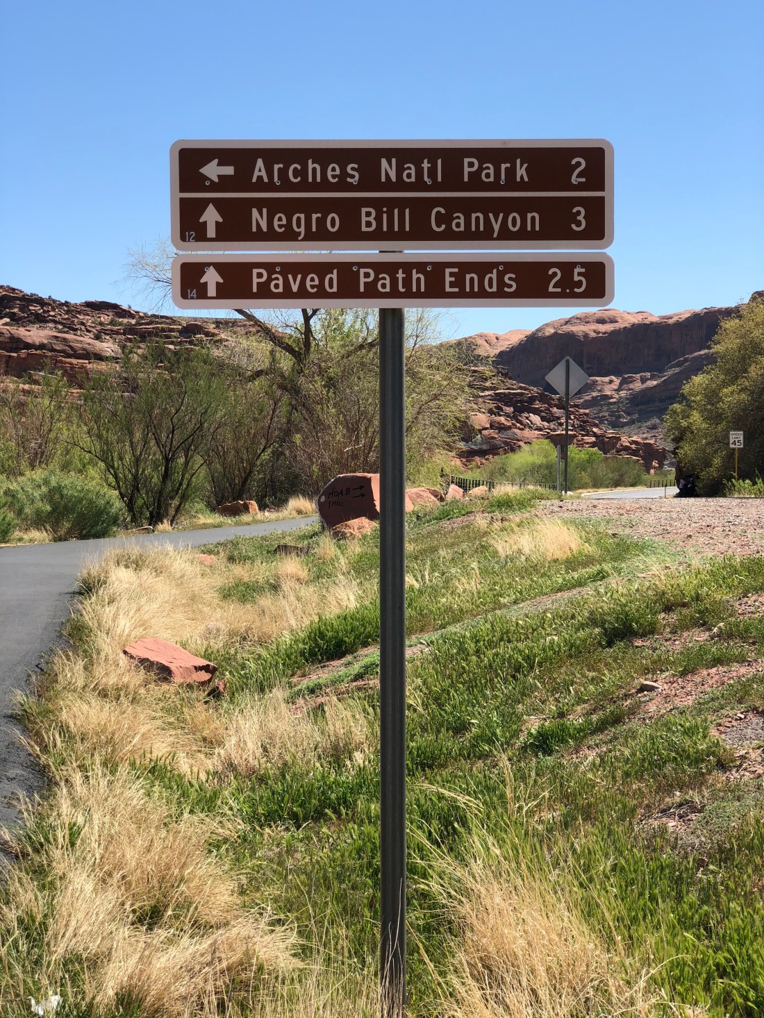
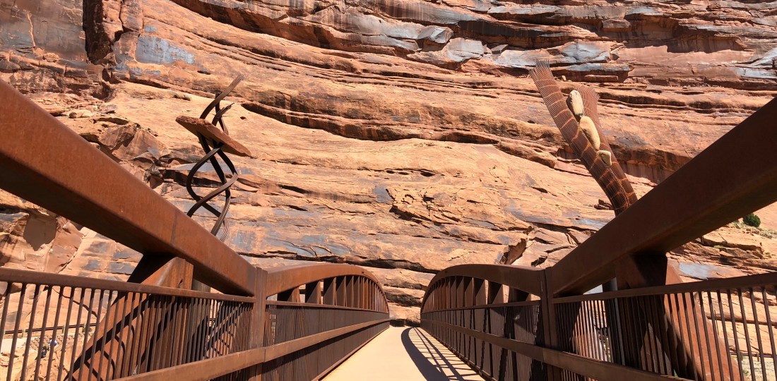
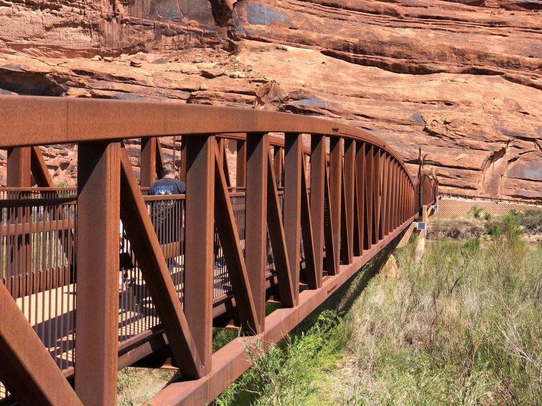
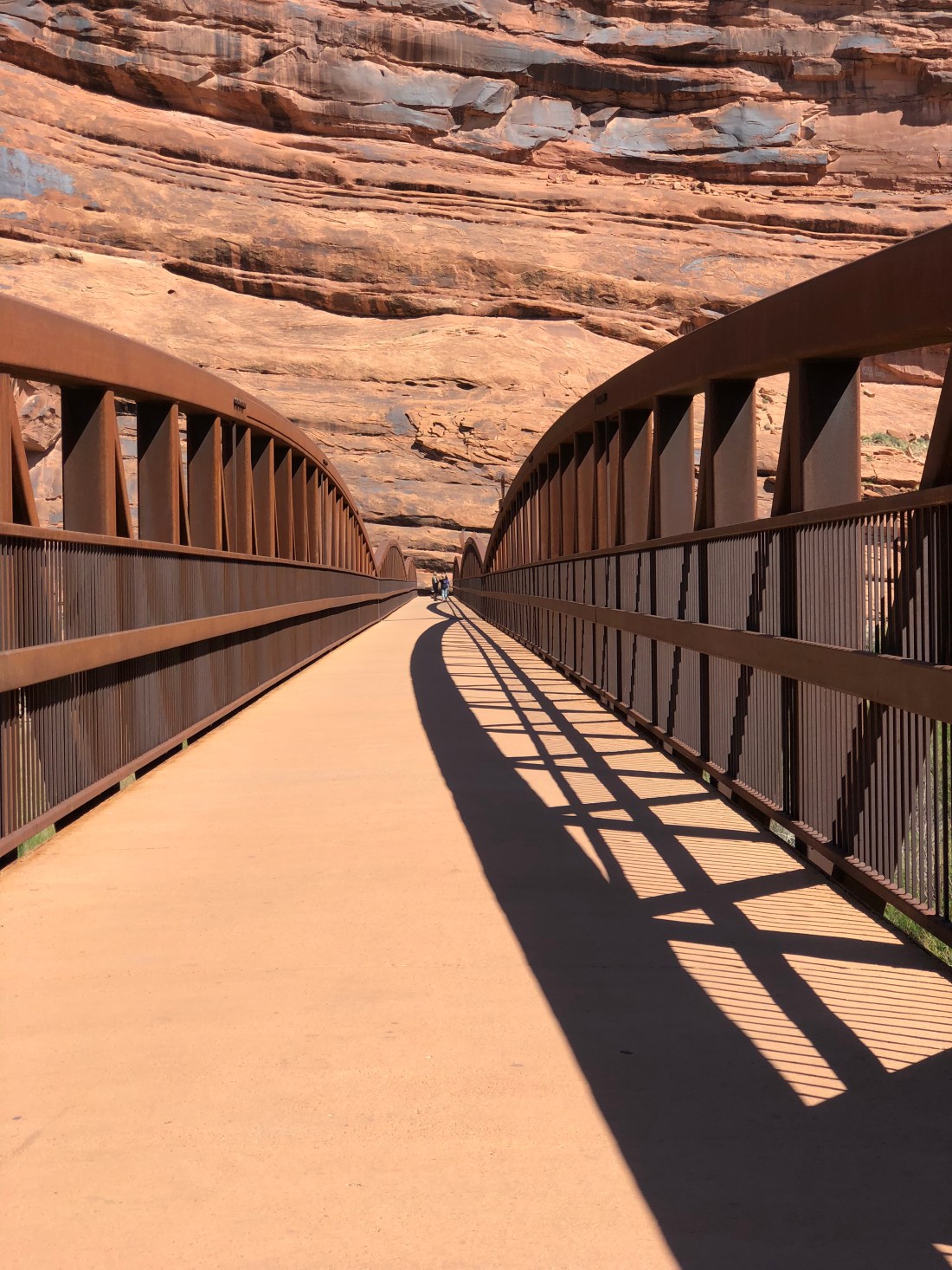
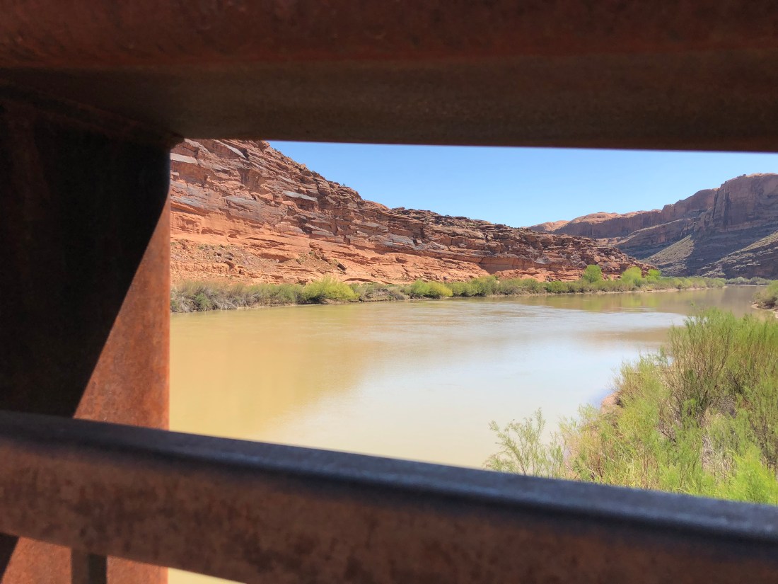
There’s a sick paved bike path that leads from Moab all the way to Gemini Bridges; crossing the Colorado on a bridge-made-art.

Though we did not ride Canyonlands today Utah 313 takes you to to Dead Horse Point State Park and though unbelievable scenery on its way to Canyonlands.
Today we rode Dead Horse Point State Park. Sadly yes, some horses did die here long ago, but not anymore. The park is $15 for a single vehicle, and the pass is good for three days. There is no water here though there is a small manned kiosk willing to relieve you of your money along with a beautiful visitors center.
Suiting up in the parking lot we noticed there’s a theme but not sure what it is….
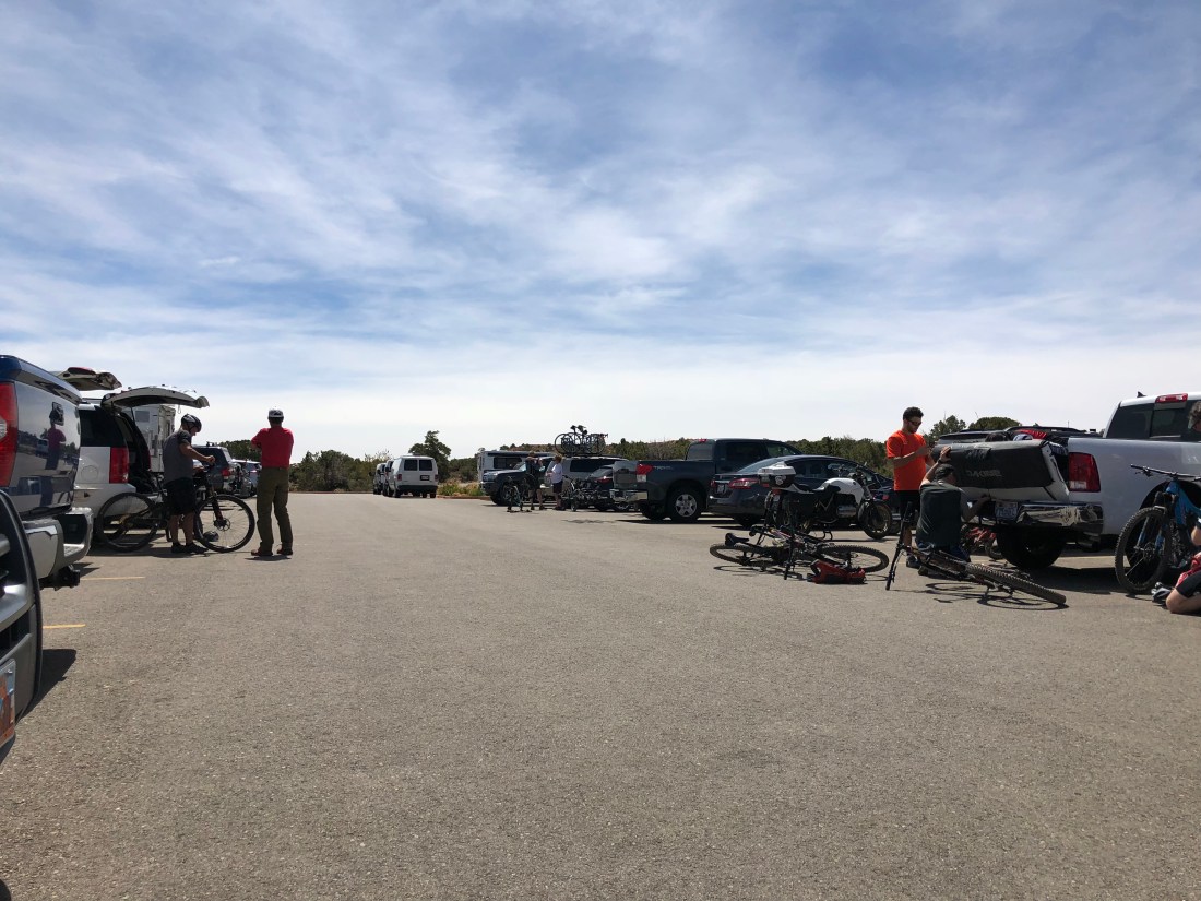
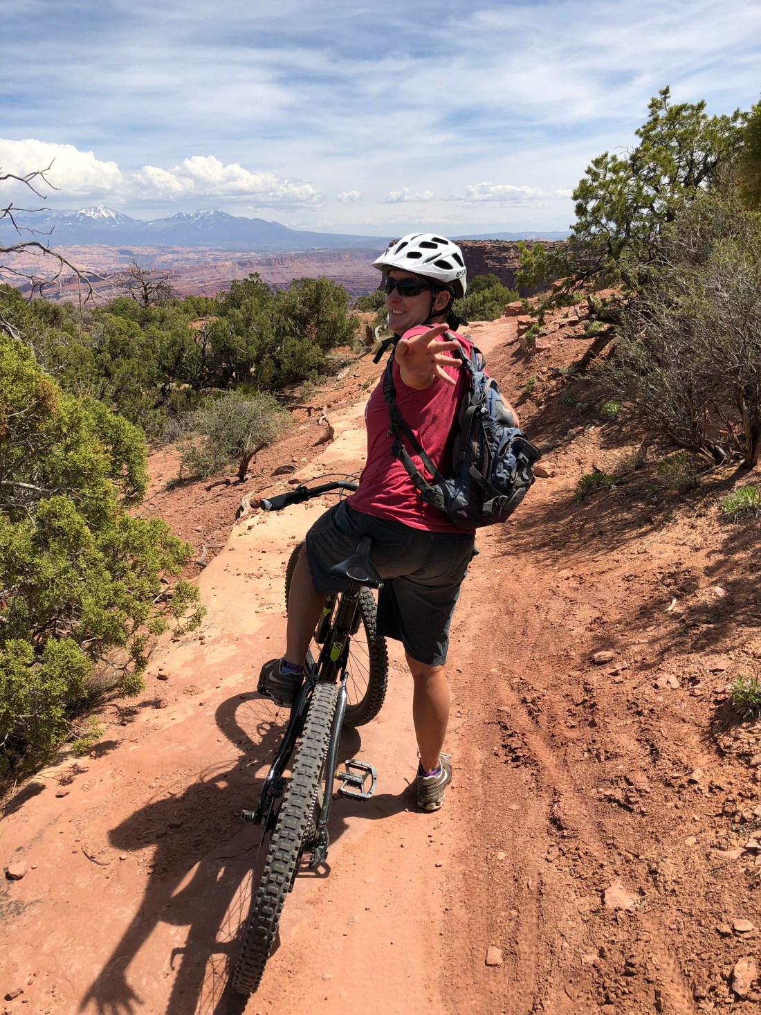
We rode the entire perimeter of the Intrepid Trail System. The park is at 5,900′ (1,800 m) and sadly I noticed the altitude immediately today.
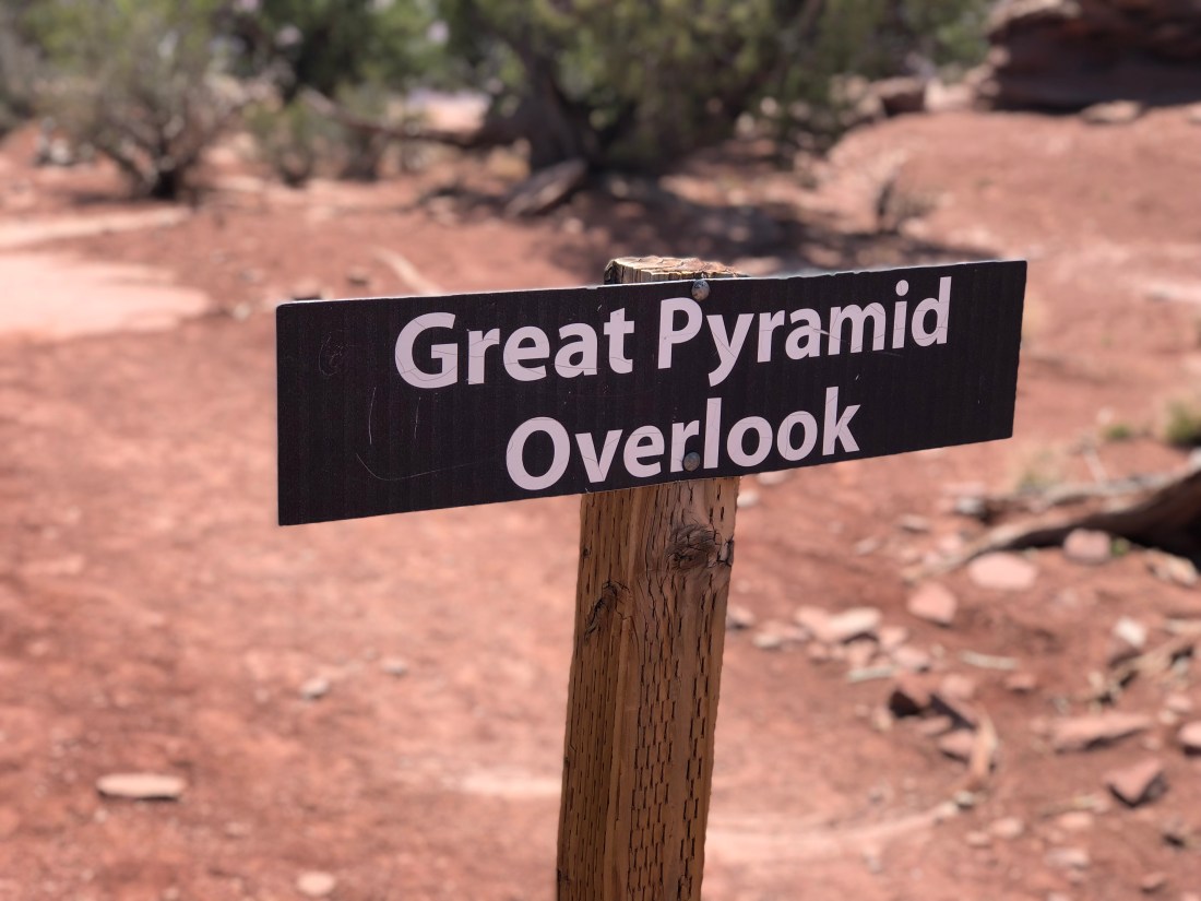
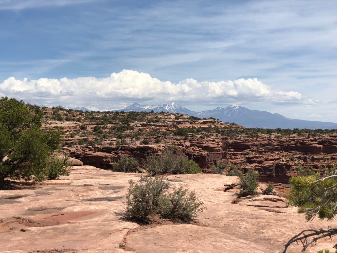
We like to ride the trail system counter clockwise and the first leg, Great Pyramid, offers spectacular eastern views.

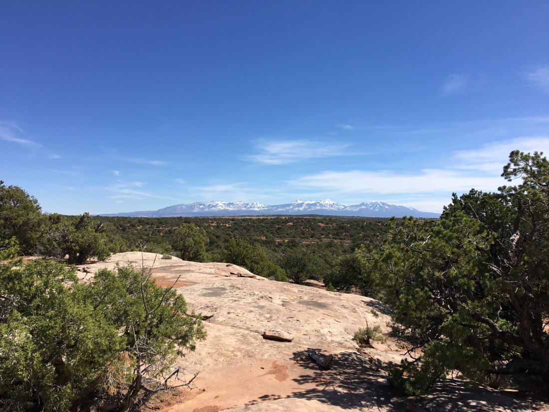
As always the La Sal mountains look on, snow capped and beautiful.

The entire Intrepid System ranges from green to advanced blue. The Big Chief trail is a glorious blue.
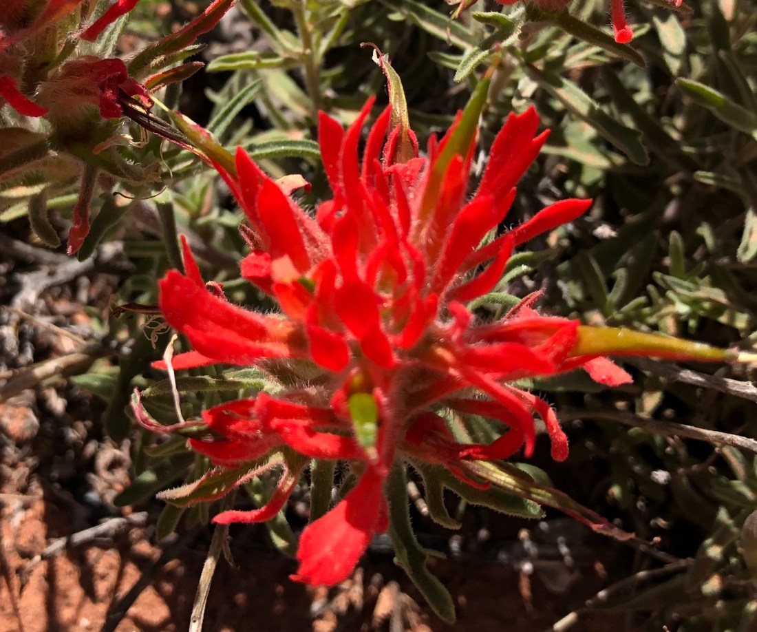
Flowers are few and far between but they can be found this time of year.


The Whiptail and Twisted Tree trails offer miles of advanced blue slickrock.
Slickrock is a sandstone rock that defines the entire Moab region. It’s called slickrock because early setters had trouble with steel horseshoes slipping of the “slick” rock.
Tomorrow we’re leaving Slickrock Campground for a site on the river. The ride wiped us out today so we’re not going tomorrow but expect lots of pictures of the Colorado. Peace!

Emily & Silent Partner
Evening, Peeps.
There’s an outdoor Disney Land in Utah. Here you will find Mountain Biking, Sky Diving, Zip Lining, Hiking, Camping, RVing, Kayaking, White Water Rafting, Boating, 4x4ing, Road Cycling, Rock Climbing and a host of other ‘ings’ I have already forgotten because there is presently more than one beer in me (how many is my secret to keep).
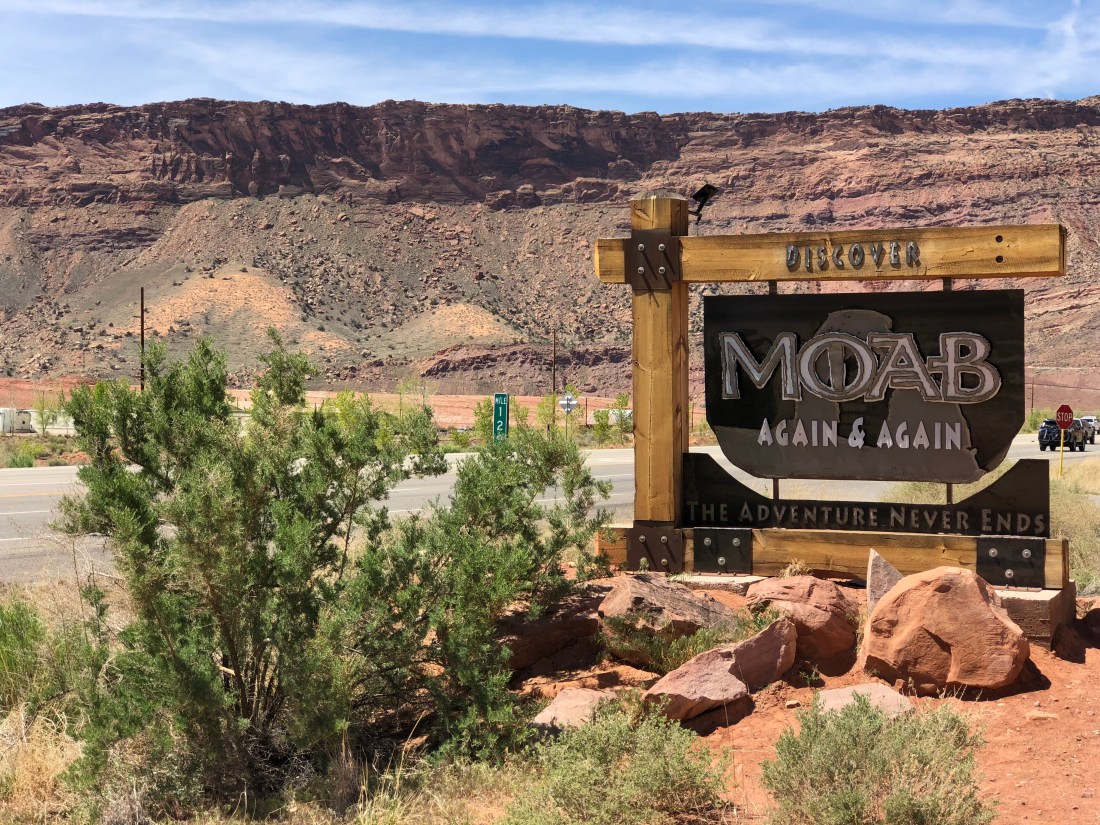
This place is called Moab. And we’re going to share it with you right now.
It is one of the best placed on Earth.
Oh yes it is.
We come to Moab every year. Yes – of course – for the mountain biking. But Moab is one of those places we have been telling you about. It’s special. You sense it the instant you come here. And there’s a lot of here to explore. Enjoy the next six days and vacation with us in this amazing place.
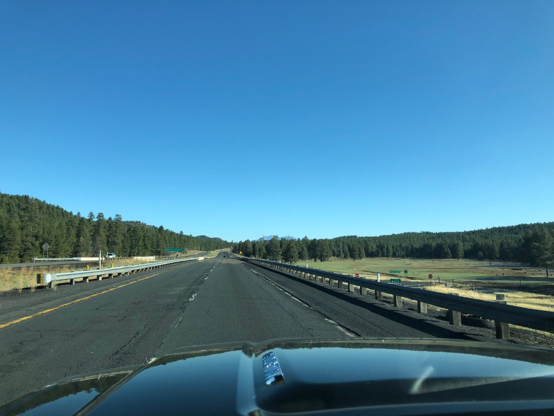
Today we left Phoenix and made our way through Flagstaff.
Usually we’re the only Airstream around but we saw a dozen of them on the road today. Weird.
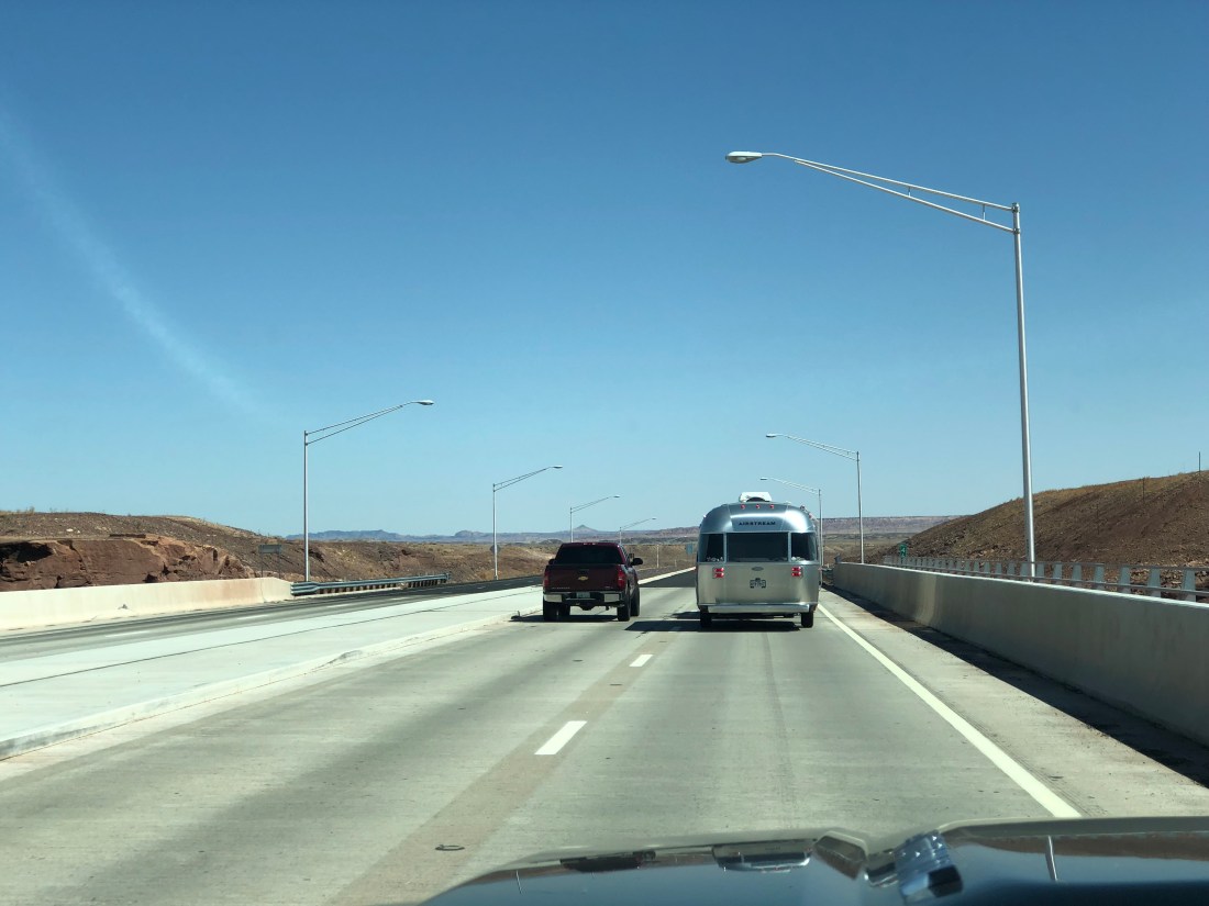
Then through Blanding & Monticello.
And finally the gorgeous La Sal Mountains beckon.

We’re staying a couple days at the Slickrock Campground in Moab and then moving on to a spot on the Colorado Riven when all the weekenders go home.

Tomorrow we’re going to bike on a mountain using mountain bikes, I will bring you plenty of pictures and more information about Moab. Peace!
Emily & Silent Partner
Evening, Peeps.
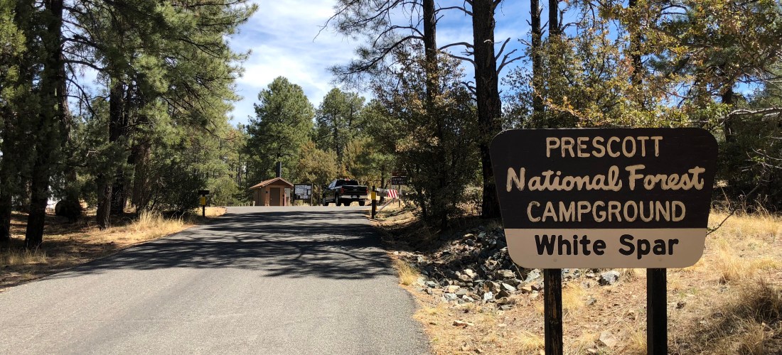
It’s that time of the year again. You know the time. The trailer’s been in hibernation – the days are getting a little longer and that tiny light behind your eye begins to blink drawing you northward. Along with all the other RVers we felt the clarion call as well, so today I bring you a live blog from Prescott, AZ.
For our stay in the high country we are blogging to you from White Spar Campground just south of Prescott, AZ (locals pronounce it “press”-“kit”). This is a fairly large campground and availability can be searched and booked on the federal portal.
Sites are spacious and deeply forested as the campground lies just inside the Prescott National Forest boundary on U.S Route 89. Traffic is moderate to high and all pads are located on high-quality tarmac. Water is available at strategic locations as are vault toilets and dumpsters. There is no sewer or power, cellular service was middling (even with the booster) and noise highly variable (though no surprise, things calm down during the week).
The city of Prescott is a rather astonishing 40,000 souls but much of that habitation is in the northern reaches. We prefer to wander around the southern courthouse plaza area where delicious ice cream, pizza and shopping is found aplenty. Conveniently laundry can be done at The Cleaning Machine just a couple blocks east on Gurley St.
Not as convenient, though free, a dump station is located at Affinity RV Service, Sales & Rentals north of town. Propane can be filled at Prescott True Value and we shop at Safeway located at the corner of 89 and Copper Basin Rd.
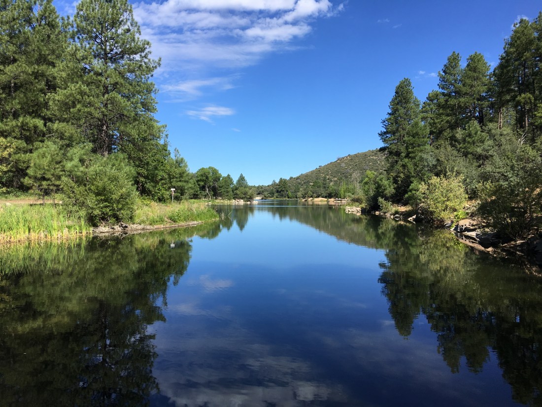
Goldwater lake is located south of Prescott. This lake offers picnicking, kayaking, mountain biking, horseback riding and hiking. Via the Goldwater Lakes Trail #396 the lake can be reached on mountain bike in less than an hour.
Ah yes, mountain biking – my favorite topic. We’re only here a few days and sadly I was sick two of those days. Still, we managed to squeeze in a couple rides on several of the local trails.
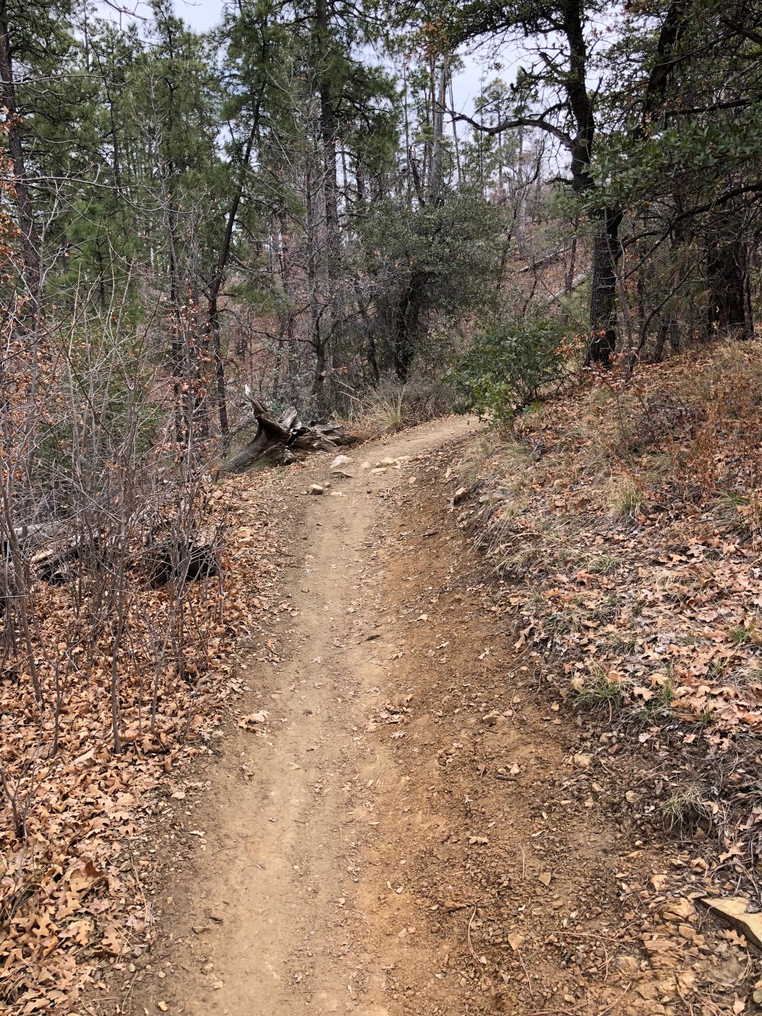
I prefer to begin at White Spar Campground heading south on Goldwater Lakes Trail #396.
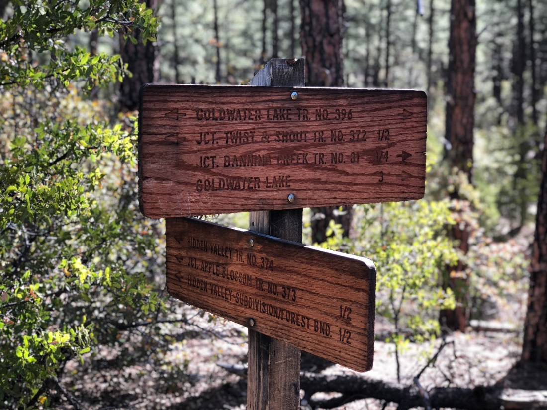
This trail is rated blue and I agree with that assessment due to fitness, as some of the climbs here routinely reach 13%. The views close to camp are worth the pain.

Further on the trail snakes its way through scenic creeks and small canyons.
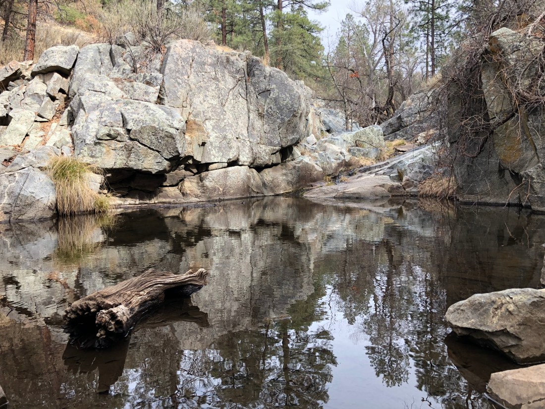
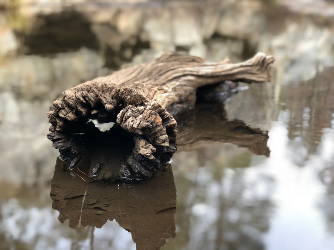
Spring hasn’t quite sprung here but it made for great photography.
Though steep the trail is not technical.

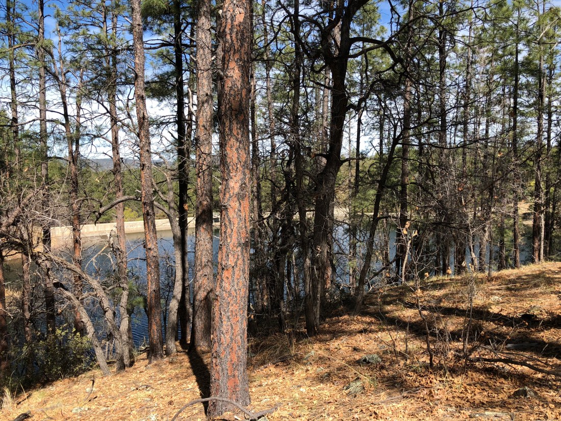
The lower Goldwater Dam peeks through the denuded forest.
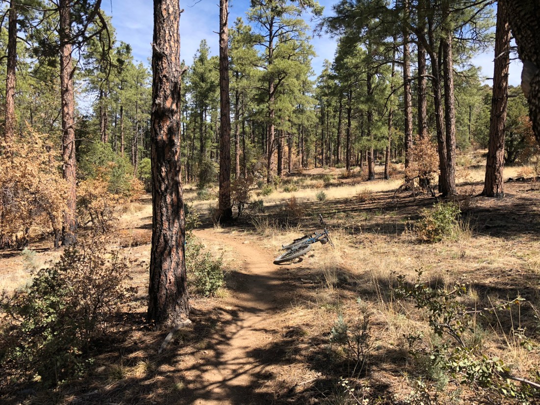
Past upper Goldwater Lake I cut into Feldmeier Trail #330.

330 is tame and enjoyable on the downhill.
At the bottom I take a very brief right on Banning Creek Trail #81, cut into Apple Blossom Trail #373 then finally Twist & Shout Trail #372 completing the loop.

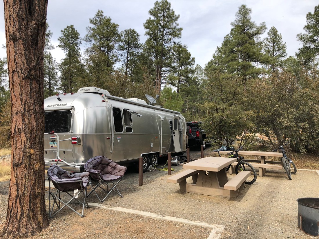
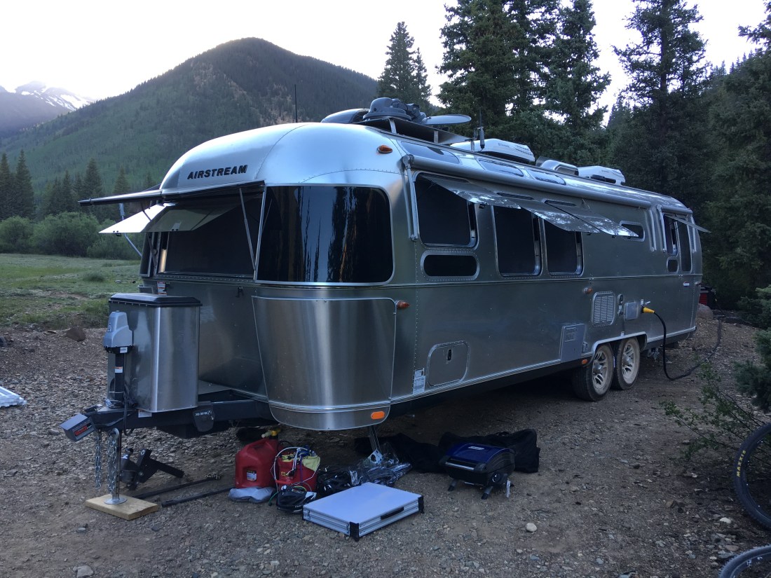
The Airstream behaved pretty well on this trip. As of late one of the decorative finishing strips has been separating so I’m going to have to install a replacement finish. I think the torment of the Arizona desert heat did its worst.

I have also been blowing through a suspicious number of converter controllers in the Airstream. The fine folks at Airstream of Scottsdale agreed to install a 3rd party controller from Best Converter that is gentler on the batteries owing to its four-stage charging strategy.

In particular I settled on the BD1260HW.


The service technician also recommended against using 6 volt batteries in the Airstream as well as discouraged running the Airstream’s 1000W inverter while hooked up to shore power. Hopefully these recommendations will stop the long run of converter controller failures.
We’ve been to this campground several times and we highly recommend it primarily due to its access to unbelievable mountain biking, proximity to town and fair price. This campground definitely has “it”!
Emily & Silent Partner
Evening, Peeps.
Welcome to another mega-post!
I’ve been looking forward to writing this for months, since I’ve mentioned previously that Crested Butte, Colorado is “one of our favoritest places in the world”. If that’s true, then this naturally begs the question, what is our favoritest place in the world?
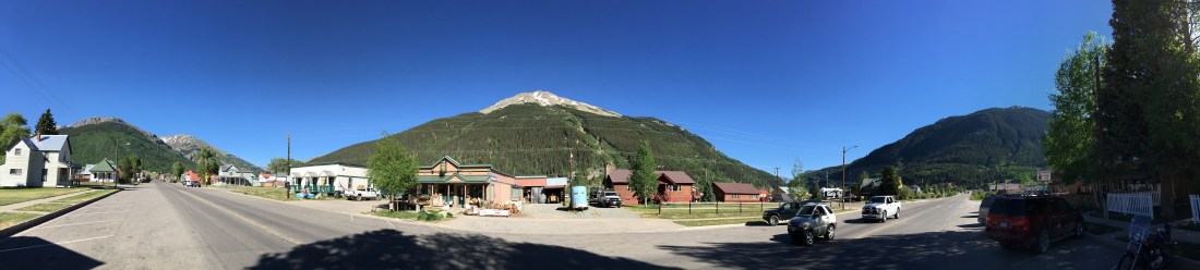
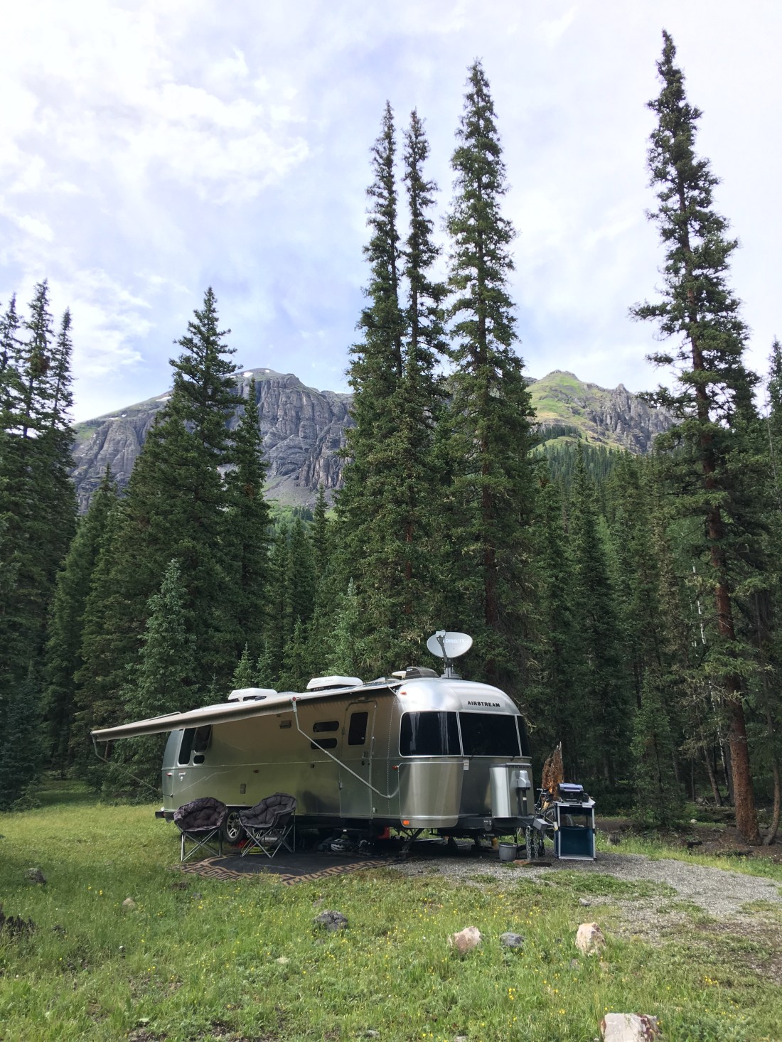
In answer this long standing mystery, I am proud to continue our series on places we’ve stayed in the Airstream by revealing our single most favoritest place in the world: Silverton, Colorado!
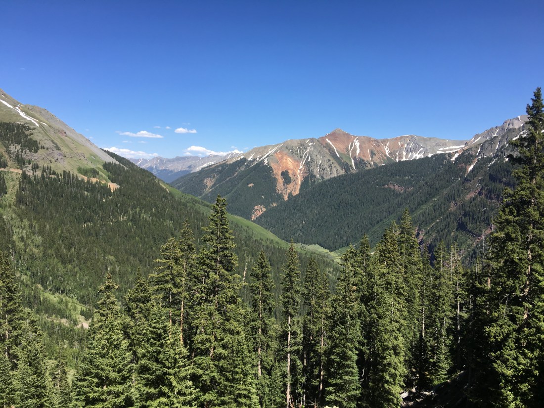
The best part about Airstreaming is immersing yourself in amazing surroundings, and Silverton turns that experience all the way up to 11. This tiny little town perches in a Tolkien-like valley high in the the San Juan Mountains, which are located in the extreme south-west corner of Colorado.
The San Juans form a violent and abrupt uplift that fracture the otherwise serene desert tableau into snow-capped madness.
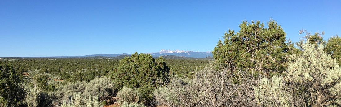
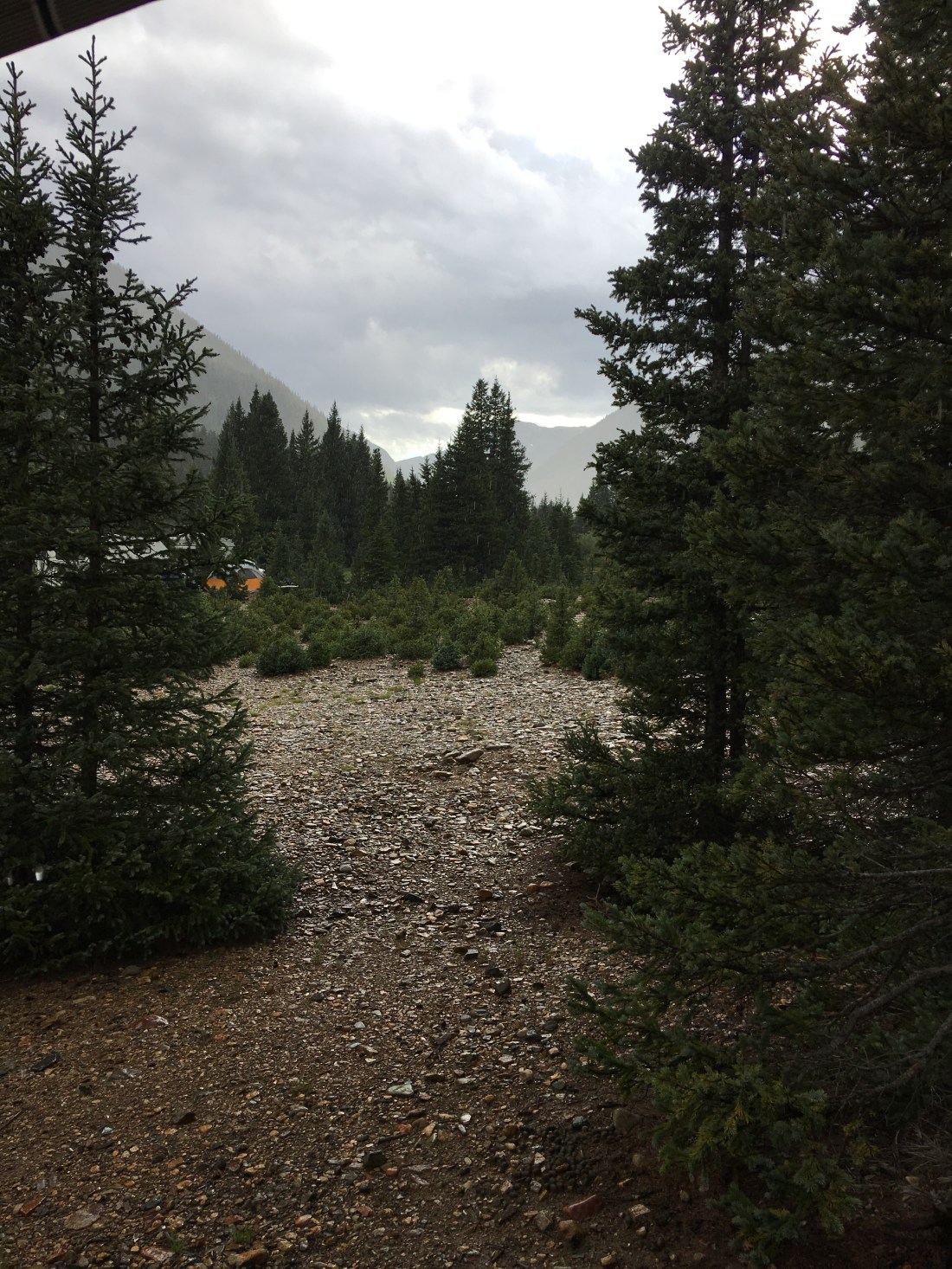
In the space of an hour you can drive from the high desert of Cortez, CO pictured above to the lush forests of Molas Pass and drop fifty degrees while doing it.
The stretch of road that leads to Silverton is called the Million Dollar Highway (aka U.S. 550) and it is widely considered to be one of the most scenic drives in America. This road offers stunning vistas as it winds its way into the mountains and traverses multiple passes in excess of 10,000′ (3048m).
The journey is punctuated by alternating pine and aspen forests, alpine lakes, historical mines, four-wheel drive roads and, if you’re coming north from Durango, it’s also flanked by the Durango & Silverton Narrow Gauge Railroad.
Harley riders flock to this area for the serpentine bends while OHV enthusiasts flush into the surrounding hills to explore miles of trails.
Or to put it another way – there is, in my personal experience, nothing quite like it.
Silverton is positively overflowing with camping opportunities, and remarkably, many of them are free.
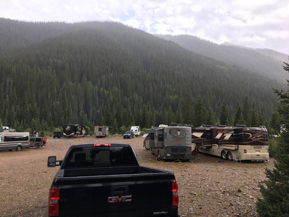
Kendall Campground is located a few miles west of Silverton on Forest Road 585. This is a so called “dispersed” campground which means there are no services except a vault toilet and no assigned campsites. As such there is also no fee. The campground is immensely busy but owing to the national forest rules which state you can only stay for 14 days there is a lot of turnover and we had very good luck finding spots.
Two years ago we scored the best spot in the campground which snuggles up to a meadow on the west side.
The year after that we backed into a cozy tree-covered location on the north side. Note all the other adventurers. We came affectionately to call this shanty town.
Considering this campground is free, it’s amazing there’s even a vault toilet. Perhaps not so surprising, it’s not maintained and, occasionally, became unusable. As we have facilities in our trailer, this wasn’t an issue for us but I felt for the folks who were tent camping.
Rules posted at the entrance to this campground clearly state you should park your rig perpendicular to the river so as to allow as many people to share the view as possible. From our stay there we learned most people can’t or don’t read.
In a campground such as this where there are no cleanly marked “sites” personal space becomes an issue. We found generally generators we off by 10pm and on by 6am. We also found people generally avoided walking through other sites. Dogs, unfortunately, we often left off leash which led to some issues for us with our little ones.
In 2014 fiber optic service arrived in the town of Silverton and with it awesome cellular service. This campground is only a couple miles (5 km) from the main cell tower and signal is blazing. Some people have complained of overloaded service but we never experienced that problem, possibly due to our cell booster. As my living depends on internet connectivity it’s hard to articulate the madness of camping in the deep San Juans while still pulling down intense speeds necessary to telecommute in the morning and then mountain biking at 10,000′ (3048 m) in the afternoon.
Anvil Campground is immediately west of Kendall Campground but only offers a few spots. Otherwise all the rules are the same as Kendall, free with a 14-day limit.
Golden Horn Campground is even further west on Forest Road 585 from Kendall and Anvil. The approach to the river seemed extreme to us but we saw plenty of big rigs down there (I still wouldn’t try it with the Airstream). This site is also free with a 14-day limit.
South Mineral Campground is a paid campground but all sites are first come first served. Getting a spot here can be very tricky, even in the middle of the week. By complete accident we scored an incredible location on a small hill.
This campground consists of two basic loops and is very busy. Still we never found it to be too noisy and many sites are well away from the road. All sites are on crushed aggregate and overhung with deep green forest. Additionally the campground hosts keep the vault toilets pristine, there are dumpsters for paying campers and limited treated spring water (also only for paying campers).
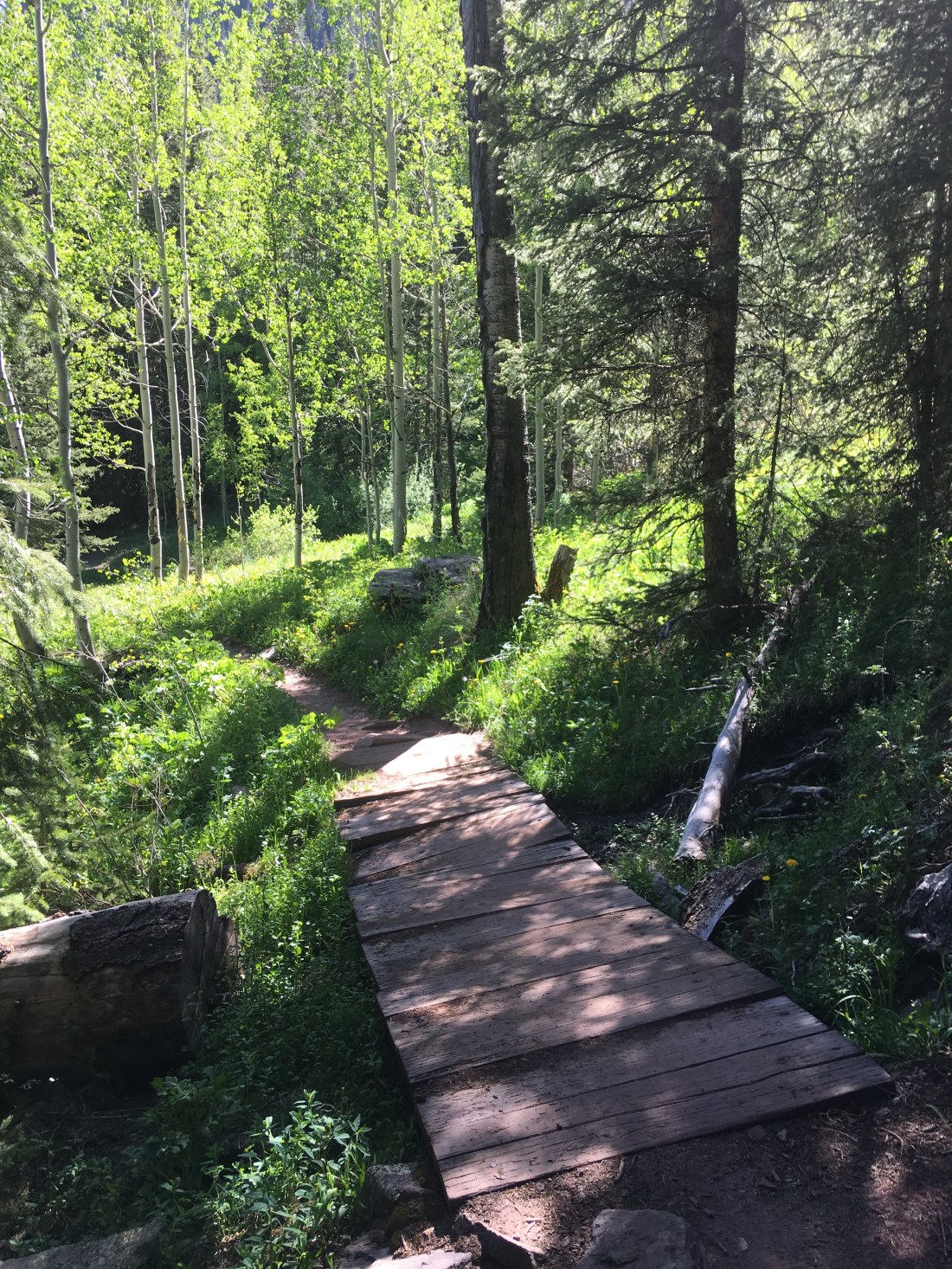
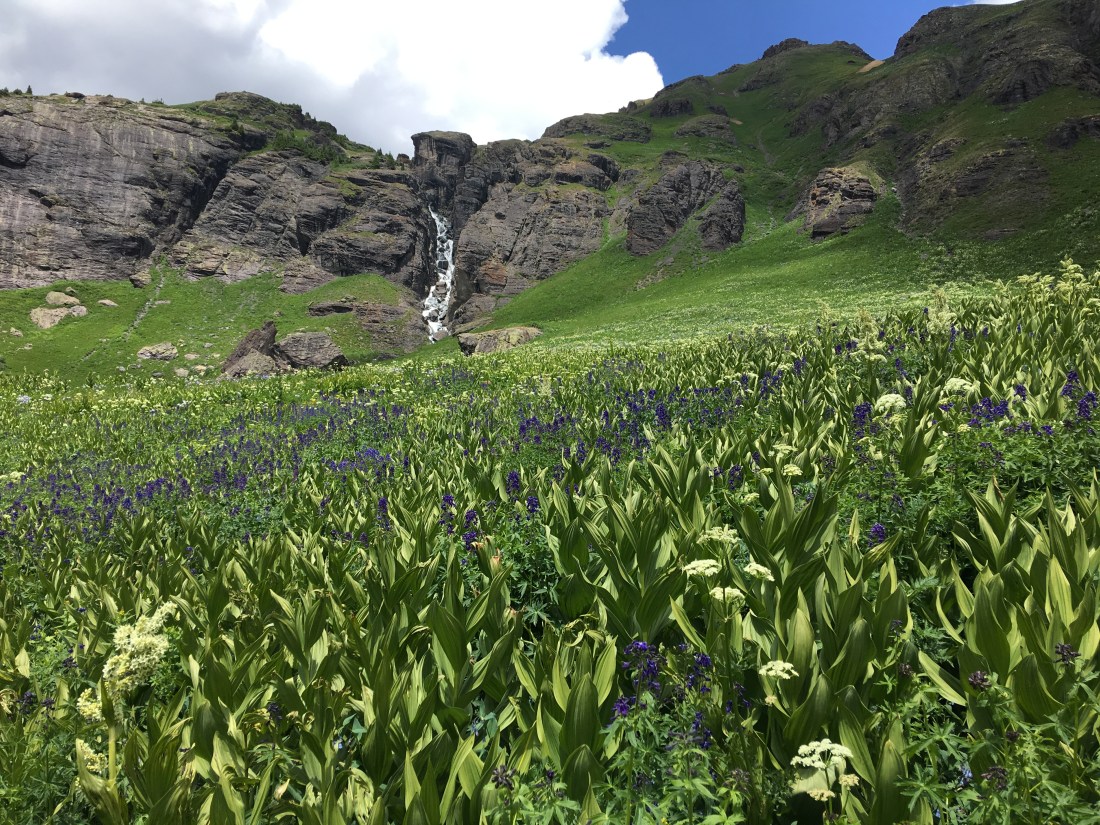
The Ice Lake trailhead is located directly across from the campground and it can get extremely busy. The Ice Lake trail is an exceptionally difficult hike gaining 2,500′ (762m) in only 3.5mi (5.6km). That’s a 13% grade!
For those that brave this torture (which should be started early in the morning to avoid the afternoon storms) they will be rewarded with god-like views, waterfalls and alpine lakes.


Forest Road 585 continues past South Mineral Campground and takes a very steep climb up to terminate at the Rico-Silverton trailhead. This drive should only be attempted by four-wheel drive high clearance vehicles and also makes for a difficult but rewarding mountain bike ride as well. The end of this road also offers a range of dispersed sites but certainly only for the most intrepid souls with capable vehicles. Taking the Airstream there was a non-starter.
There is a wealth of additional camping around Silverton including free dispersed sites at the mouth of Maggie Gulch and the Highland Mary in Cunningham Gulch. At least three RV parks offer camping directly in town. Little Molas Lake and Molas Lake Park and Campground offer additional paid camping south of town in the spectacular Molas Pass.
In a pinch you can find almost anything you need at Silverton Grocery or Silverton Hardware. Prices are commensurate though, so if you have the means we highly recommend you stock up in Durango or Montrose first, both of which are roughly an hour drive from Silverton.
The dispersed camping sites do not have trash collection so you can haul your garbage to a free transfer station only a mile or so north of town.
Sewer dump stations and fresh water are available in town at the Red Mountain Motel & RV Park and Silver Summit RV Park & Jeep. We recommend you get there early as some of the dump stations are blocked by Jeep washes later in the day. As there is little competition for these services expect an outrageous fee.
Landry facilities are open to the public at the Silver Summit RV Park & Jeep and Silverton Lakes RV Resort.
There is a very well provisioned Conoco station strategically positioned at the entrance to town. Diesel is available along with unleaded and many many tourists line up to use the pumps.
Silverton is the terminus for the Silverton & Durango Narrow Gauge Railroad and services multiple trains per day.
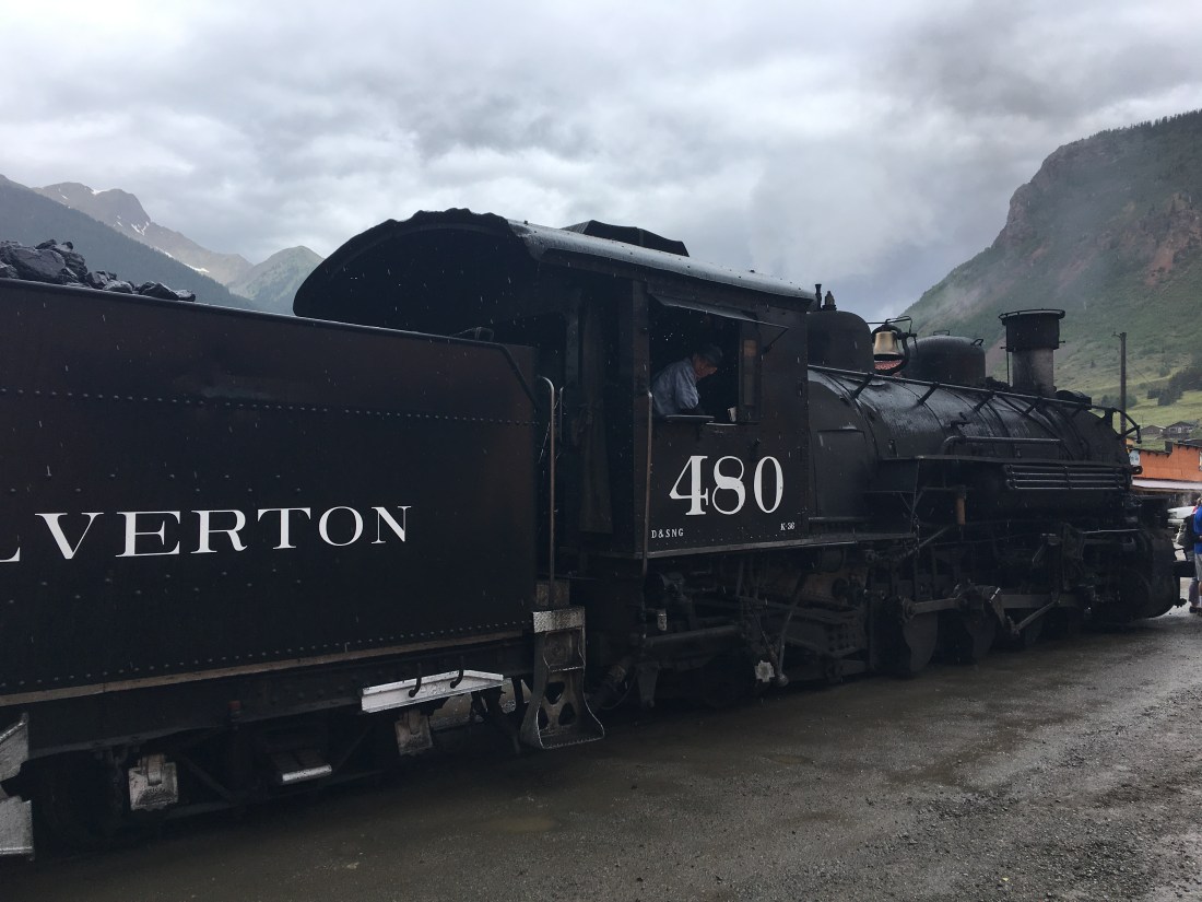
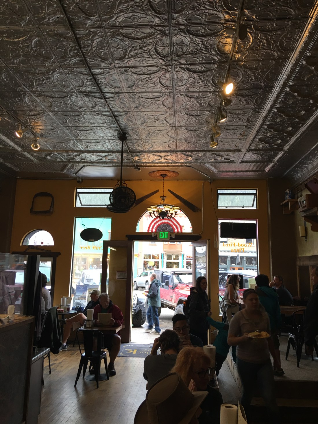
There are scores of restaurants and stores ready to serve these trains full of hungry and spendy customers so it pays to eat early or late to avoid the rush.
The San Juan County Historical Museum is an absolutely mind-blowing experience that documents Silverton history in a myriad of narratives that journey from Silverton’s earliest roots all the way to the present. Displays include mining history, rock and mineral collections and even the city jail.


Make no mistake, Silverton is essentially owned by the OHV/4-Wheel crowd. There are countless Jeep rental outfits in Silverton, Durango and Ouray plus a constant stream of visitors hauling their own toys. The local RV parks make extensive accommodations for these visitors and the town even bears extensive signage about OHV protocol on paved roads. Even so we never felt crowded out or loss of zen sharing this space with our OHV friends. There’s a lot of territory to explore so even when mountain biking encounters with motorized vehicles were far apart.
There are extensive hiking opportunities around Silverton including Ice Lake, Rico Silverton, Highland Mary Lake Trailhead and the Colorado Trail. I’m not much of a hiker but I suppose if you want to waste your time this way so be it (I kid, I kid).
The Mayflower Gold Mill is a self-guided tour that gives you unprecedented access to every level of the Mayflower Mill, which processed ores for many varieties of metals all the way up to the 1980’s. Since I’m a engineer this self-guided tour kept me entertained for hours. Documentation in the mill is extensive and a wide range of the equipment can still be turned on by museum goers.
The Old Hundred Mine is a genuine no-holds barred gold mine located a few miles north of town at the base of Galena Mountain. The extent and scale of this mine is hard to express until you’ve experienced it for yourself. The tour itself follows a fairly short civilized portion of the lower level that has been heavily stabilized and lit. These refinements in no way diminishes the tours effectiveness, however. Entrance to the mine is achieved using an actual rail car where you then disembark and walk with tour operators as they demonstrate period mining equipment, explain blasting strategies, do show and tells on sample ores obtained from the mine and carefully point out connecting shafts.
Outside the mine you can make your way east up Cunningham Gulch where you can look up to the top of Galena Mountain and see the Old Hundred bunkhouse and tramhouse pinned impossibly high in the savage geology. Using binoculars to really zoom in on these tiny structures the true scale of the Old Hundred begins to set in. I highly recommend the tour, though possibly not for anyone claustrophobic, scared of the dark or uncomfortable being splashed with casual spring water seepage from the surrounding rock.
Ah yes, my favorite topic – mountain biking. As much as we love Silverton, this town is geared entirely for the off-road enthusiast of the four-wheel variety. This means most of the mountain biking we’re found is along routes shared by Jeeps and RZRs, though not all of it.
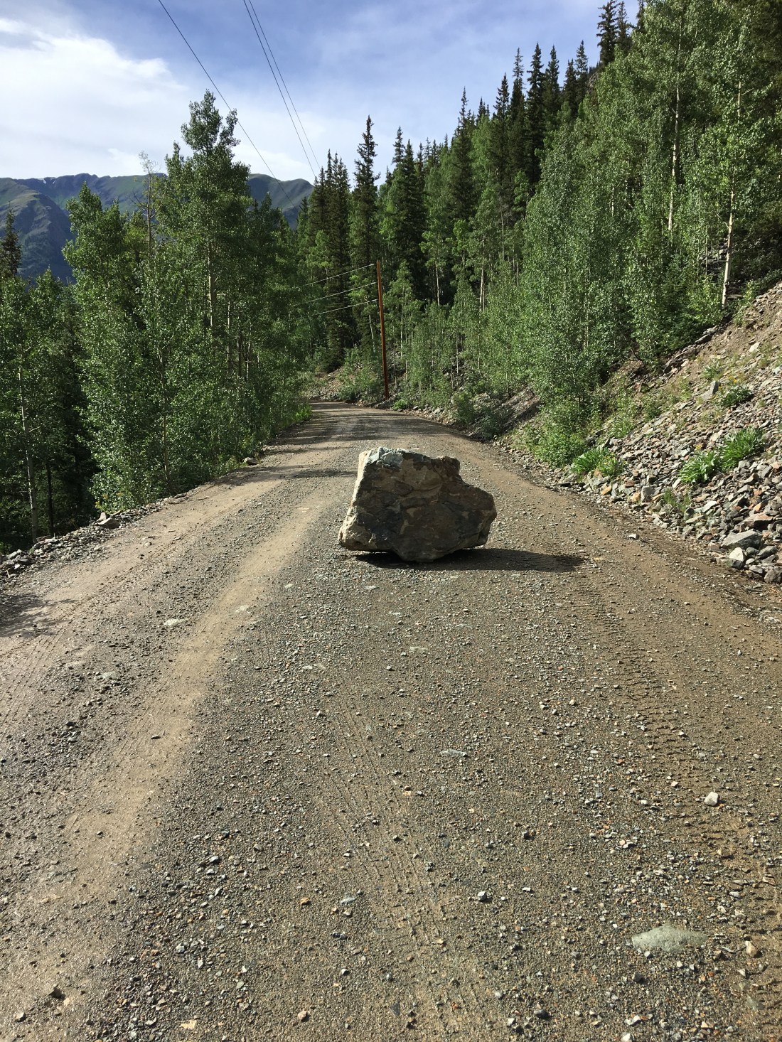
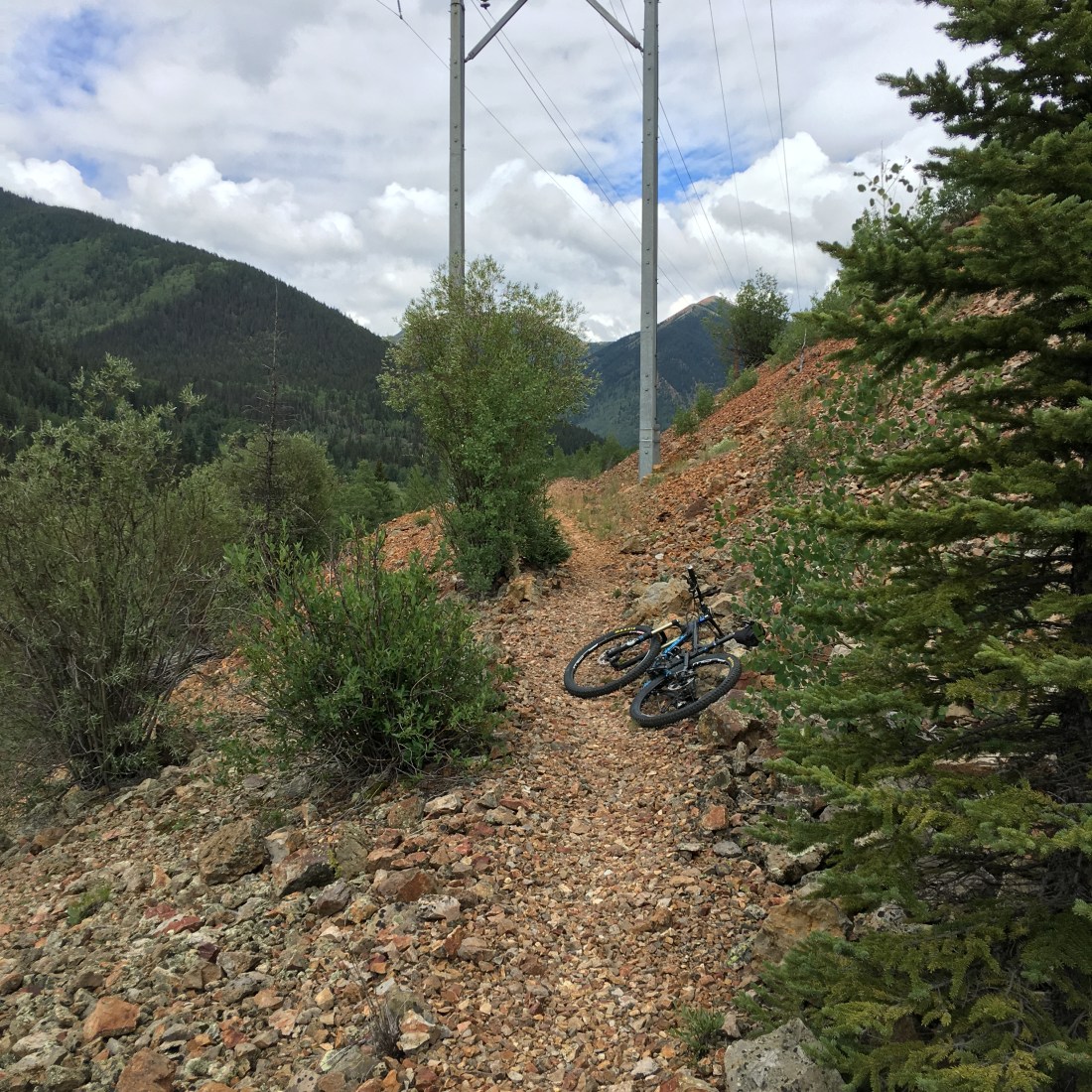
The Rainbow/Nute Chute Trail is one of the few dedicated mountain bike trails in Silverton. Following an old narrow gauge rail bed out of town this ride rarely exceeds 4% and provides stunning views. The east end of the trail scampers over some pretty sketchy terrain.

At the time of this writing part of the trail was entirely washed out on this iron rich scree slope but I found an alternate drop-in only a mile east of town on the 550.
Further west the trail is rather mystical, most of which is overhung by forest.

The Rico Silverton trail is located at the end of Forest Road 585 west of town. While technically open for mountain biking I found conditions on this trail to be muddy and rutted making for frequent dismounts and a lot of walking. The ride from South Mineral Campground to the trailhead is severe and also offers occasional dismounts on the incredibly steep terrain but I found it more enjoyable than the trail itself. I also recommend ample bug repellent as the horse flies can be atrocious.
Lime Creek Road, so named for the aspens that turn lime green in summer, makes for an easy-going ride through the San Juans. Averaging only 5% this is a forest road but it’s quiet and scenic. The drive from Silverton takes about 30 minutes and passes through the incredibly scenic Molas Pass.
Colorado Trail Segment 25 can be picked up by parking at the Little Molas Lake Campground. Climbs are moderate but I felt like they were double the grade due to the extreme altitude which tops out above timberline at 12,000′ (3657m). The scenery is epic – of course.
Cunningham gulch is located on County Road 4A a few miles north of town. You can ride to the ride or drive to the intersection of County Road 2 and County Road 4 and park there. The grade is somewhere in the neighborhood of 7% over several miles. This road is popular with OHV enthusiasts but not choked with them. The ride for practical purposes begins at the Old Hundred mine and stops at Highland Mary Lake Trailhead which is popular with hikers. Along the way you’ll see marmots, pikas, alpine flowers and wild raspberries is you’re late enough in the year.
Arrastra Gulch is closer to town, beginning essentially at the Mayflower Gold Mill and following County Road 52 west. The climb is short and intense as it follows an ancient tram system that was used to haul pay to the mill. There are many offshoots but I follow a northern OHV tail off of County Road 52 to an old mine near Little Giant Basin.

Maggie Gulch is located north of Cunningham Gulch on County Road 23. This short ride offers an extremely intense climb that is also shared by OHV enthusiasts. I only take the ride a couple miles to a right-hand branch in the road that terminates at an impressive waterfall.
Forest Road 585 begins just a mile or so east of town and offers access to a half-dozen campgrounds, OHV trails and several hikes. The road is rather busy but we found it too offered nice riding from South Mineral Campground to U.S. 550 and back again.
Scenic Drive is a gobsmacking ride immediately west of town that looks down on Silverton like it’s a toy model Swiss village. The ride is easy and I typically rode it two times over lunch to get in a good workout, but the real reason you ride here is the view. It literally escapes my ability to crystallize into words the views you can drink in here as you look down onto this town stuck in time. Steam engines puff away, entirely unimpressed with the fact that we’re well into the 21st century, tourists ebb and flow through the many shops and restaurants and San Juans look on in silence.
I’m not generally a pessimist but I feel like most of the RV channels and blogs I read don’t always own up to the realities of full-time camper living. Below are some of the issues we experienced.
Allow me to make this completely clear. The weather in Silverton is terrible.
If you choose to spend your time here be forewarned that it rains much of the time and temperatures often hover around freezing, even in summer. It pays to get your activities done as early as possible as rain and hail move in around noon. I found myself in a fairly intense situation at Ice Lake and wound up with early symptoms of hypothermia as I did not bring a thick enough rain jacket.
Since we’re in a deluxe Airstream and we live in the desert, rain for us is a treat so we deeply enjoy the experience.
I work in technology for a living as a software architect and I can say, unequivocally, technology sucks. In particular, allow me to vent my rage upon on my Buffalo RAID 5 1TB NAS. That piece of crap crashed last year and sucked down a decade’s worth of photos at and around Silverton.
I’ve thought for so many years how I could write a cool travel blog, share my experiences and my dazzling photography until one morning I awoke to found I’d lost it all – despite Buffalo’s claims that this NAS it would give you warning of a drive failure because RAID is a redundant solution. Not so much.
Though not directly related to Airstreaming, I personally recommend Microsoft OneDrive over on-premises storage solutions. This is a cloud storage product that costs $100/yr for 1TB or storage, you get 5 Office 365 licenses and it’s always backed up, always on and always safe. Plus you can also configure your Android and Apple devices to automatically upload your videos and photos, make albums and share stuff with your friends.
Alas, we will of course, make our way back to Silverton and enjoy its goodness as the sting of lost memories fade and new ones are made, but I will never forget that betrayal Buffalo visited upon me.
I have to reiterate one more time – Silverton is not for everyone. The weather can be terrible and temperatures cold. In exchange, however, you can explore a savage countryside barely tamed by the 21st century and lose yourself in a myriad of exploratory pursuits that will leave your head spinning. Silverton has the it factor in so many ways I can only hope this blog leaves slightly more than just a faint impression and explains to the world why this really is our favoritest place in the world!
Fred & Emily
Evening, Peeps.
A few weeks ago we released a survey asking our fine readers what Phoenix area trail they would like us to review next. Gold Canyon Lost Goldmine won so you wish was our command and we spent two, yes two weekends riding out there for you!
Please find our latest YouTube video here, and enjoy! Oh, and psst.. watch all the way past the credits at the end for a little Easter egg.
That is all.
