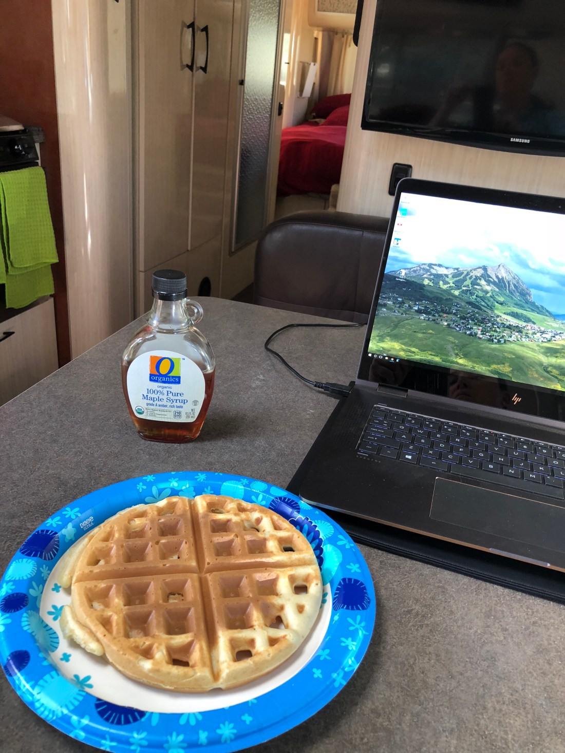
It’s 4th of July weekend and time to Airstream again! For the next few days we’re up here at Prescott’s White Spar Campground. We already did an extensive review of this area here, so instead we’re using this time to blog about what’s new – in this case, more mountain biking!
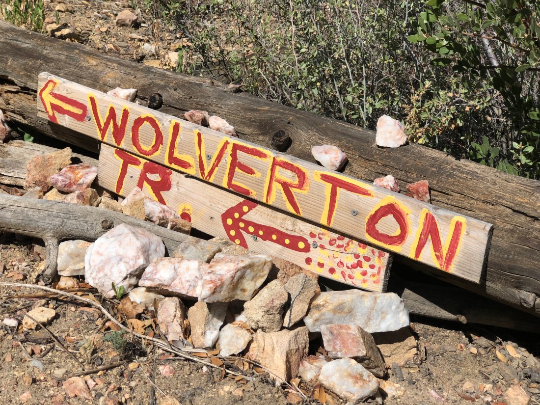
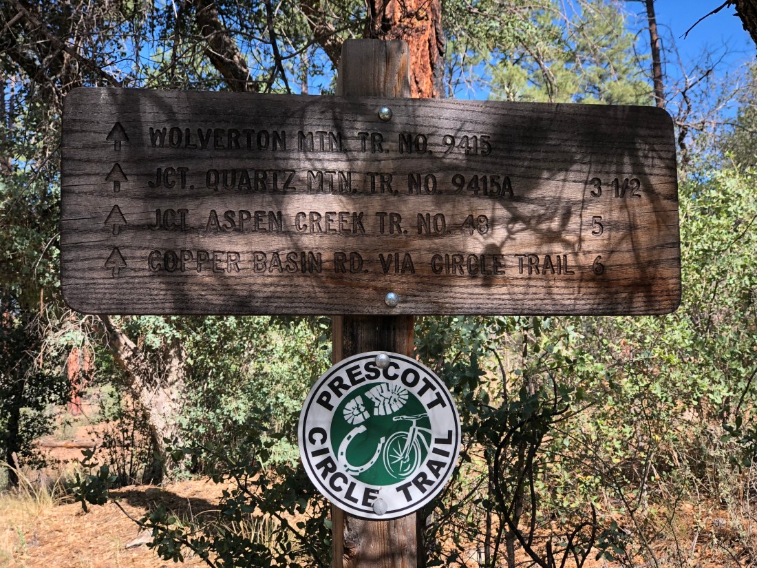
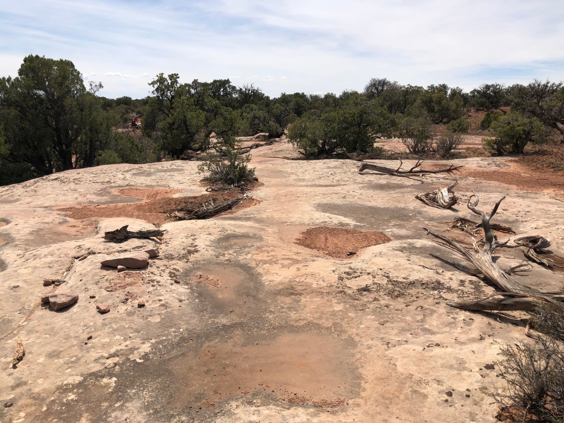
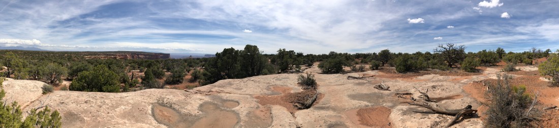
The Wolverton Mountain Trail is rated as a blue-black and after comparing notes on the ride we agree with this rating.
This 10-mile (16km) out-and-back begins across from the campground and immediately slaps you in the face with aggressive sustained climbing that meanders anywhere between 5% and 10%.
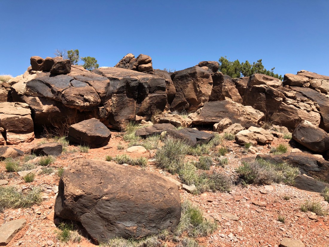
I think the trail might be better named “Touched by Fire”, though. The climb takes you through dense scrub and evidence of a terrible forest fire sometime in the past.
One thing that caught us off guard climbing here was the exposure – there is so little foliage, and so much dead-fall, the temperatures already hit low 90s (33C) by 9AM.
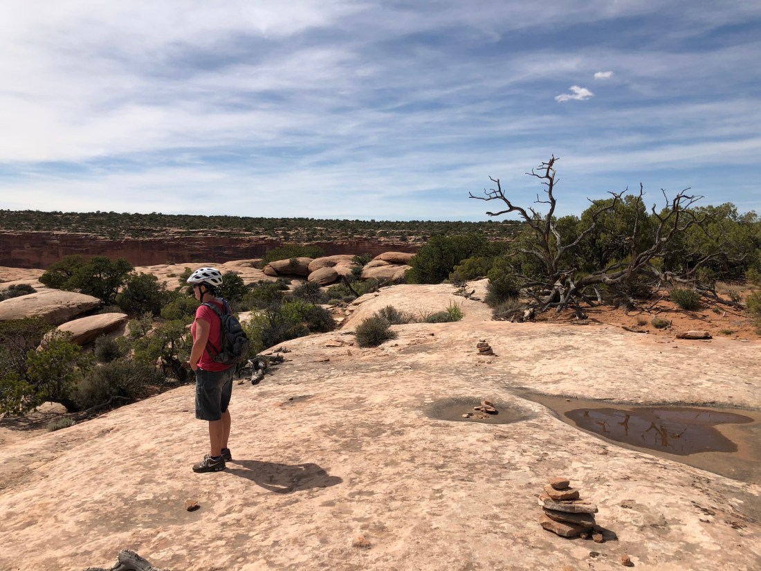
By the end of the ride we’d both worked our way through most of our water.
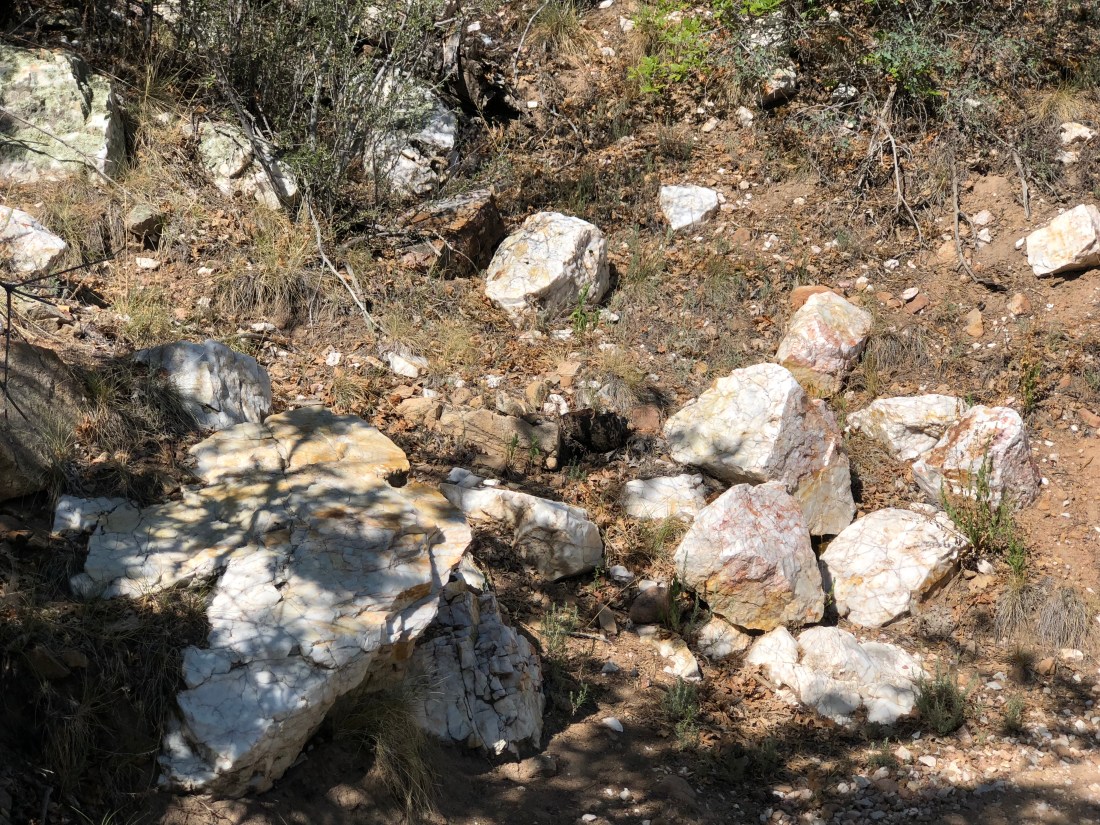
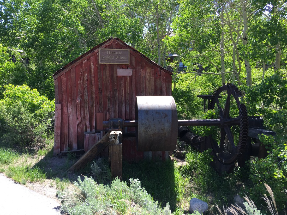
The climb consists of moderately technical surface though much of the trail is steep off-camber single-track and crushed rock like this. It never occurred to me why the campground was named “White Spar” but it turns out the term “spar” refers to any bright crystalline substance.
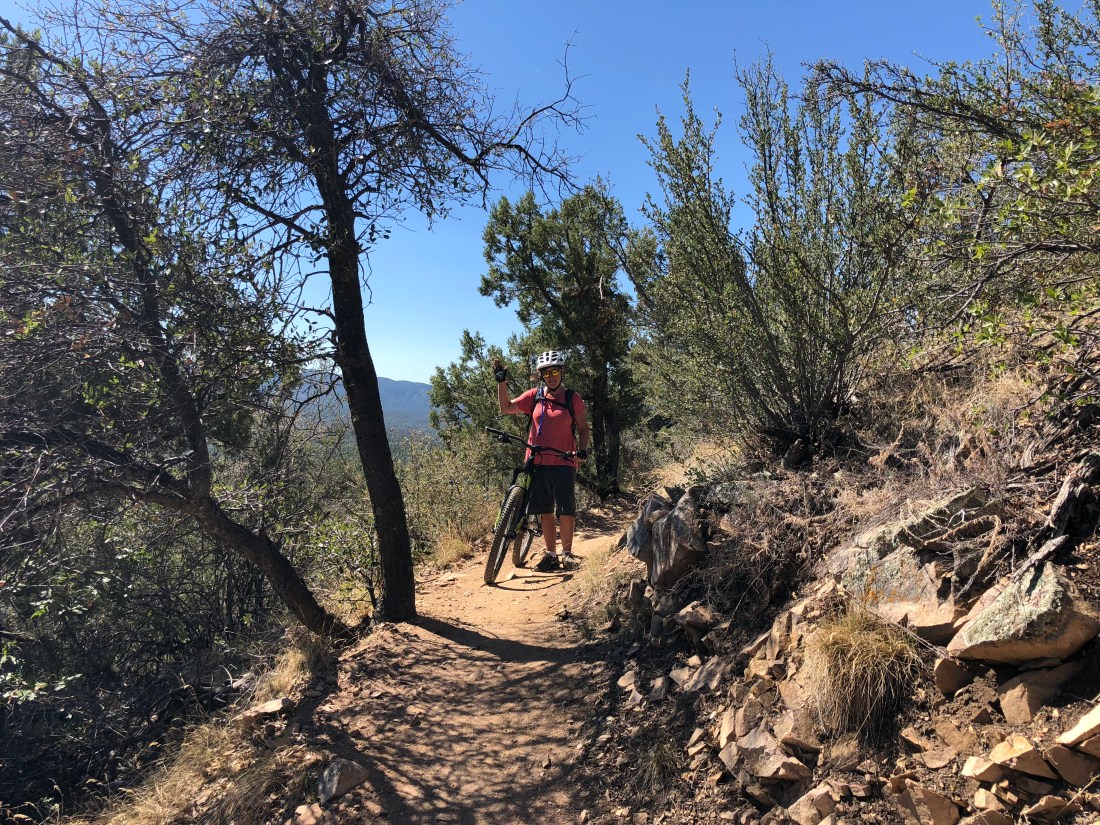
We only made it 4mi (6.4km) in before turning back, the altitude and heat was getting to us.
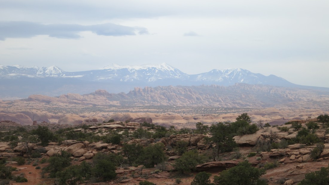
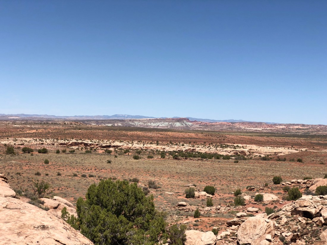
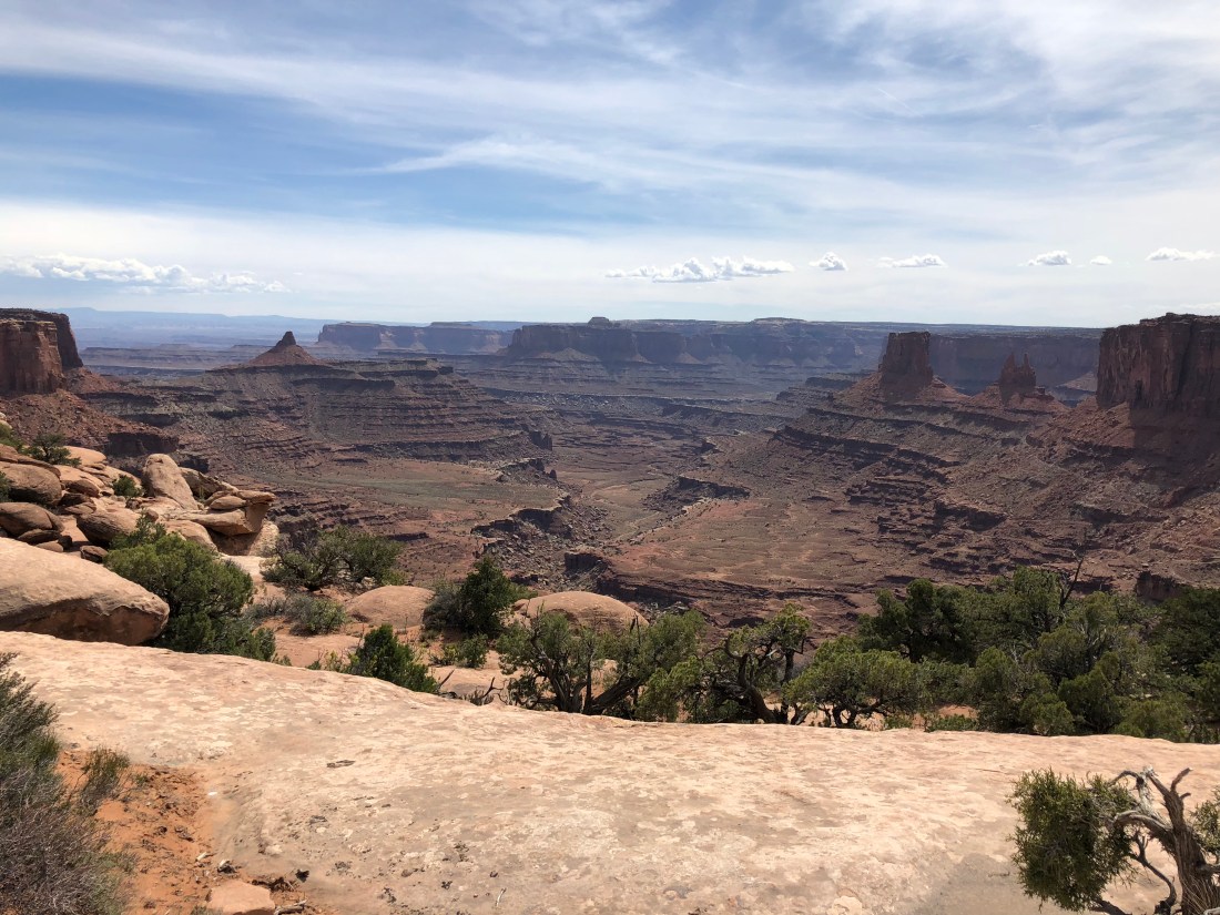
On the descent you are greeted with an extraordinary view; San Francisco Peaks visible in the distance.
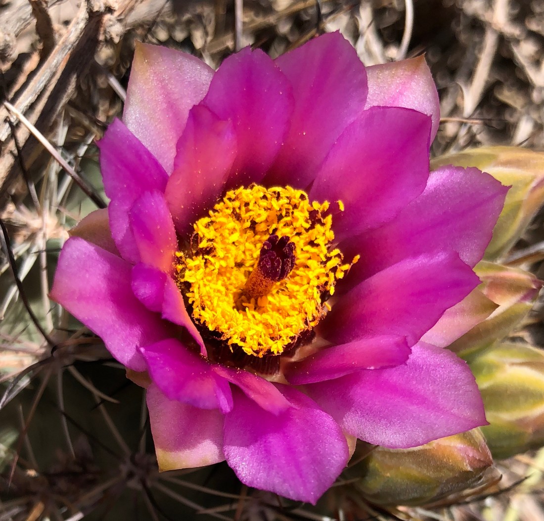
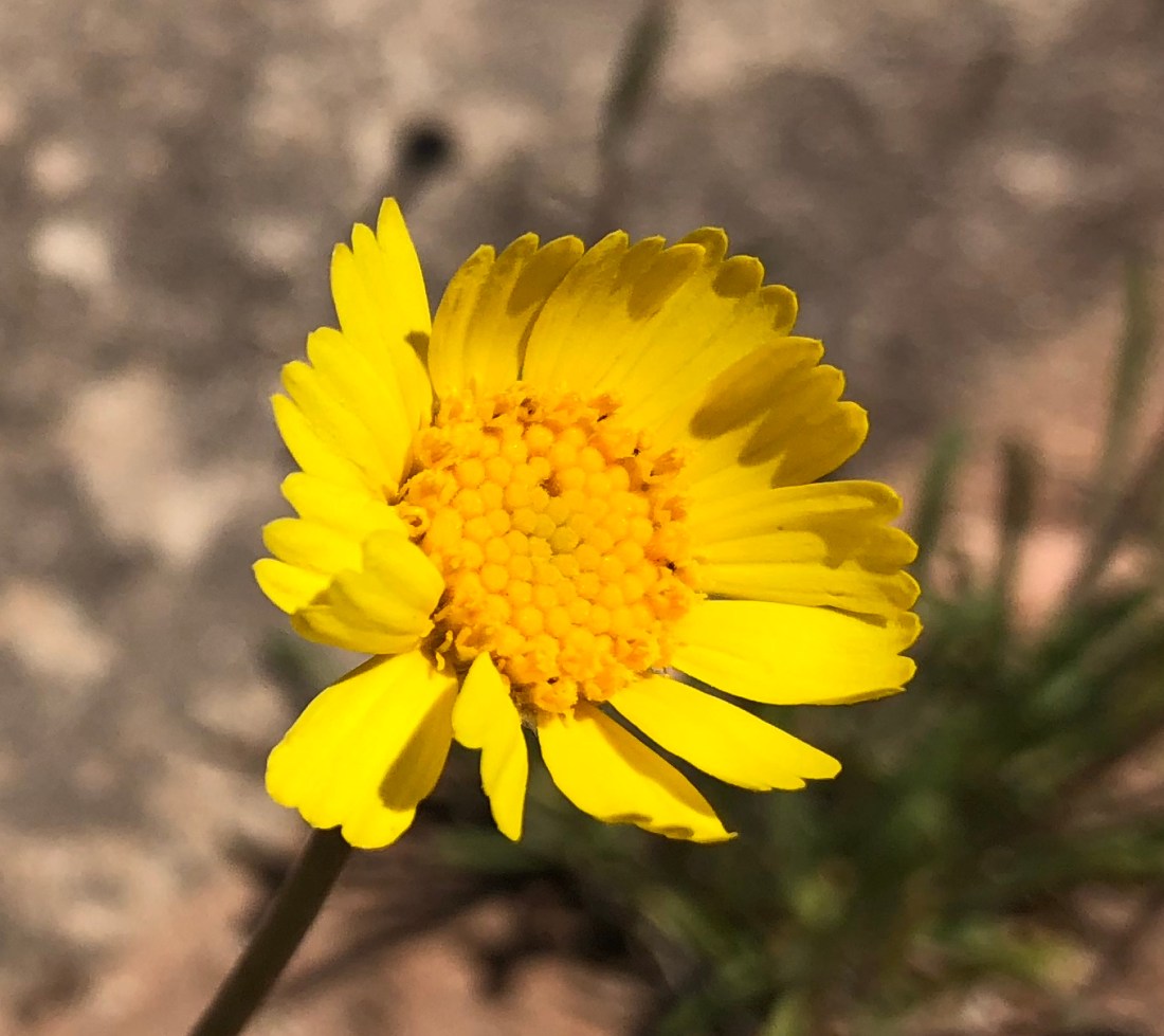
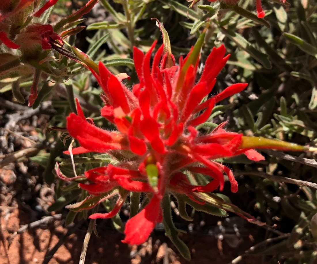
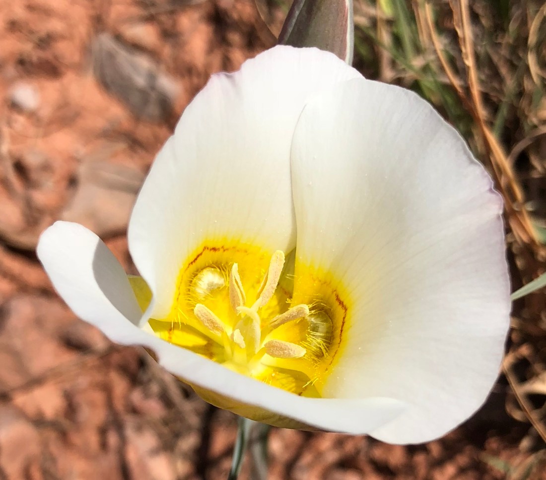
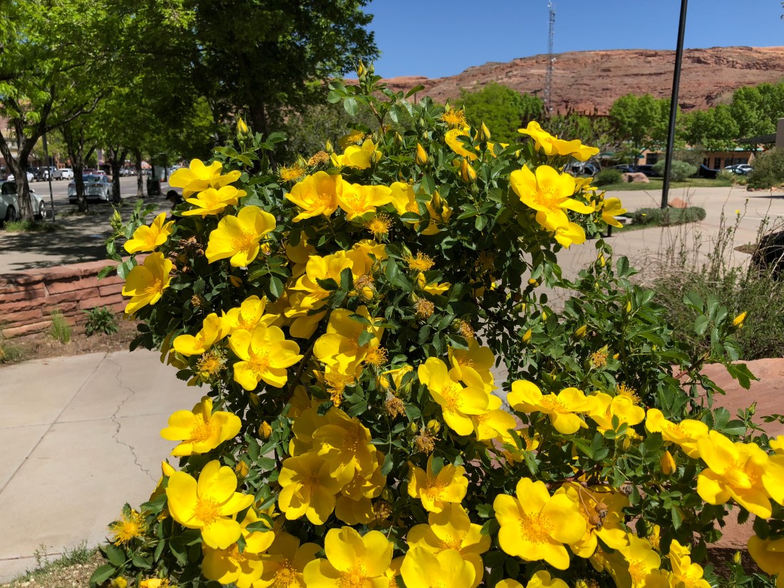
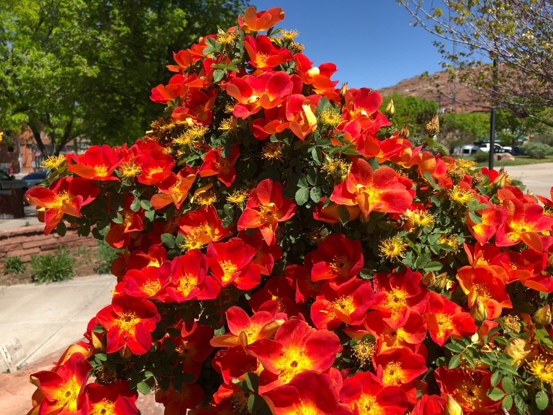
Also we took some time to smell the flowers.
And… enormous private telescopes?
Conclusion
We’ll absolutely ride Wolverton Mountain Trail again, probably on Tuesday. By then we should be adjusted to the altitude and we’ll head out a little earlier. Seen you soon with more Airstream updates!
Please join us for our 8th YouTube episode, E1.8 Night Riding with NiteRider Pro Series Lights. In this video we review a range of NiteRider lights as we make a circuit around McDowell Mountain Regional Park in the first of 2018’s summer Night Ride Series.
As always please subscribe to our YouTube channel if you like our adventures, we want to bring you more!
Please join us in celebration as we release our 7th YouTube episode, E1.7 Summer Rides – Pemberton. In this episode we discuss summer riding and take you on an extensive tour of the Pemberton Loop at McDowell Mountain Regional Park.
Please subscribe to our YouTube channel if you like our adventures, we want to bring you more! We’ve listened to your comments, boosted our audio and offered better maps!
In the late Spring of 2017 I was beginning to hear signals from my employer they would want all remote workers back in the office. We made a trip from Colorado down to Arizona so I could take a meeting and at the end of that fateful day we found ourselves with a sad decision to make. The die was cast – we would only have a few months left of precious freedom before going back to cube-land. Full timing was near its end.
So how best to spend the time?
California of course! We’d always meant to go there, it was close, and full of our favorite thing – mountains. While we were in town we driveway surfed at Fred’s house. That evening drinking beer and sitting by the pool Fred said, “Why not Mammoth Lakes?” We’d never heard of it. A quick trip to the Google revealed an alpine village chocked full of mountain biking and skiing. The destination was set!
Booking
For our stay in Mammoth Lakes we decided on New Shady Rest Campground. For reasons we don’t entirely understand, this campground seems to be first come first served for most of the summer. We arrived at the beginning of June so the sites had just opened up and we got a sweet spot at site #93. Later in the year, reservations can be made at the federal portal here.
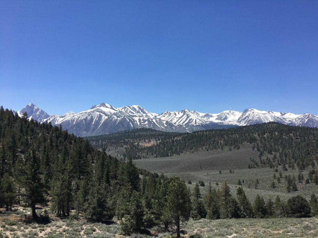
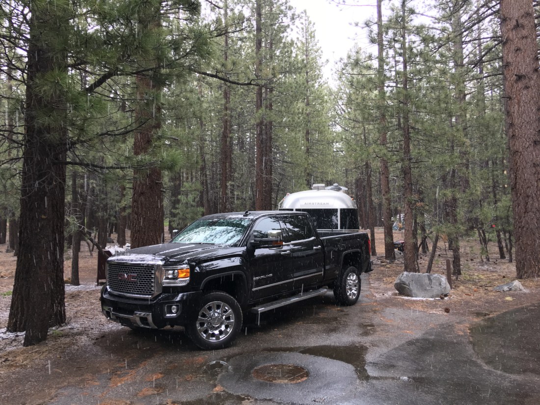
Like any mountain destination that early in the year, Mammoth Lakes was beautiful one moment.
And brutal the next. That is snow.
By any measure this is an enormous campground, and that doesn’t even include Old Shady Rest Campground across the street. Sites are somewhat narrow but heavily forested and well groomed. All pads and roads are well maintained pavement, though the roads are nerve-wrackingly tight and we witnessed more than one 5th wheel scraping the trees. Traffic was moderate and noise was middling. Oddly we found campfire smoke from surrounding sites to be especially bad here, but we did stay on the east end – maybe prevailing winds take the smoke there.
Water is available in a number of locations along with an RV fill-up and dump station at the entrance to the campground. Bathroom facilities were old but well maintained and clean. While we were staying there the dump station was temporarily closed but a self-service station is available at the Mammoth Lakes Community Water District just down the street.
On the reservation front, I can only speculate, but I wonder if the no-reservation policy is to keep booking fair, since Mammoth Lakes is essentially between the two megalopolises of Los Angeles and San Francisco. Whatever the case, it worked to our advantage and we had a glorious two weeks there.
Choose Your Path Wisely
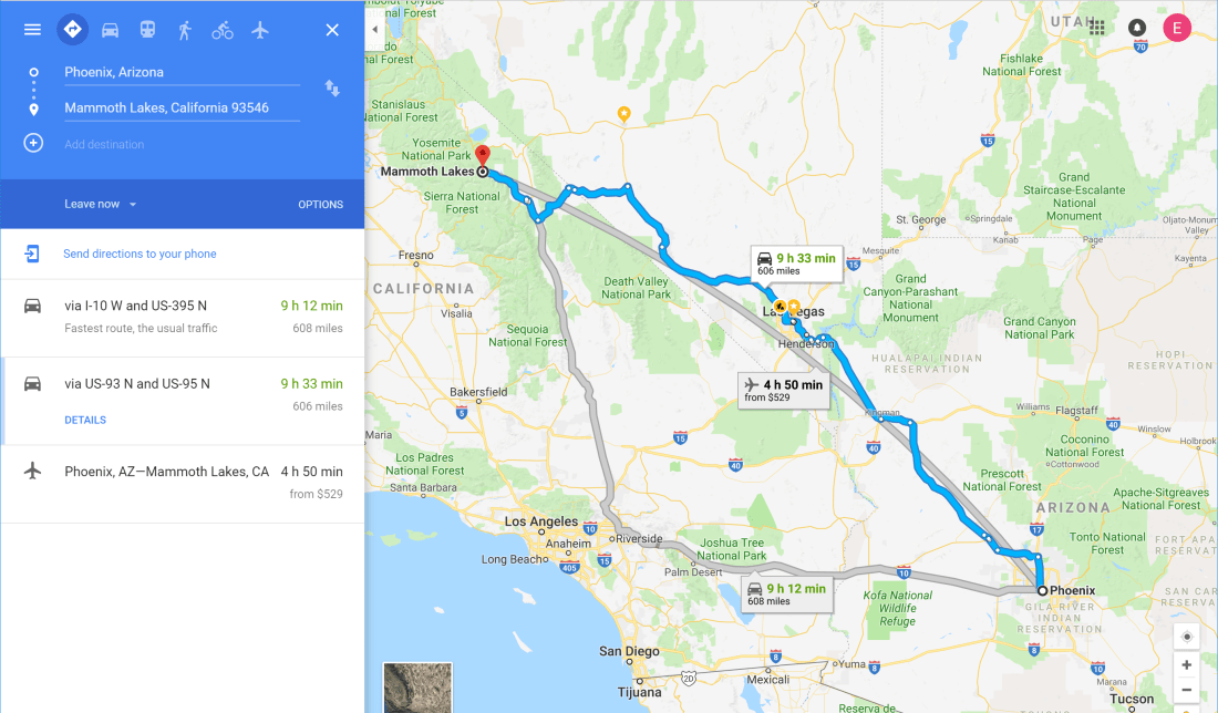
In all our time towing the trailer, I think we’ve really only had two genuine misfires. One time was getting ourselves stuck in a rural road in Moab, and the other was my fateful decision to follow the “scenic” route from Phoenix to Mammoth Lakes.
Little did I know that CA 168 was a curled up intestine of death worthy of only the most hardened RVers. I found out, of course, when we crossed from Nevada into California and I started to see signs like, “Vehicles over 30′ not recommended”. By then we were committed so we soldiered on.
Though obviously we lived, that drive was some of the most intense mountain driving I have ever done with the Airstream, even more intense than the Rocky Mountains. The road alternately shrank to one lane and offered up sharp corners and steep inclines. Thank god it was little traveled so I had plenty of room to maneuver. If I had to do it again, though, I would take the Los Angeles route, trading near death cliff-diving for horrible traffic.
Amenities & Activities
City of Mammoth Lakes
The City of Mammoth Lakes is a remarkable little Ski/Mountain Bike town characterized, for me, by the extremes. On our drive to Mammoth Lakes we drove through Bishop and it was 110° F (43° C) and entirely given over the cactus and desert.
In 20 minutes we were in pine trees and aspen groves at 72° F (22° C).
That June had also capped off a record setting snow season. So much so, Mammoth mountain was entirely off limits to bikes because of this stuff.
Incredibly, just a short way down the mountain the snow was gone and trails were open. This water was of course, going somewhere – look at this intense whitewater we saw when we left Mammoth Lakes.
Eats
Mammoth Lakes is a tourist town but it seems to get rather sleepy in the summer months. Still there are plenty of restaurants and shops waiting for customers. We found good pizza at Giovanni’s Pizza, even better at John’s Pizza Works and good coffee at the Looney Bean.
Shopping
Footloose Sports near the campground offered a very good selection of mountain biking gear and rental bikes. Directly next door you can find Rite Aid for your apothecary needs and a DIY Home Center for your hardware needs (ahem, rivets).
Laundry facilities were found at the Mammoth Lakes Laundromat and excellent grocery shopping at Vons. Keep in mind by California law you must buy plastic bags so it pays to get some reusable ones.
Fun Facts
Curiously Mammoth Lakes forms part of the Los Angeles water shed. I find that amazing because LA is hundreds of miles away. But anyone who’s lived out west knows Whisky’s for ‘Drinkin and Water’s for ‘Fightin.
Mountain Biking
Ah yes, mountain biking – my favorite topic. Owing to the strange snow season Mammoth Mountain and the surrounding trails were closed. Still we found plenty of options that made for a thoroughly rewarding set of rides.
Big Smokey Loop
The Big Smokey Loop is a 15 minute drive east of town and slightly lower elevation than Mammoth Lakes. We discovered one constants about riding the Sierra Nevadas is sand, lots of it. We struggled through unending piles of the stuff on this ride, which taught me a 29+ might be the better way to go next time (see Fred’s review of the Trek Stache 5).
The trail is all fire roads and is rated at blue-green. I would normally consider this is green ride but the loose sand, squirrely climbs and steep descent near the end pushed it into blue territory.
In retrospect it was an interesting ride but I would likely stick to the Knolls Loop area and explore more there next time. It was hardly a waste though, the view of the distant Ansel Adams Wilderness et al was second to none.
Mammoth Creek Trail
Mammoth Lakes has a splendid bike path circling the entire town and Mammoth Creek Trail forms the southern leg. The ride in total alternates from trail to bike path to streets and offers a great tour of the city. Though rated green I found the climbs totally satisfying as the altitude does make pedaling a little harder. It’s also fun to see how the other half lives as you climb through some exclusive neighborhoods and ski resorts.
Knolls Loop
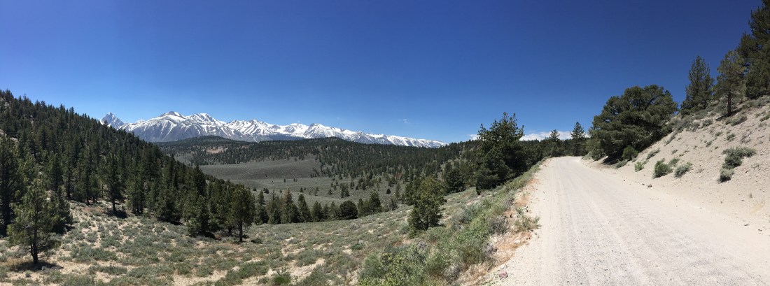
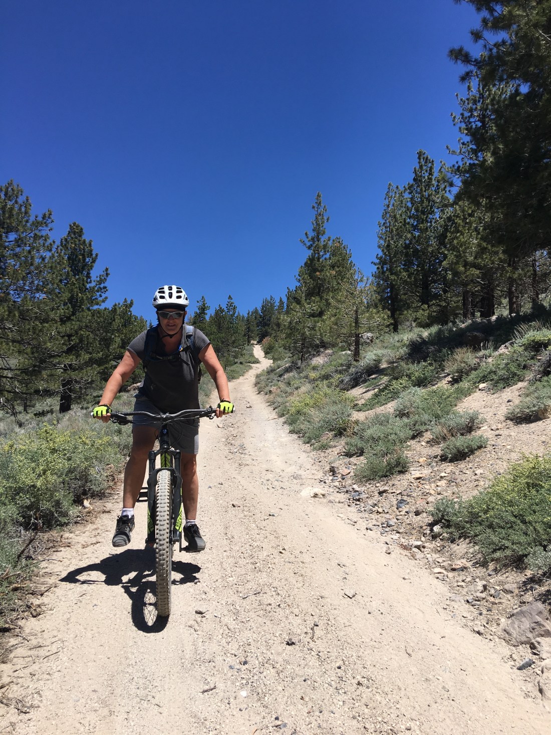
Knolls Loop was our go-to trail while staying in Mammoth Lakes and we rode it easily a half dozen times. The trailhead is found just outside of camp and takes you on a 10 mile (16km) tour of the Inyo National Forest.
As with Big Smokey Loop the trail consists mainly of forest road and lots and lots of sand. When takes clockwise, however, we found most of the sand to be on the downhill sections making a ride on standard 29ers thoroughly enjoyable.
The eastern portion of the ride is somewhat of a lung-buster but rewards the intrepid rider with awesome views.
The roads back in this area are incredibly complex and it pays to take a mapping application such as MTB Project or a printed map. There’s also a serviceable map of this hairball here.
What Could Go Wrong
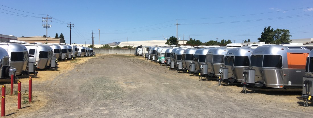
Strangely we discovered our satellite dish died at the beginning of the Mammoth Lakes stay. We talked it over and decided we did want it fixed before our return to Phoenix in three months so we called ahead to Bay Area Airstream Adventures. This led to an unplanned week-long stay in Vacaville and a couple trips to the dealer to get things sorted out.
Bay Area Airstream Adventures
Even though I was annoyed at being blown off course, this was pretty cool. Have you ever seen so many Airstreams?
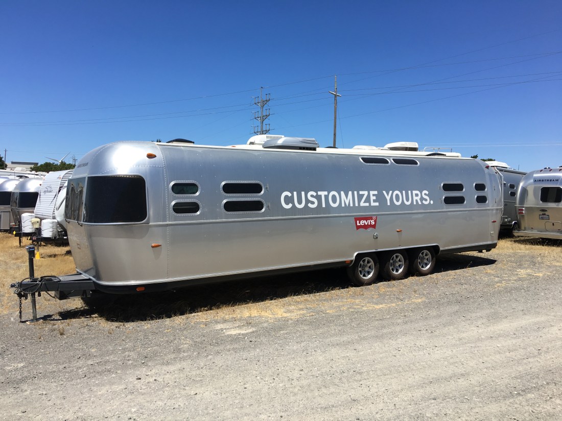
Also I think I saw the second Airstream love of my life there.
I’ve always thought it would be awesome to get a 35′ Airstream and refurbish it. They’re relatively uncommon though. Speaking to one salesman I learned the long frames have a tendency to crack and the triple axles make them hard to park. The models with slides also had uneven tire wear due to the odd weight distribution.
Besides all that just look at it – gorgeous!
Also a quick shout out – these guys were so nice and accommodating. We waited in the lounge with our dogs all day and they kept checking on us and making sure we were ok. Very cool customer service.
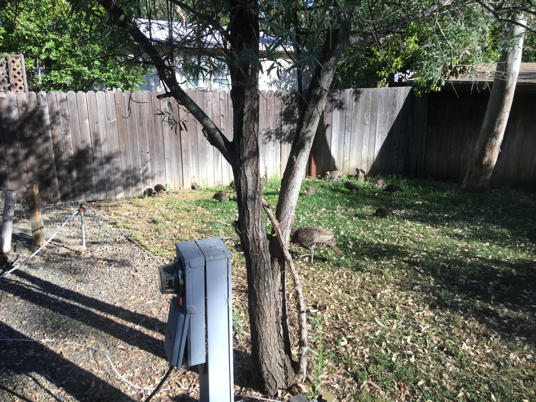
Vineyard RV Park
While alternating between taking the Airstream in for repairs and waiting for parts we stayed at the Vineyard RV Park. In all ways this was a great park with friendly people, good staff, excellent sites and a nice pool.
Also, we met Nola the pig there!
Another kick about staying there was the wild turkeys and their babies.
We even made it into San Francisco for a day.
Alas the Airstream was eventually fixed and we went on our way to the Redwoods, but that’s a story for another blog.
Parting Thoughts
Mammoth Lakes was awesome. We’re even mulling going back there this September – we’ll see if the winds of change allow that to happen. But we thoroughly enjoyed the people, the campground and the riding. Mammoth Lakes definitely has “it” and we highly recommend it.
As for the satellite repairs – in retrospect, our temporary path through Sacramento/Vacaville was a hoot. We enjoyed the hell out of our stay and we got to meet Nola! So I guess it played out in the end.
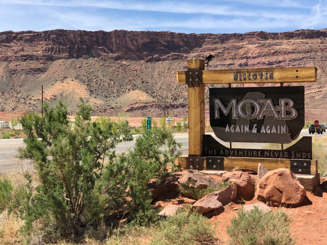
My heart is heavy as we are now back in Phoenix….and therefore, not Moab. As I work my way back into my professional life, it occurs to me there are a few additional thoughts to share about Moab from previous trips, so enjoy some random musings.
What’s In a Name
I find it totally fitting that even the name Moab is somewhat mysterious. For me the Paiute origin story, referring to the word moapa, meaning “mosquito”, has the most resonance. Still if Moab was instead named Vina or Uvadalia I suspect it would have exactly the same energy and feel.
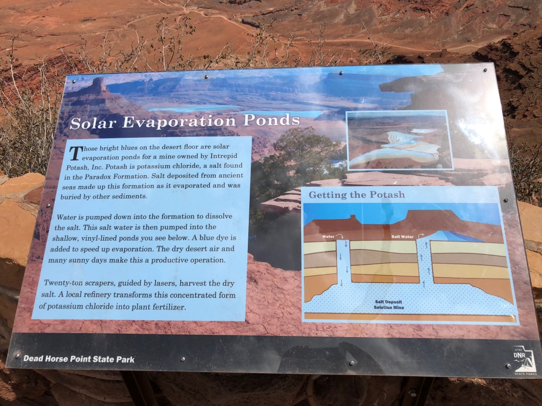
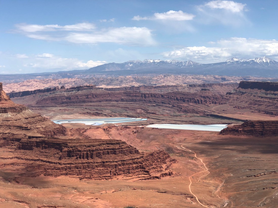
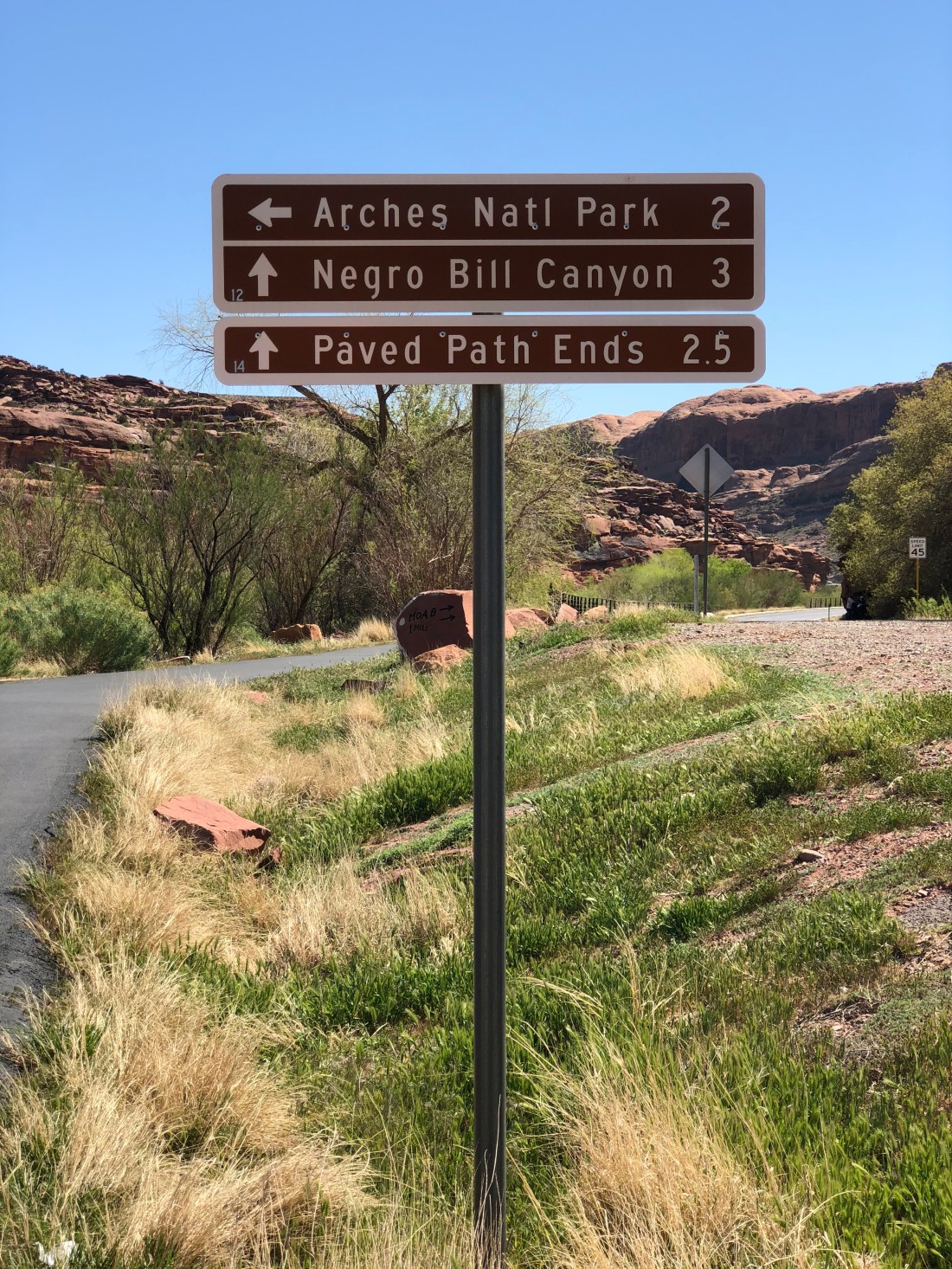
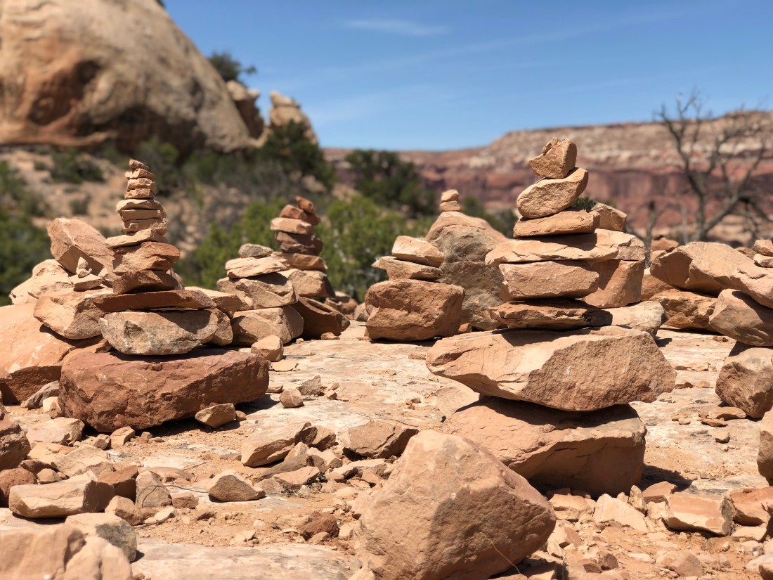
But keep in mind – all of Moab and surrounding area is amazing. Do you really need to pay for it, when everything is amazing? For example, drive up Utah 128 from Moab to Interstate 70 along the Colorado River, it’ll blow your mind. Or, Utah 313 to Dead Horse Point. I happen to find the drive through Canyonlands more rewarding, and the view at the point equal to the task (though yes you do have to pay for that too). Or for free you can ride the Zephyr trail (mentioned later) that crosses into the north end of the park.
Still, we stayed in Arches one time (see the featured image) because, well, everyone said it was the thing to do. The park has essentially one road that you can drive for an out-and-back, at the low low fee of $25, or, you can pay the low-low fee of $25, drag your trailer all the way to the end of the 28mi (45km) road and maybe get a camping spot.
A year ago we made a point to get to the park early and found the front gate can’t (or won’t) tell you whether the campground is full, so we paid the stupid fee and drove the 28mi (45km) and we discovered that almost no sites fit the Airstream, and ones that did were occupied. You can’t mountain bike the park, you can’t take your dogs out anywhere except on the streets & campground and cell coverage is terrible.
Despite these setbacks the campground host took pity on us and offered us a one-night stay in the host’s spot because they were staying in the ranger’s cabin. For this we are profoundly grateful, but my take on Arches National Park is that the park is pretty cool but the fee is outrageous for what you get.
Mountain Biking Pipe Dream
Pipe Dream is a blue/black trail that runs directly along the western edge of town. I found this trail more black than blue so I never got any zen here owing to the habitual dabbing and dismounts. I can still see it being a handy go-to trail if you lived in Moab as an excellent “work on your skills” destination.
Mountain Biking Zephyr
Zephyr is considered more of a connector than a destination trail, but nevertheless we rode it once to see what’s there.
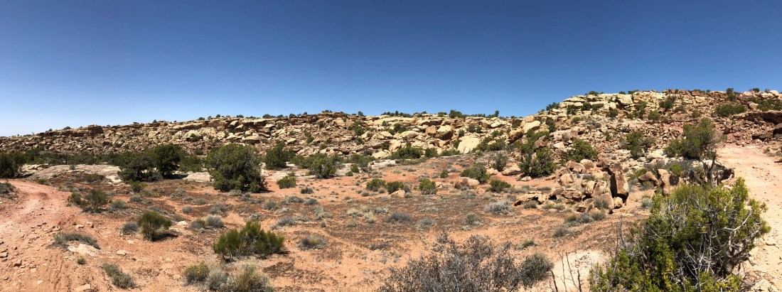
The oddity about this trail is is crosses briefly into Arches National Park for free, and it offers some truly heart-stopping landscapes such as these. Though this looks like an undulating landscape of routine slickrock, look closer and you’ll notice the beginnings of a verdant canyon filled with water, green trees and birds. Though the trail itself was, for me, entirely forgettable the “Planet of the Apes” like scenery absolutely made it worthwhile.
La Sal Mountain Range
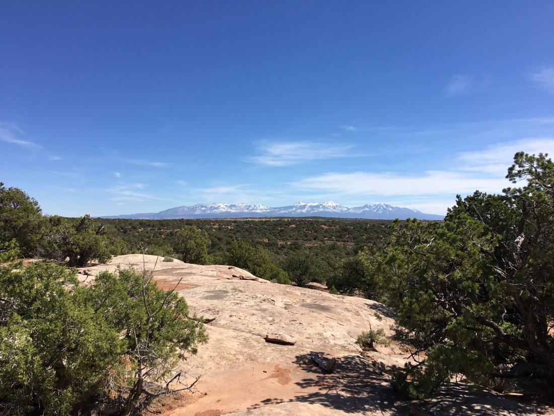
The La Sal mountains just blow my mind. I just can’t get over the juxtaposition of looking up at the mountains and seeing snow when it’s 100° F (38° C) in the canyons.
Also I don’t know why this amazes me, by the La Sals are considered part of the Rocky Mountains and a source of Uranium.
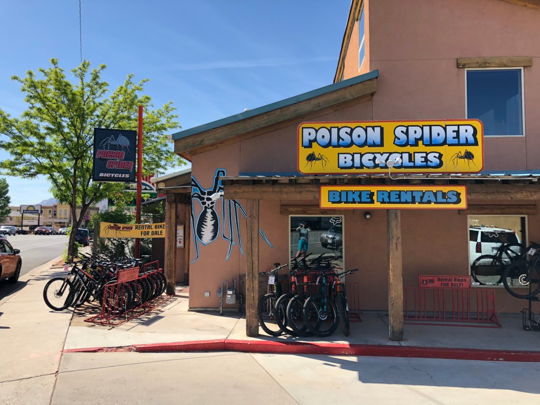
Fred and I rode The Whole Enchilada a couple years ago, which starts high up in a snowy aspen grove and bottoms out on the Colorado river. We caught a shuttle from the previously mentioned Poison Spider Bicycles, but honestly, the shuttle should go two hours earlier – it was hot as hell and I wound up with early signs of heat stroke at the end of the ride.
Overall we both found the ride a little too extreme for our sensibilities, and agreed that the Porcupine Rim portion of the ride was the most enjoyable and least deathy. The final segment down to the river, though, was way more than either of us would do again.
Still, it is pretty amazing to start a ride in snow and wind up over 100°!
Eats
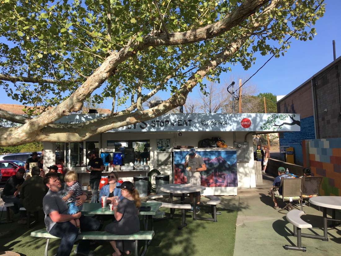
I forgot to mention Milt’s Stop N’ Eat in our previous blogs. Milt’s is a kitschy actual 50’s era diner located on Moab’s former main drag. They serve exactly the right food for after mountain biking including delicious burgers and yummy salty fries. We highly recommend the experience, though sadly they’re closed Mondays.
Conclusion
But Emily, you didn’t mention the most Moab of all Moab mountain bike trails, Slickrock!
I’d have some pictures for you if my crappy Buffalo NAS hadn’t taken them to the briny deep, but I’ll commit heresy here: We didn’t like Slickrock.
Stone ● Cold ● Silence
Here’s why – the trail is blue/black. Fred and I tried Slickrock a few years ago really before we should have. Specifically, Slickrock is steep – like 100% grade steep. That requires massive fitness, and we found we just didn’t have it at the time. And fitness is important when you’re pumping your way up this massive incline with your eyeballs exploding out your face and there’s just no place to bail. If you stop your’re sliding to god knows where.
Someday we’ll do it again, especially now that we have the fitness and the skills. But I still remember it, and I suspect I’ll like Klondike Bluffs better (gasp). We’ll see!
And that, my friends, is what Moab is all about. There’s always more to come back for and great stories to tell (someday ask me about Magnificent 7 and almost dying in a Uranium tornado).
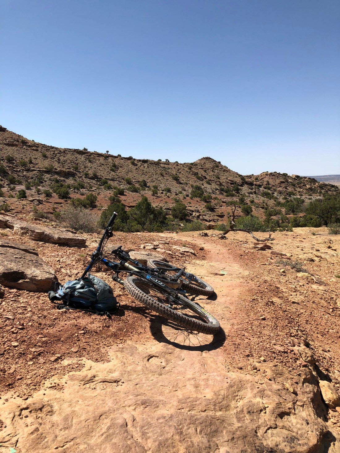
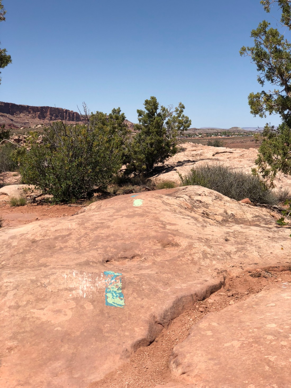
Yesterday was an early start with but one objective – mountain bike Klondike Bluffs. Even though temperatures this time of year hover in the 50’s (10C) in the morning and low 80’s (27C) in the afternoon something about slickrock reflects a lot of sunlight making it seem much hotter than it is. We wanted to eliminate any chance of dehydration and/or heat stroke since I’ve gotten myself into trouble here in the past.
Mountain Biking Klondike Bluffs
Reaching Klondike Bluffs in the AM we set off.
Klodike Bluffs is so named because of these.
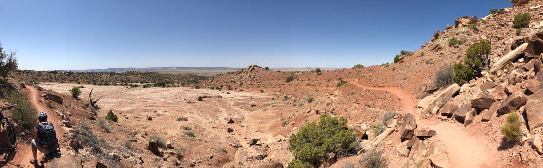
The trail system is a brilliant arrangement of easy to hard trails where you can make your own adventure across amazing terrain. Crudely speaking the bluffs is a large rectangle with the long sides running north to south. The rectangle is bisected by multiple east/west downhill runs rated in the blue/black category.
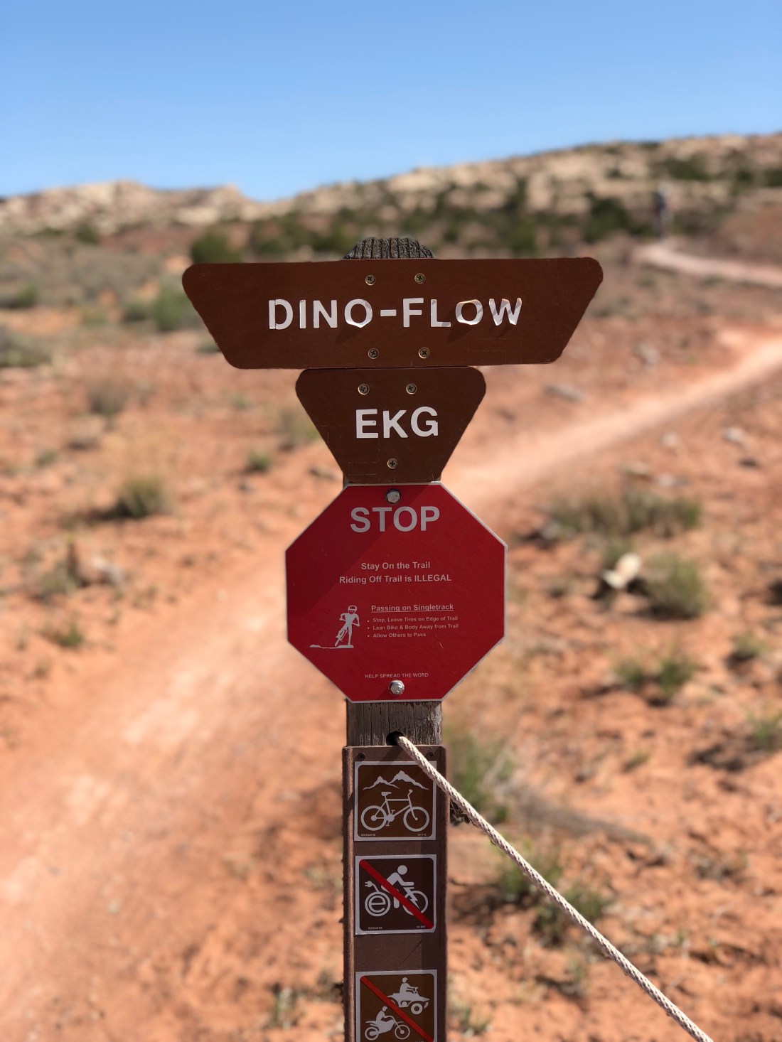
Dino Flow is a nice green/blue trail where you can get get warmed up.
The trail flirts with portions of slickrock but also follows plenty of hardpack and has a half-dozen features that make you work your skills so you can never quite get complacent.
Dino Flow is also undulated which gets your heart rate at just about the right level before diving into Mega Steps.
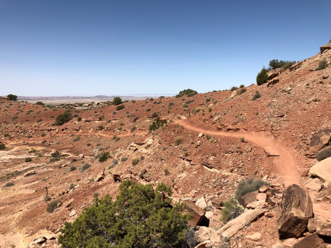
Mega Steps
Mega Steps is one of several blue/black trails that run east to west forming dramatic downhills (or climbs), depending on your direction of travel.
We find the Mega Steps climb to be lung-busting but the least lung-busting of all the options out there.
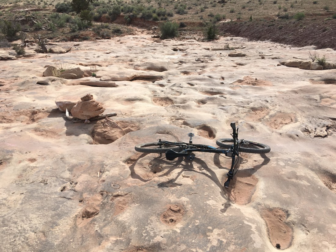
In Moab parlance a “step” is a natural slickrock feature resembling human steps. Mega Steps, as shown in the featured image, look like steps more suited to Godzilla. Personally I feel like climbing Mega Steps is what the bottom of an empty swimming pool would be like like to an ant.
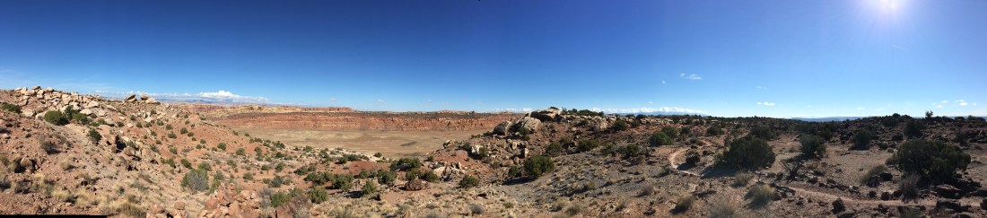
At the top of the steps we took a breather.
Klondike Bluff Outer Loop
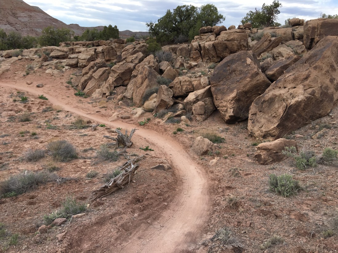
Mega Steps joins into the Klondike Bluff Outer loop before splitting onto Little Salty.
This is a blue connector that at times shares a 4×4 trail. Yes this is a jeep trail.
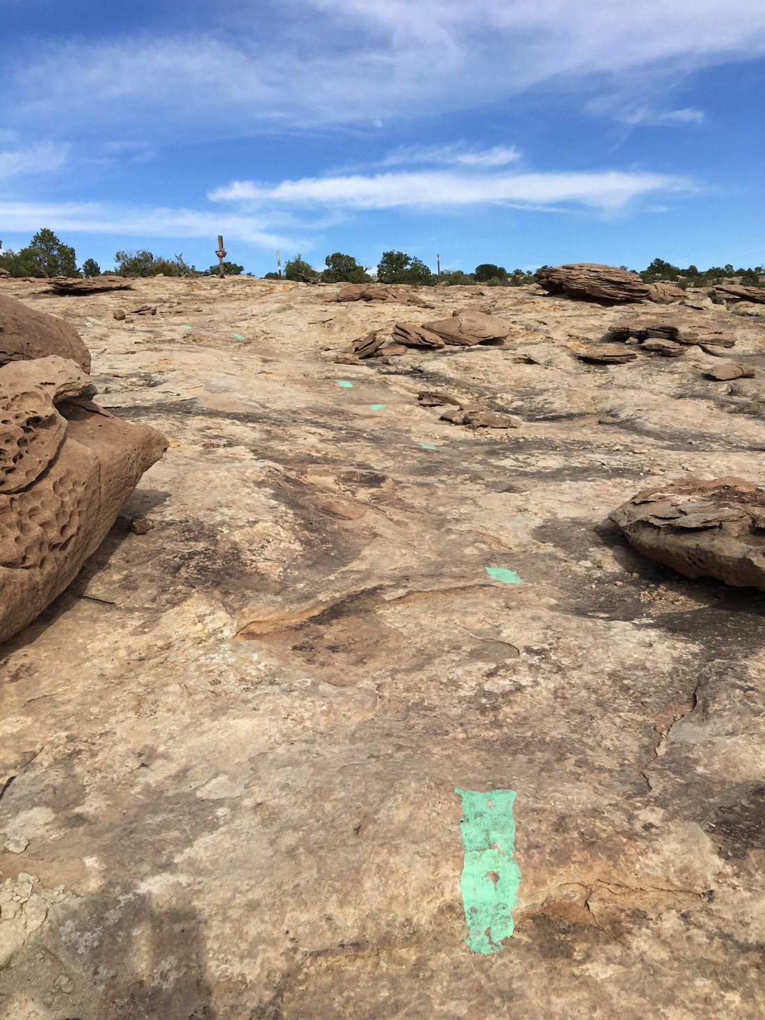
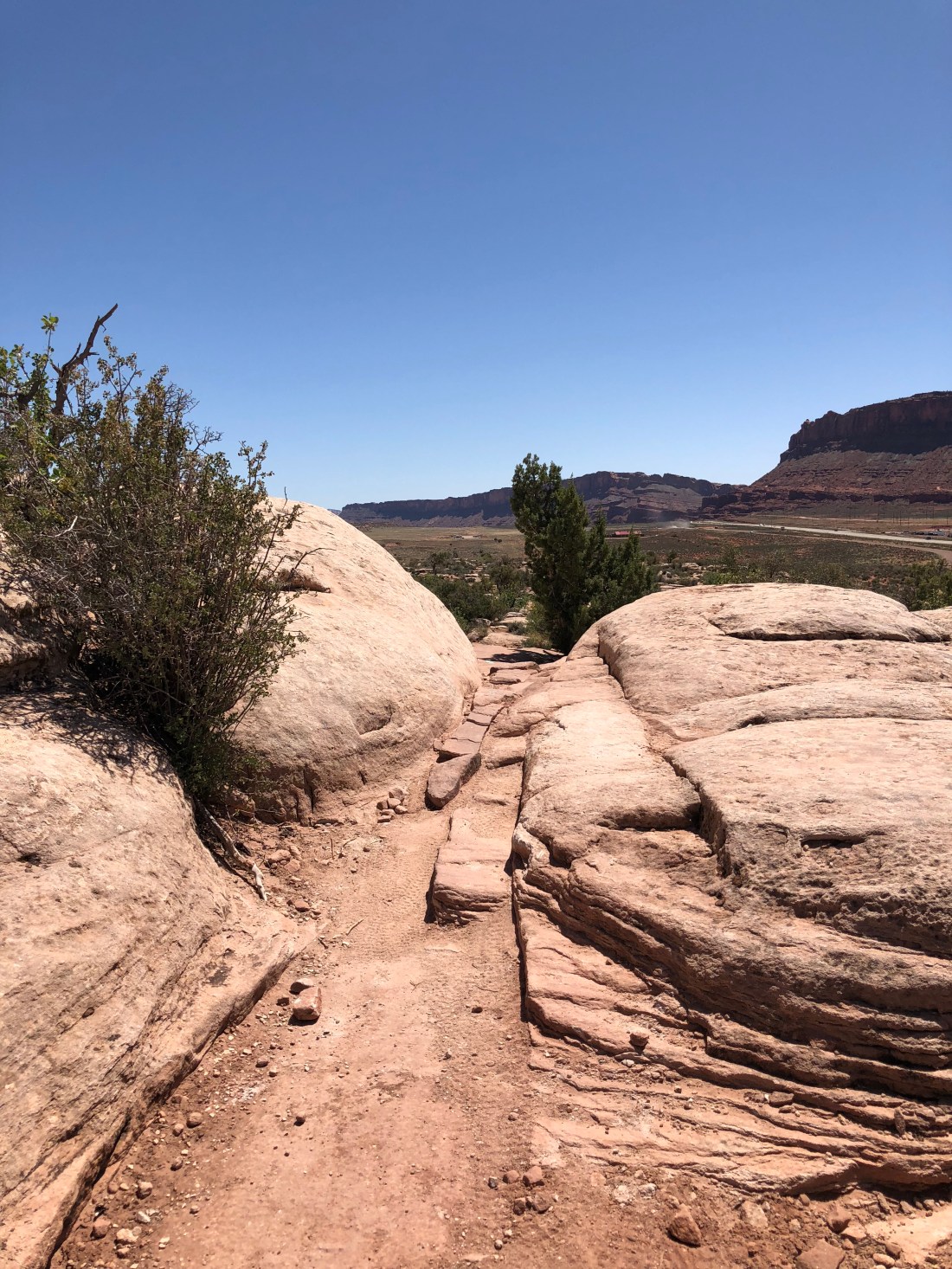
Little Salty
Time got away from me on the tie-in to little salty so I didn’t catch more pictures, but the Little Salty is a blue/black decent of about 50% hardpack then 50% fairly intense downhill slickrock like so.
For one reason or another this kind of slickrock descent puts me in a deep zen mode, picking lines and following the dots. By far Klondike Bluffs is my favorite ride out here. At least, until I ride more of the dozens of trails out here that I have yet to explore.
Conclusion
Sadly yesterday was our last day of riding, and tomorrow we prepare to go back home …and back to work. I’ve mentioned “it” as a recurring theme in this blog – and Moab has a thousand different kinds of “it”. Should you decide to visit, keep in mind everybody else knows Moab has “it” too – plan your lodging well, be prepare for crowds, but also be prepared for vistas and experiences so gorgeous they’ll break your hear.
Welcome to day 5 of our Moab musings! See what I did there? A little alliteration – pretty fancy right? Today was another mountain bike ride and lazing about and gazing wistfully into the Colorado while eating Doritos, drinking beer and reading my book.
And wondering why cell coverage is so bad…
But anyway, because of all that belly button gazing today’s blog is shorter but that’s ok, enjoy the pictures.
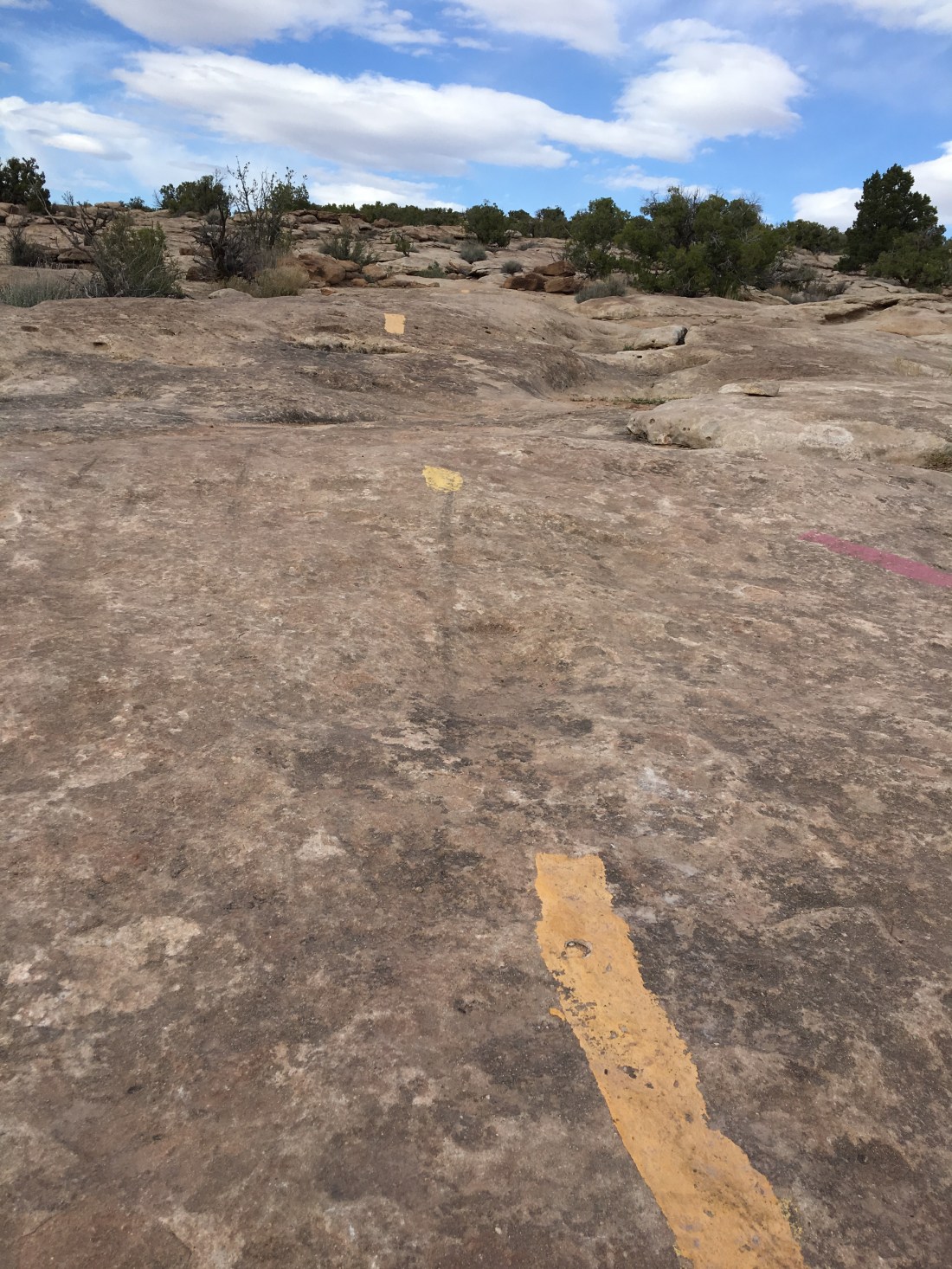
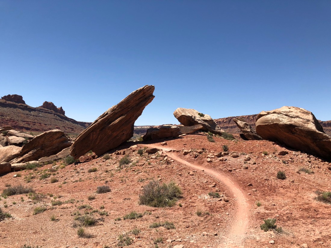
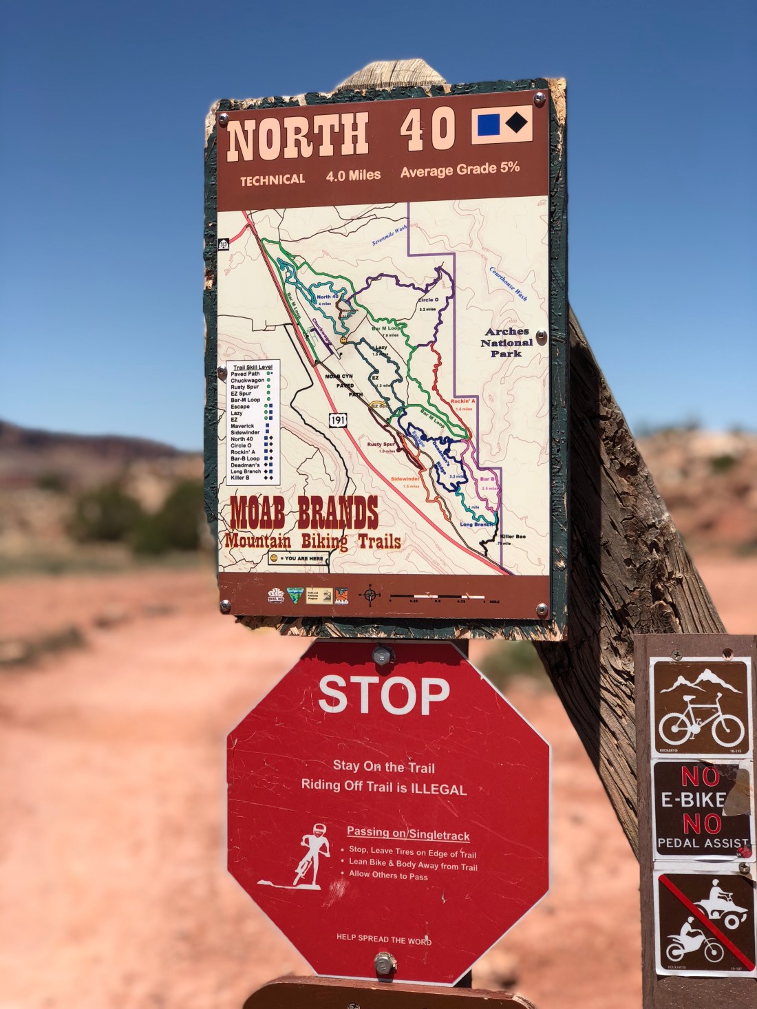
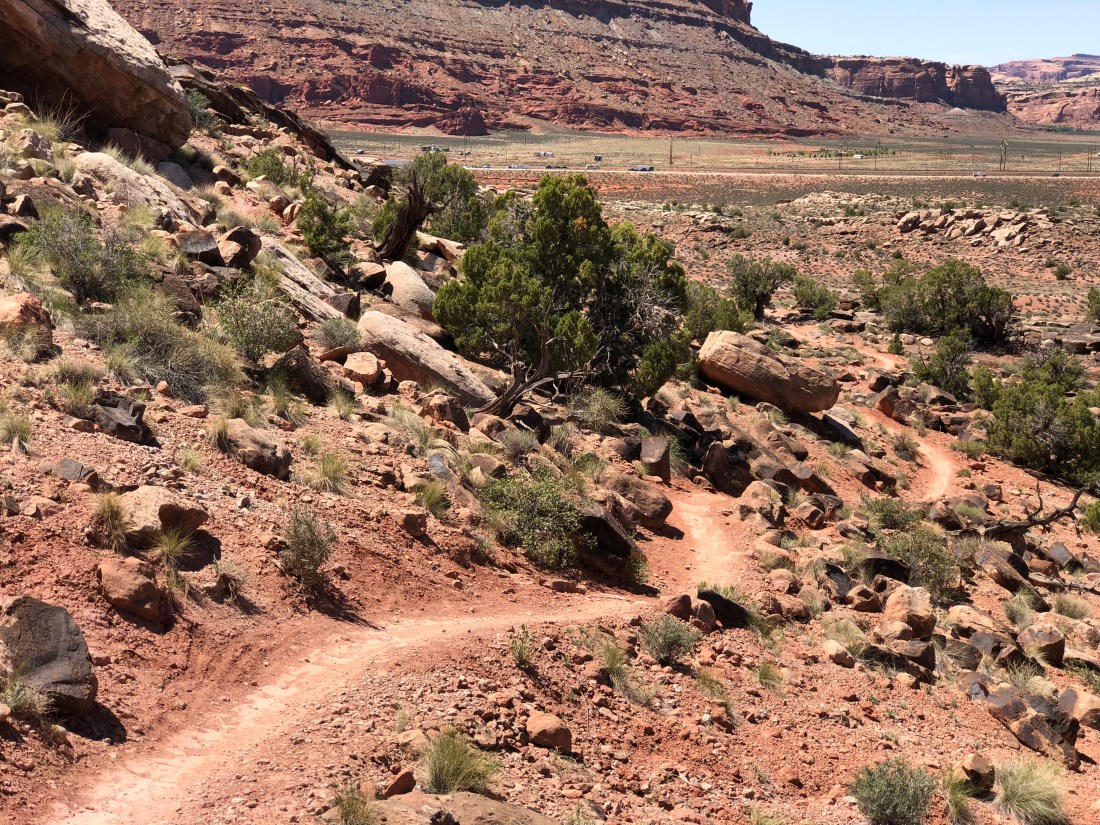
Mountain Biking the North 40
The North 40 is a short and fairly laid back blue/black trail north of town in what is referred to the as the “Bar M” trail system.
Adventure Machines
Before I tell you more about this trail, I should mention I love geeking out over how people build their “adventure machines”, some of which were in the parking lot.
I wonder how much difference that roof rack really makes in the scheme of things?
The Ride
The North 40 is kind of like when your own dog bites you. You’re thinking- but – you love me. You know me. Why would you bite me? North 40 seems so tame as it climbs some easy going slickrock and hardpack.
But then it starts throwing this kind of stuff at you.
Now that’s ok. I mean, I don’t want my dog biting me – but a trail like this keeps you honest. It makes you a better rider, and the risk is generally well constrained. I dismounted a half-dozen times, but I think laying down your Moab neural network would make internalizing those lines a snap if you were lucky enough to ride here all the time.
More Flowers
I’m not sure why, but flowers in the desert amaze me. I think it’s because of the contrast – in a terribly hostile place like the Utah desert where almost nothing lives you find this!
A Little Geology
Evidently Mighty Manganese is responsible for the black coloration on the rocks in Moab. We read that on a sign in canyon lands. Well – ok they didn’t say “mighty”, I added that part, probably from too much Sesame Street in the 70’s, but my statement is still accurate.
The distinctive green color in many of the hills around here is, according to the fine folks at the Utah Geological Survey, caused by chlorite or clay consisting of iron silicate.
To Be Continued…
Tomorrow we’re riding the Klondike Bluffs. Peace out my friends, one more day of riding to come.
Welcome to day 3 and 4 of our not-quite-as-live-as-I’d-like blog from Moab. Today we’re coming to you from the Eklecticafe where exceptional eats and coffees are found aplenty.
I’m blogging from here because cell coverage on the Colorado stinks, even with the booster. So we took a nice lazy morning to imbibe some flavored caffeine, eat some delicious strudel and share the past couple days in photos and prose.
Leaving Slickrock Campground
We left Slickrock campground but not before a furry-friend sendoff.
I have some ambiguity about this campground. The prices were high, but possibly not out of line when you consider being in the heart of town. The facilities were used – hard – but the staff was friendly, and they sold beer at the front desk. The electrical connections at the site bordered on a fire hazard, but the pads were clean, shade covered and otherwise well maintained.
I suppose my conclusion is I would come back, but probably again just as a mid-point while trying to land a better location on the Colorado.
Camping the Colorado
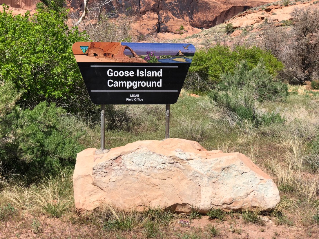
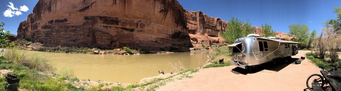
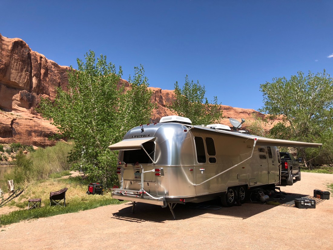
On day 3 of our adventure we moved to Goose Island Campground.
Goose Island is a remarkable BLM facility located not much more than a mile east of Moab on Utah 126.
We like this campground because it’s close to town yet limited to a couple dozen sites nestled up against a dramatic bend in the Colorado River. For $15/night you get unbelievable views of the river and epic sandstone cliffs worked meticulously by water and wind.
The campground offers trash collection and immaculately kept vault toilets but no water. Generator hours are a little odd at 8AM to 8PM, though we understand everyone wants to enjoy the outdoors in quiet.
Being so close to town this campground is busy. All sites are walk-ups so prospective campers (including ourselves) troll the area at all hours trying to score a spot. It’s also not entirely unusual for outside campers to stop by and drop trash in the receptacles, though there not supposed to. Given the amount of activity around here it’s understandable.
As I mentioned earlier, cell coverage here stinks. With the booster I can get internet but it’s too flaky to upload pictures for the blog. Still it’s entirely sufficient for texts and email.
Lastly as seen above foliage is light making satellite reception a snap.
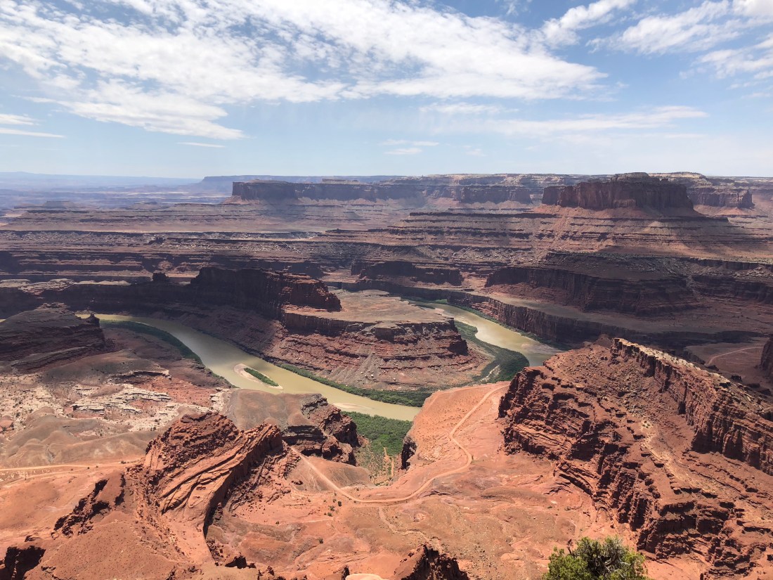
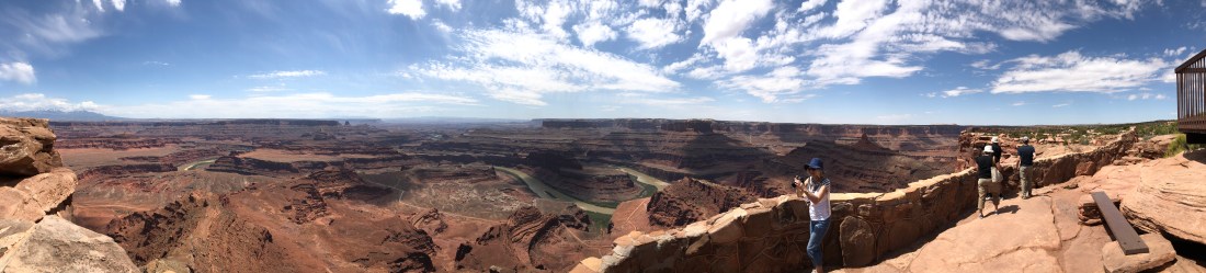
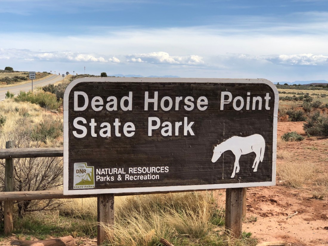
Dead Horse Point State Park Take 2
In an effort to economize on our three-day pass to Dead Horse Point State Park, we rode there again on Day 4. You can read up on the trail details in our previous post here. Below are a few more non-mountain biking highlights.
More Flowers
The Point of the Point
The point of the point is this.
I’ve been to the Grand Canyon numerous times but I find this view infinitely more rewarding. It’s still grand, but somehow more intimate.
A Little Moab Walkabout
On Day 3 we spent some time in Moab grabbing food and groceries. We highly recommend the Moab Brewery. Patio seating is the best.
Eddie McStiff’s has awesome Pizza, though oddly not until after 3.
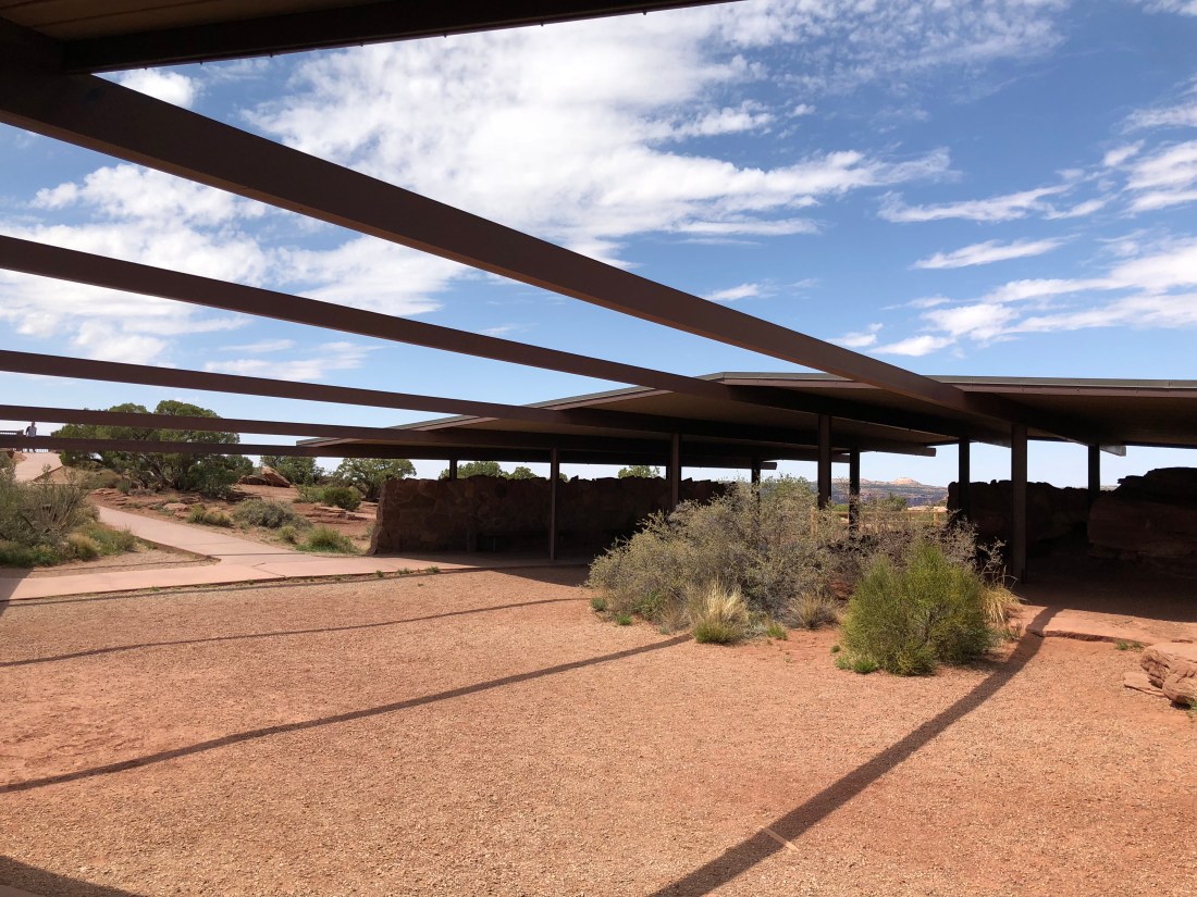
The Moab Information Center right next door has a gorgeous garden.
To be continued….
We’re lazing around today, I might ride North 40 if I can get out of vacation mode – you’ll find out tomorrow. Peace!
These guys are polite and professional, and have repaired massive damage on my rig fast. They also run a fleet a shuttles all over Moab and rent out a shower for dirty riders. Prices are fair and the service is impeccable.
Stop by for some swag if you have time.
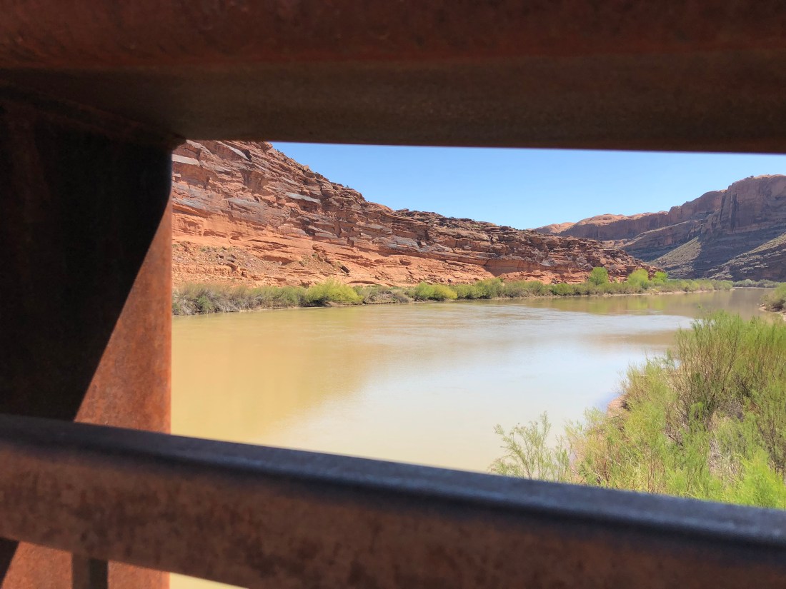
Camping The Colorado
Moab abuts the Colorado river and this swollen aquatic byway underpins a huge portion of “things to do” here. Of interest to us, BLM built multiple campgrounds along the river with limited services but great prices. We’re moving to one of those campgrounds tomorrow.
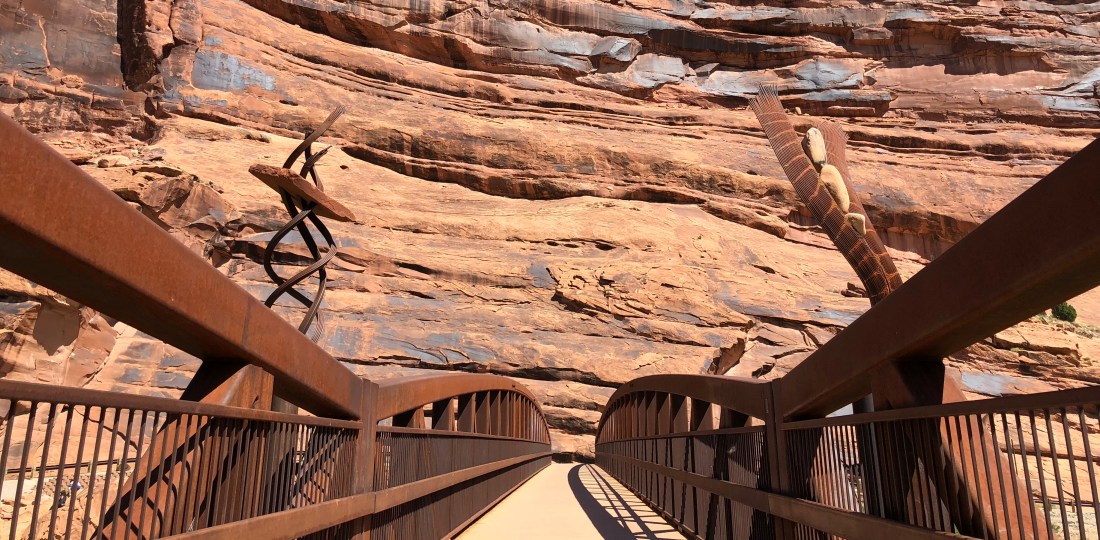
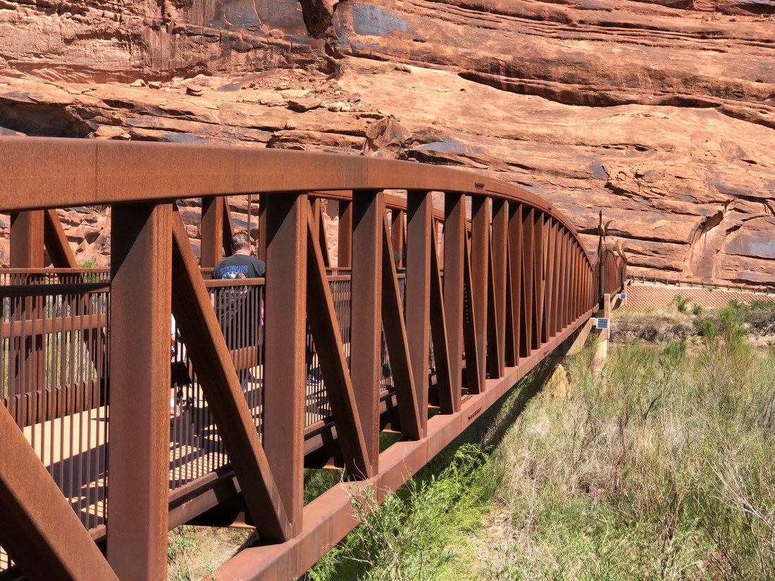
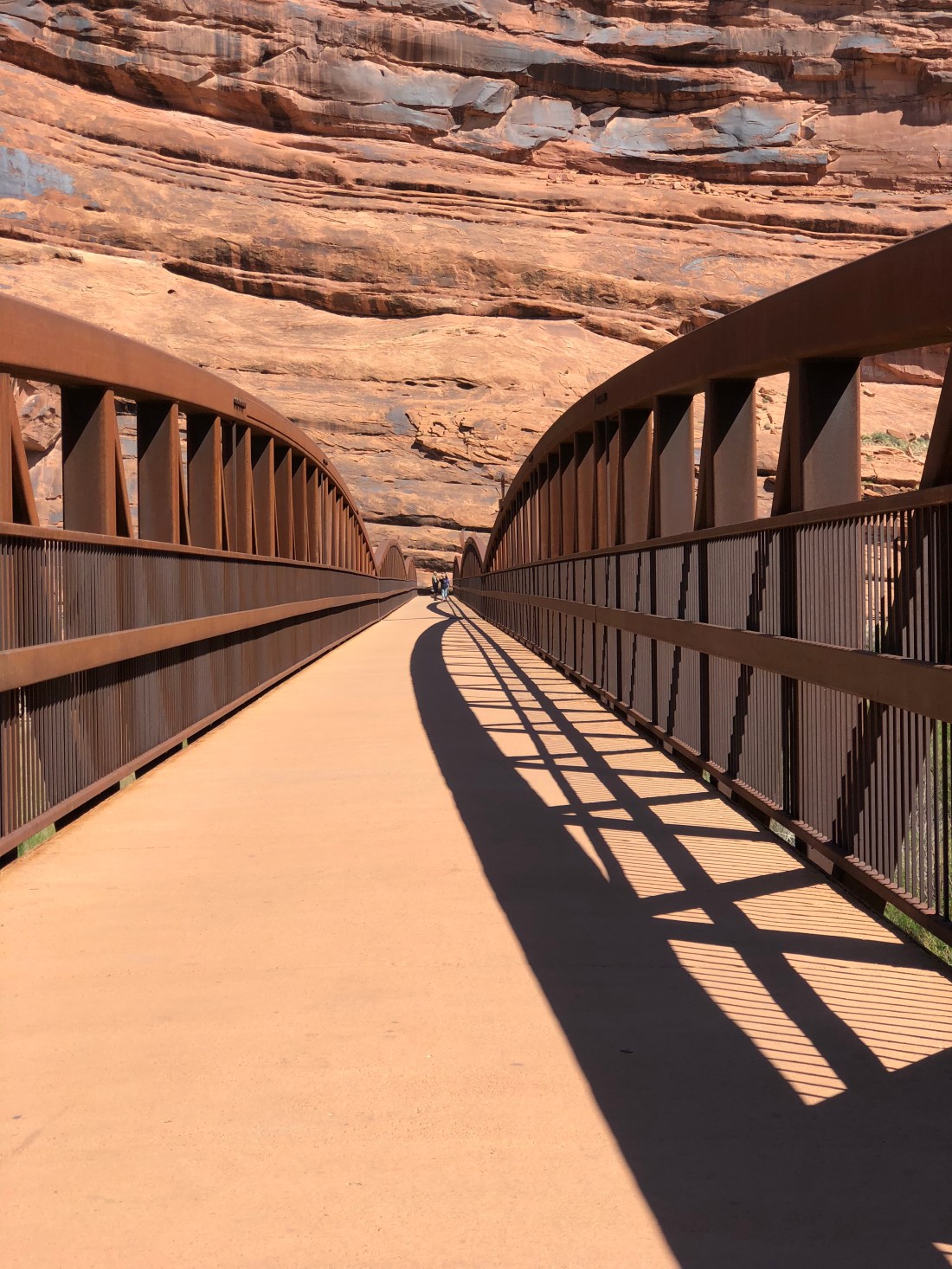
There’s a sick paved bike path that leads from Moab all the way to Gemini Bridges; crossing the Colorado on a bridge-made-art.
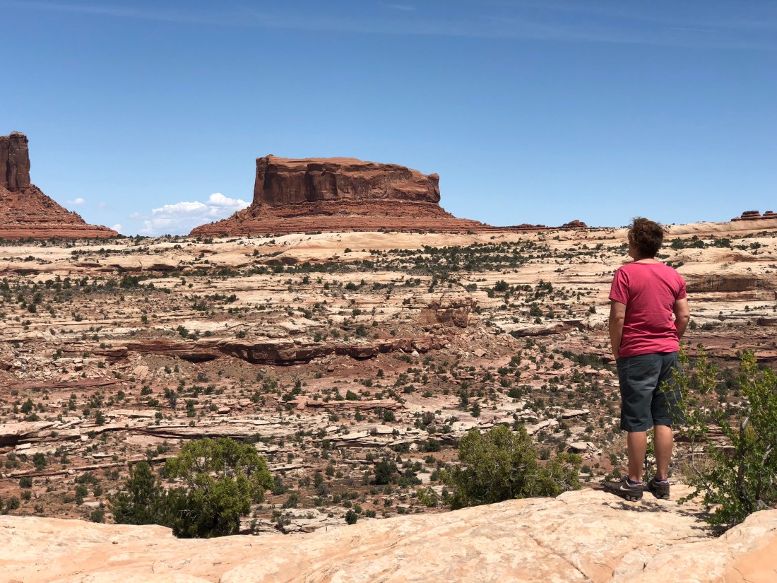
Canyonlands National Park
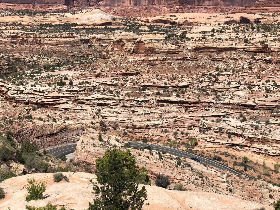
Though we did not ride Canyonlands today Utah 313 takes you to to Dead Horse Point State Park and though unbelievable scenery on its way to Canyonlands.
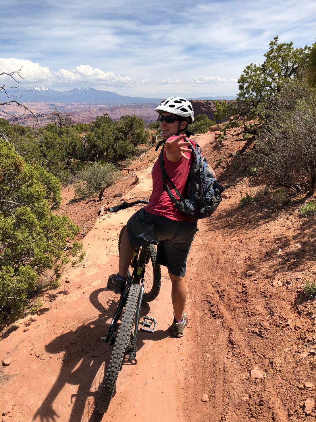
Mountain Biking Dead Horse Point State Park
Today we rode Dead Horse Point State Park. Sadly yes, some horses did die here long ago, but not anymore. The park is $15 for a single vehicle, and the pass is good for three days. There is no water here though there is a small manned kiosk willing to relieve you of your money along with a beautiful visitors center.
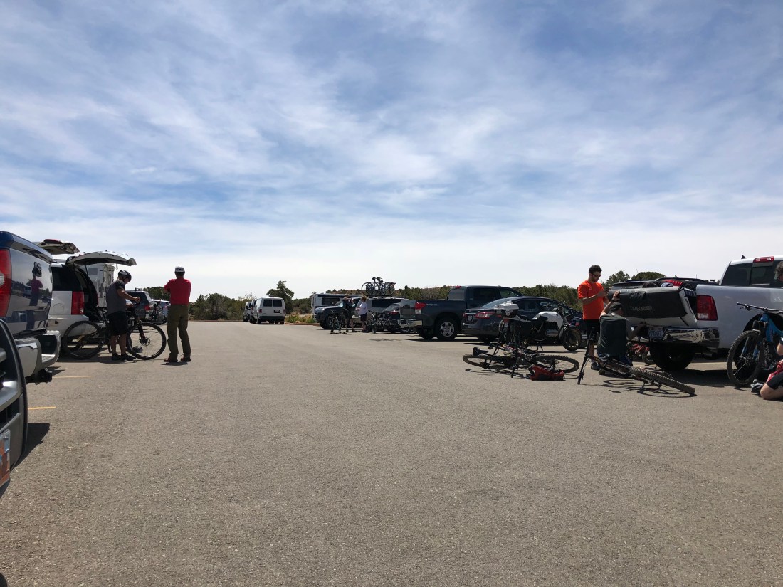
Suiting up in the parking lot we noticed there’s a theme but not sure what it is….
We rode the entire perimeter of the Intrepid Trail System. The park is at 5,900′ (1,800 m) and sadly I noticed the altitude immediately today.
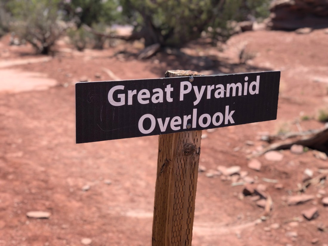
Great Pyramid
We like to ride the trail system counter clockwise and the first leg, Great Pyramid, offers spectacular eastern views.
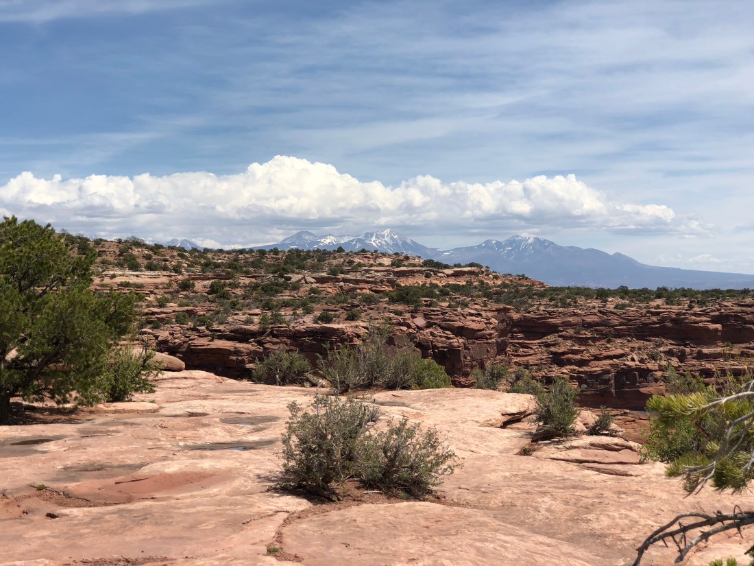
The La Sals
As always the La Sal mountains look on, snow capped and beautiful.
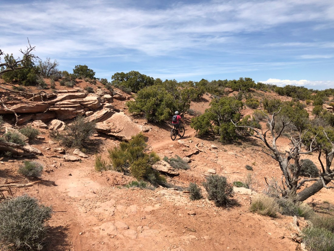
Big Chief
The entire Intrepid System ranges from green to advanced blue. The Big Chief trail is a glorious blue.
Desert Flowers
Flowers are few and far between but they can be found this time of year.
Slickrock is a sandstone rock that defines the entire Moab region. It’s called slickrock because early setters had trouble with steel horseshoes slipping of the “slick” rock.
To be continued….
Tomorrow we’re leaving Slickrock Campground for a site on the river. The ride wiped us out today so we’re not going tomorrow but expect lots of pictures of the Colorado. Peace!
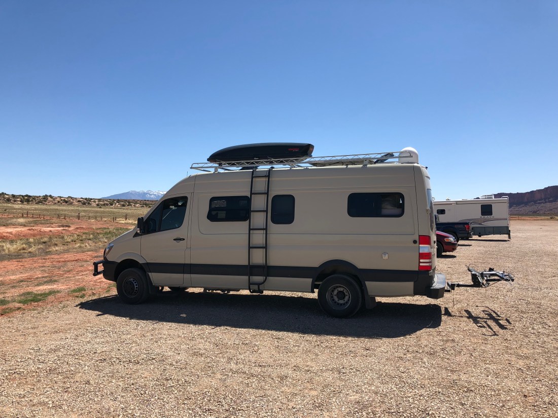
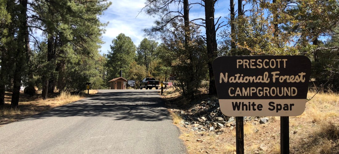
It’s that time of the year again. You know the time. The trailer’s been in hibernation – the days are getting a little longer and that tiny light behind your eye begins to blink drawing you northward. Along with all the other RVers we felt the clarion call as well, so today I bring you a live blog from Prescott, AZ.
Booking
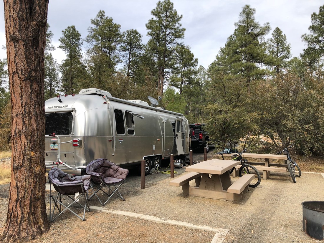
For our stay in the high country we are blogging to you from White Spar Campground just south of Prescott, AZ (locals pronounce it “press”-“kit”). This is a fairly large campground and availability can be searched and booked on the federal portal.
Sites are spacious and deeply forested as the campground lies just inside the Prescott National Forest boundary on U.S Route 89. Traffic is moderate to high and all pads are located on high-quality tarmac. Water is available at strategic locations as are vault toilets and dumpsters. There is no sewer or power, cellular service was middling (even with the booster) and noise highly variable (though no surprise, things calm down during the week).
Amenities & Activities
City of Prescott
The city of Prescott is a rather astonishing 40,000 souls but much of that habitation is in the northern reaches. We prefer to wander around the southern courthouse plaza area where delicious ice cream, pizza and shopping is found aplenty. Conveniently laundry can be done at The Cleaning Machine just a couple blocks east on Gurley St.
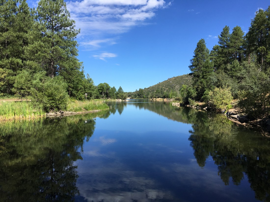
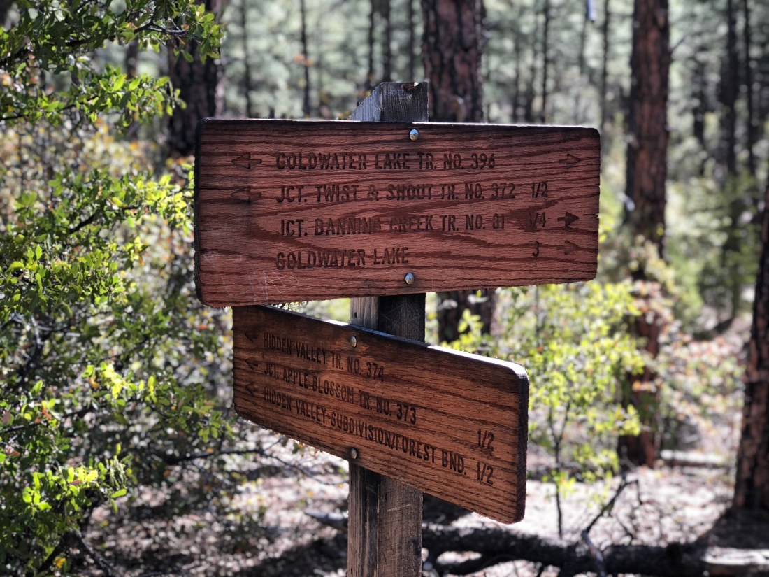
Goldwater lake is located south of Prescott. This lake offers picnicking, kayaking, mountain biking, horseback riding and hiking. Via the Goldwater Lakes Trail #396 the lake can be reached on mountain bike in less than an hour.
Mountain Biking
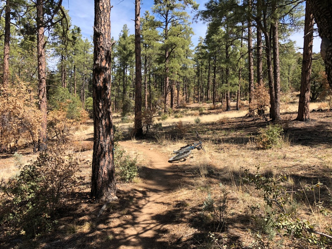
Ah yes, mountain biking – my favorite topic. We’re only here a few days and sadly I was sick two of those days. Still, we managed to squeeze in a couple rides on several of the local trails.
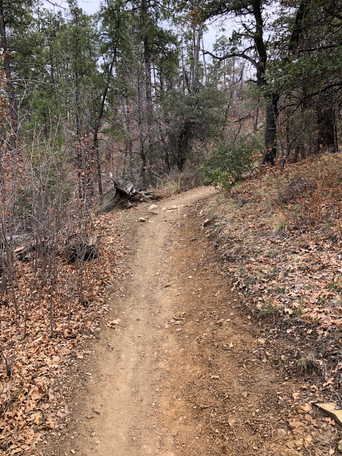
This trail is rated blue and I agree with that assessment due to fitness, as some of the climbs here routinely reach 13%. The views close to camp are worth the pain.
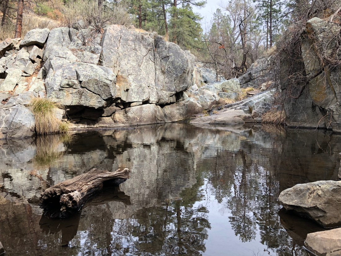
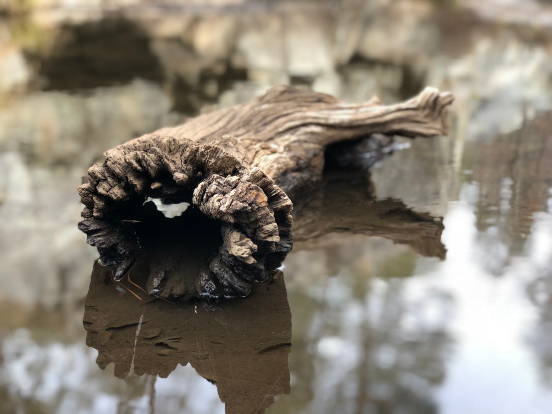
Further on the trail snakes its way through scenic creeks and small canyons.
Spring hasn’t quite sprung here but it made for great photography.
Though steep the trail is not technical.
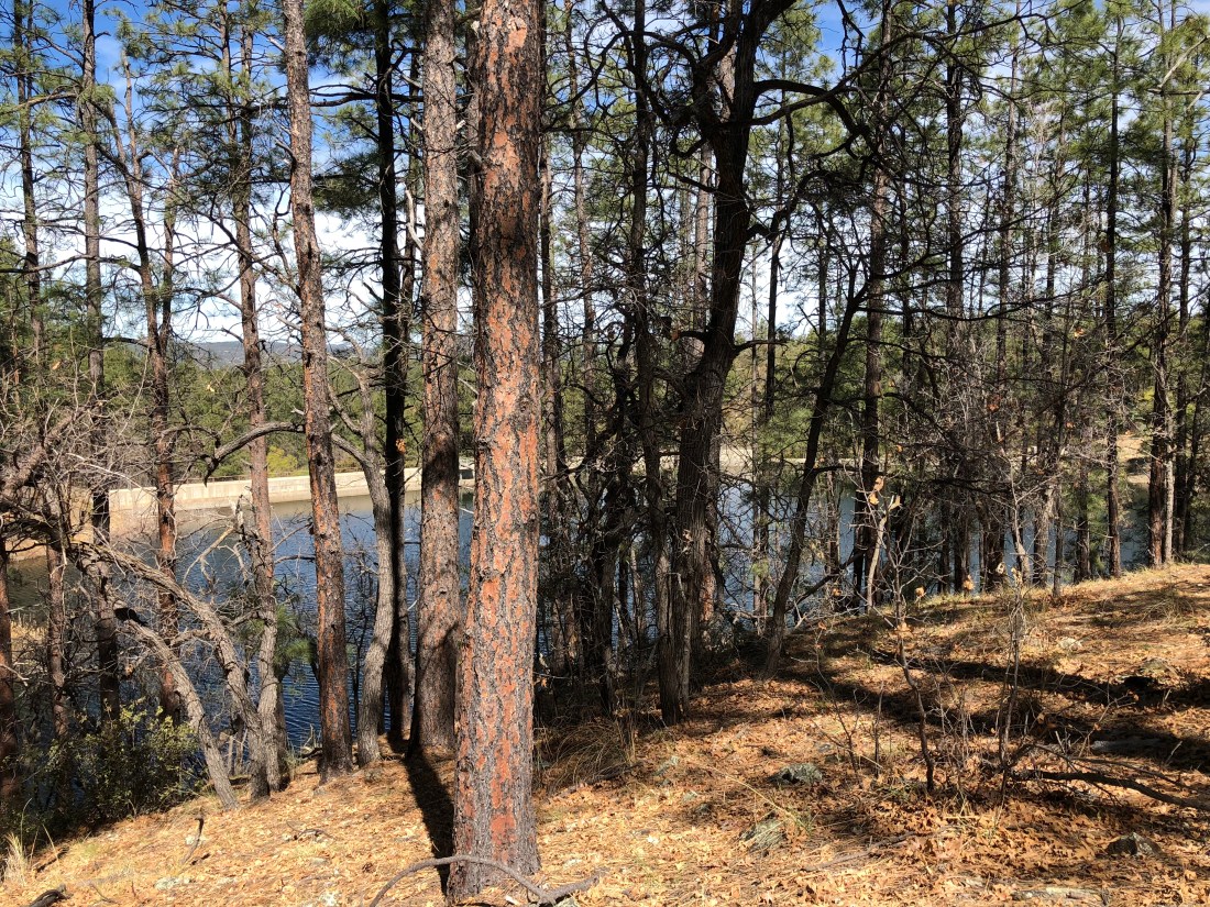
The lower Goldwater Dam peeks through the denuded forest.
The Airstream behaved pretty well on this trip. As of late one of the decorative finishing strips has been separating so I’m going to have to install a replacement finish. I think the torment of the Arizona desert heat did its worst.
I have also been blowing through a suspicious number of converter controllers in the Airstream. The fine folks at Airstream of Scottsdale agreed to install a 3rd party controller from Best Converter that is gentler on the batteries owing to its four-stage charging strategy.
The service technician also recommended against using 6 volt batteries in the Airstream as well as discouraged running the Airstream’s 1000W inverter while hooked up to shore power. Hopefully these recommendations will stop the long run of converter controller failures.
Recommendation
We’ve been to this campground several times and we highly recommend it primarily due to its access to unbelievable mountain biking, proximity to town and fair price. This campground definitely has “it”!